Red Bluff - Red Bluff Muni
Airport details
| Country | United States of America |
| State | California |
| Region | K2 |
| Airspace | Oakland Ctr |
| Municipality | Red Bluff |
| Elevation | 352ft (107m) |
| Timezone | GMT -8 |
| Coordinates | 40.15530, -122.25243 |
| Magnetic var | |
| Type | land |
| Available since | X-Plane v10.40 |
| ICAO code | KRBL |
| IATA code | RBL |
| FAA code | RBL |
Communication
| Red Bluff Muni ASOS | 120.775 |
Nearby Points of Interest:
Saint Mary's Parish
-Odd Fellows Building
-Old Bank of America Building
-Cottonwood Historic District
-Maywood Woman's Club
-Reading Adobe Site
-Oconee Hill Cemetery
-Edward Frisbie House
-Gianella Bridge
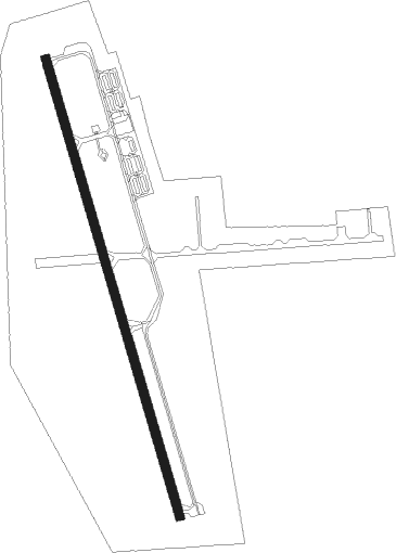
Runway info
| Runway 15 / 33 | ||
| length | 1658m (5440ft) | |
| bearing | 165° / 345° | |
| width | 30m (100ft) | |
| surface | asphalt | |
| blast zone | 46m (151ft) / 0m (0ft) | |
Nearby beacons
| code | identifier | dist | bearing | frequency |
|---|---|---|---|---|
| RBL | RED BLUFF VORTAC | 3.4 | 164° | 115.70 |
| RDD | REDDING VOR/DME | 21 | 354° | 108.40 |
| UK | KEARN (UKIAH) NDB | 69.8 | 228° | 371 |
Instrument approach procedures
| runway | airway (heading) | route (dist, bearing) |
|---|---|---|
| RW15 | BEIRA (156°) | BEIRA AXHEC (8mi, 141°) 4500ft |
| RW15 | ITMOR (203°) | ITMOR AXHEC (17mi, 233°) 4500ft |
| RW15 | RBL (344°) | RBL AXHEC (19mi, 344°) 4500ft AXHEC (turn) 4500ft |
| RNAV | AXHEC 4500ft GEBXA (10mi, 165°) 2000ft VEBCU (3mi, 165°) 1020ft KRBL (2mi, 163°) 387ft (6851mi, 108°) 597ft TOWAN (6854mi, 288°) 3500ft TOWAN (turn) | |
| RW33 | GONGS (334°) | GONGS TOWAN (10mi, 316°) 3500ft |
| RW33 | HENLE (36°) | HENLE IMYIB (7mi, 92°) 5800ft TOWAN (6mi, 92°) 3500ft |
| RW33 | RBL (344°) | RBL TOWAN (14mi, 165°) 3500ft TOWAN (turn) 3500ft |
| RNAV | TOWAN 3500ft VIJIX (11mi, 345°) 2000ft KRBL (6mi, 345°) 384ft (6851mi, 108°) 602ft PUVGE (6849mi, 288°) HOMAN (10mi, 53°) 4000ft HOMAN (turn) |
Disclaimer
The information on this website is not for real aviation. Use this data with the X-Plane flight simulator only! Data taken with kind consent from X-Plane 12 source code and data files. Content is subject to change without notice.