Richmond - Richmond Muni
Airport details
| Country | United States of America |
| State | Indiana |
| Region | K5 |
| Airspace | Indianapolis Ctr |
| Municipality | Richmond |
| Elevation | 1140ft (347m) |
| Timezone | GMT -5 |
| Coordinates | 39.75608, -84.84270 |
| Magnetic var | |
| Type | land |
| Available since | X-Plane v10.40 |
| ICAO code | KRID |
| IATA code | RID |
| FAA code | RID |
Communication
| Richmond Muni AWOS 3 | 121.225 |
| Richmond Muni CTAF/UNICOM | 122.700 |
| Richmond Muni COLUMBUS Approach/Departure | 118.425 |
Nearby Points of Interest:
Forest Hills Country Club
-Old Richmond Historic District
-East Main Street-Glen Miller Park Historic District
-Henry and Alice Gennett House
-Starr Historic District
-Bethel A.M.E. Church
-Richmond Civic Theater
-Richmond Downtown Historic District
-Andrew F. Scott House
-Wayne County Courthouse
-Richmond Gas Company Building
-Richmond Railroad Station Historic District
-Earlham College Observatory
-David Worth Dennis House
-Reeveston Place Historic District
-Mary Birdsall House
-Abram Gaar House and Farm
-Lewis Jones House
-Oliver P. Morton House
-Centerville Historic District
-Liberty Residential Historic District
-Liberty Courthouse Square Historic District
-Union County Courthouse
-King-Dennis Farm
-Acton House
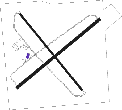
Runway info
Runway 6 / 24  | ||
| length | 1675m (5495ft) | |
| bearing | 62° / 242° | |
| width | 46m (150ft) | |
| surface | asphalt | |
| displ threshold | 91m (299ft) / 0m (0ft) | |
| Runway 15 / 33 | ||
| length | 1526m (5007ft) | |
| bearing | 138° / 318° | |
| width | 30m (100ft) | |
| surface | asphalt | |
Nearby beacons
| code | identifier | dist | bearing | frequency |
|---|---|---|---|---|
| RID | RICHMOND VOR/DME | 0.1 | 106° | 110.60 |
| SQ | PNTHR (CONNERSVILLE) NDB | 13.3 | 274° | 227 |
| UWL | NEW CASTLE NDB | 23.1 | 285° | 385 |
| HKF | HOOK FIELD (MIDDLETOWN) NDB | 23.9 | 123° | 239 |
| AT | BRUNY (DAYTON) NDB | 24 | 80° | 315 |
| AWW | WINCHESTER NDB | 25 | 349° | 212 |
| DQN | DAYTON VOR/DME | 25.8 | 60° | 114.50 |
| MW | ONIDA (MIDDLETOWN) NDB | 26.2 | 109° | 223 |
| HLB | BATESVILLE NDB | 31.2 | 225° | 254 |
| JN | BALLL (MUNCIE) NDB | 33.6 | 312° | 365 |
| MI | BALLL (MUNCIE) NDB | 33.6 | 312° | 365 |
| AI | VIDEO (ANDERSON) NDB | 36 | 295° | 394 |
| FFO | PATTERSON (DAYTON) TACAN | 36.5 | 85° | 115.20 |
| MIE | MUNCIE VOR/DME | 38.4 | 311° | 114.40 |
| CVG | CINCINNATI VORTAC | 44.9 | 169° | 117.30 |
| SHB | SHELBYVILLE VOR/DME | 45.9 | 263° | 112 |
| SGH | DME | 46.2 | 85° | 113.20 |
| ROD | ROSEWOOD VORTAC | 48.7 | 56° | 117.50 |
| PWF | SPORTYS (BATAVIA) NDB | 50.1 | 137° | 245 |
| HW | CUBLA (WILMINGTON) NDB | 50.8 | 113° | 299 |
| BA | CLIFS (COLUMBUS) NDB | 52.1 | 246° | 410 |
| MZZ | MARION VOR/DME | 58.6 | 311° | 108.60 |
| GVR | (MADISON) DME | 66.6 | 212° | 114.65 |
Instrument approach procedures
| runway | airway (heading) | route (dist, bearing) |
|---|---|---|
| RW06 | SNACK (62°) | SNACK 6000ft SNACK (turn) 2800ft |
| RNAV | SNACK 2800ft OZROC (6mi, 62°) 2800ft KRID (5mi, 62°) 1179ft (5167mi, 115°) 1500ft PEWEZ (5158mi, 295°) 2700ft PEWEZ (turn) | |
| RW24 | PEWEZ (242°) | PEWEZ 6000ft PEWEZ (turn) 2800ft |
| RNAV | PEWEZ 2800ft JERMY (6mi, 242°) 2700ft OTJIW (3mi, 242°) 1740ft KRID (2mi, 242°) 1186ft (5167mi, 115°) 1339ft SNACK (5176mi, 295°) 2800ft SNACK (turn) | |
| RW33 | SKYRA (318°) | SKYRA 6000ft SKYRA (turn) 3000ft |
| RNAV | SKYRA 3000ft PIGTE (6mi, 318°) 2700ft KRID (5mi, 318°) 1185ft (5167mi, 115°) 1540ft SKYRA (5160mi, 295°) 3000ft SKYRA (turn) |
Disclaimer
The information on this website is not for real aviation. Use this data with the X-Plane flight simulator only! Data taken with kind consent from X-Plane 12 source code and data files. Content is subject to change without notice.