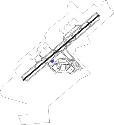
Fort Myers - Southwest Florida Intl
Airport details
| Country | United States of America |
| State | Florida |
| Region | K7 |
| Airspace | Miami Oceanic Ctr |
| Municipality | Lee County |
| Elevation | 26ft (8m) |
| Timezone | GMT -5 |
| Coordinates | 26.53617, -81.75517 |
| Magnetic var | |
| Type | land |
| Available since | X-Plane v10.40 |
| ICAO code | KRSW |
| IATA code | RSW |
| FAA code | RSW |
Communication
| Southwest Florida Intl ATIS | 124.650 |
| Southwest Florida Intl CTAF/UNICOM | 122.950 |
| Southwest Florida Intl Clearance DEL | 132.075 |
| Southwest Florida Intl Ground Control | 121.900 |
| Southwest Florida Intl FORT MYERS Tower | 128.750 |
| Southwest Florida Intl FORT MYERS Approach/Departure | 119.750 |
| Southwest Florida Intl FORT MYERS Approach/Departure | 125.150 |
| Southwest Florida Intl FORT MYERS Approach/Departure | 126.800 |
Approach frequencies
| ILS-cat-I | RW06 | 111.5 | 18.00mi |
| 3° GS | RW06 | 111.5 | 18.00mi |
Nearby Points of Interest:
Buckingham School
-Jewett-Thompson House
-Alderman House
-Old Lee County Courthouse
-William H. Towles House
-Murphy-Burroughs House
-Casa Rio
-Menge-Hansen Marine Ways
-Alva Consolidated Schools
-Capt. Francis A. Hendry House
-Old Hendry County Courthouse
-Caldwell Home Place
-Downtown LaBelle Historic District
-Tween Waters Inn Historic District
-Captiva School and Chapel-by-the-Sea Historic District
-Seaboard Coast Line Railroad Depot
-Naples Historic District
-Punta Gorda Fish Company Ice House
-Punta Gorda Atlantic Coast Line Depot
-A. C. Freeman House
-Old First National Bank of Punta Gorda
-Villa Bianca
-Clarence L. Babcock House
-Whidden's Marina
-Charlotte Harbor and Northern Railway Depot
Runway info
| Runway 6 / 24 | ||
| length | 3659m (12005ft) | |
| bearing | 57° / 237° | |
| width | 46m (150ft) | |
| surface | asphalt | |
| blast zone | 122m (400ft) / 122m (400ft) | |
Nearby beacons
| code | identifier | dist | bearing | frequency |
|---|---|---|---|---|
| RSW | LEE COUNTY (FORT MYERS) VORTAC | 1.1 | 253° | 111.80 |
| FM | CALOO (FORT MYERS) NDB | 10.5 | 264° | 341 |
| CYY | CYPRESS (NAPLES) VOR/DME | 23 | 183° | 108.60 |
| PGD | PUNTA GORDA VOR | 26.1 | 328° | 110.20 |
| LBV | LA BELLE VORTAC | 26.2 | 51° | 110.40 |
| SRQ | SARASOTA VOR/DME | 67.8 | 317° | 117 |
Departure and arrival routes
| Transition altitude | 18000ft |
| Transition level | 18000ft |
| SID end points | distance | outbound heading | |
|---|---|---|---|
| RW06 | |||
| CSHEL6 | 123mi | 12° | |
| ALICO7, MOOKY6, SCUBY7 | 19mi | 166° | |
| RW24 | |||
| CSHEL6 | 123mi | 12° | |
| ALICO7, MOOKY6, SCUBY7 | 19mi | 166° | |
| STAR starting points | distance | inbound heading | |
|---|---|---|---|
| ALL | |||
| JOSFF5 | 48.1 | 125° | |
| RW06 | |||
| TYNEE2 | 14.4 | 69° | |
| SHFTY5 | 26.2 | 231° | |
| RW24 | |||
| TYNEE2 | 14.4 | 69° | |
| SHFTY5 | 26.2 | 231° | |
Instrument approach procedures
| runway | airway (heading) | route (dist, bearing) |
|---|---|---|
| RW06 | CORFU (322°) | CORFU PONTY (12mi, 258°) 2300ft LENPE (5mi, 321°) 2000ft |
| RW06 | PINTS (125°) | PINTS SOKIE (20mi, 153°) 3000ft LENPE (5mi, 141°) 2000ft |
| RNAV | LENPE 2000ft CELBO (6mi, 57°) 1500ft KRSW (5mi, 57°) 82ft GALVE (3mi, 57°) RUTHY (8mi, 115°) CORFU (7mi, 212°) 2300ft CORFU (turn) | |
| RW24 | CORFU (322°) | CORFU NABAC (12mi, 35°) 2300ft RODDE (5mi, 321°) 2000ft |
| RW24 | LBV (231°) | LBV RODDE (15mi, 227°) 2000ft |
| RW24 | VASES (191°) | VASES ODERY (7mi, 146°) 2500ft RODDE (5mi, 141°) 2000ft |
| RNAV | RODDE 2000ft OMOKY (6mi, 237°) 1500ft KRSW (5mi, 237°) 82ft HASBO (6mi, 237°) CORFU (11mi, 113°) 2300ft CORFU (turn) |
Holding patterns
| STAR name | hold at | type | turn | heading* | altitude | leg | speed limit |
|---|---|---|---|---|---|---|---|
| JOSFF5 | JOSFF | VHF | right | 311 (131)° | < 17999ft | DME 7.0mi | ICAO rules |
| SHFTY5 | HEPOX | VHF | right | 354 (174)° | DME 11.0mi | ICAO rules | |
| SHFTY5 | MAZZY | VHF | right | 341 (161)° | DME 8.0mi | ICAO rules | |
| SHFTY5 | SHFTY | VHF | left | 3 (183)° | DME 11.0mi | ICAO rules | |
| SHFTY5 | WOSAK | VHF | right | 354 (174)° | DME 11.0mi | ICAO rules | |
| TYNEE2 | CODGR | VHF | right | 289 (109)° | DME 11.0mi | ICAO rules | |
| TYNEE2 | EGAME | VHF | left | 346 (166)° | 1.5min timed | ICAO rules | |
| TYNEE2 | FRZBE | VHF | left | 329 (149)° | 1.5min timed | ICAO rules | |
| TYNEE2 | JOSFF | VHF | right | 311 (131)° | < 17999ft | DME 7.0mi | ICAO rules |
| TYNEE2 | OGGER | VHF | right | 342 (162)° | 1.5min timed | ICAO rules | |
| TYNEE2 | TYNEE | VHF | left | 329 (149)° | 1.0min timed | ICAO rules | |
| *) magnetic outbound (inbound) holding course | |||||||
Disclaimer
The information on this website is not for real aviation. Use this data with the X-Plane flight simulator only! Data taken with kind consent from X-Plane 12 source code and data files. Content is subject to change without notice.
