Blue Earth - Blue Earth Muni
Airport details
| Country | United States of America |
| State | Minnesota |
| Region | K3 |
| Airspace | Minneapolis Ctr |
| Municipality | Faribault County |
| Elevation | 1104ft (336m) |
| Timezone | GMT -6 |
| Coordinates | 43.59536, -94.09286 |
| Magnetic var | |
| Type | land |
| Available since | X-Plane v10.40 |
| ICAO code | KSBU |
| IATA code | n/a |
| FAA code | SBU |
Communication
| Blue Earth Muni CTAF/UNICOM | 122.800 |
Nearby Points of Interest:
Church of the Good Shepherd-Episcopal
-Faribault County Courthouse
-Red Rock Center for the Arts
-Martin County Courthouse
-Orville P. and Sarah Chubb House
-Sterling Congregational Church
-Chicago, Milwaukee, St. Paul and Pacific Depot and Lunchroom
-First Baptist Church
-Winnebago County Courthouse
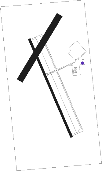
Runway info
Runway 16 / 34  | ||
| length | 1037m (3402ft) | |
| bearing | 155° / 335° | |
| width | 23m (75ft) | |
| surface | asphalt | |
| Runway 03 / 21 | ||
| length | 700m (2297ft) | |
| bearing | 45° / 225° | |
| width | 61m (200ft) | |
| surface | grass | |
Nearby beacons
| code | identifier | dist | bearing | frequency |
|---|---|---|---|---|
| FQ | MONTZ (FAIRMONT) NDB | 9.8 | 264° | 420 |
| FNX | DME | 14.1 | 278° | 114.25 |
| FRM | DME | 14.6 | 279° | 110.20 |
| AEL | ALBERT LEA VOR/DME | 31.8 | 83° | 109.80 |
| MKT | MANKATO VOR/DME | 38.3 | 16° | 110.80 |
| EGQ | EMMETSBURG NDB | 40 | 231° | 410 |
| MCW | MASON CITY VOR/DME | 44.8 | 123° | 114.90 |
| MC | SURFF (MASON CITY) NDB | 46.6 | 125° | 348 |
| FOW | HALFWAY (MORRISTOWN) VOR/DME | 48.1 | 50° | 111.20 |
| OW | TONNA (OWATONNA) NDB | 49.7 | 63° | 379 |
| FOD | FORT DODGE VORTAC | 59.7 | 192° | 113.50 |
Instrument approach procedures
| runway | airway (heading) | route (dist, bearing) |
|---|---|---|
| RW34 | TRIGS (335°) | TRIGS 2700ft |
| RNAV | TRIGS 2700ft DOGGO (5mi, 335°) 2700ft NEEPS (3mi, 335°) 1800ft KSBU (2mi, 335°) 1142ft (5583mi, 115°) 1398ft TRIGS (5580mi, 295°) 2700ft TRIGS (turn) |
Disclaimer
The information on this website is not for real aviation. Use this data with the X-Plane flight simulator only! Data taken with kind consent from X-Plane 12 source code and data files. Content is subject to change without notice.