Sumter
Airport details
| Country | United States of America |
| State | South Carolina |
| Region | K7 |
| Airspace | Jacksonville Ctr |
| Municipality | Sumter County |
| Elevation | 182ft (55m) |
| Timezone | GMT -5 |
| Coordinates | 33.99503, -80.36133 |
| Magnetic var | |
| Type | land |
| Available since | X-Plane v10.40 |
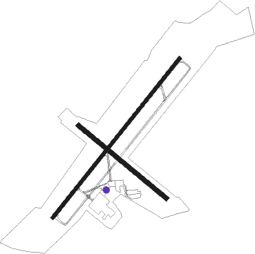
| ICAO code | KSMS |
| IATA code | SUM |
| FAA code | SMS |
Communication
| Sumter AWOS | 118.075 |
| Sumter CTAF/UNICOM | 122.700 |
| Sumter SHAW Approach/Departure | 125.400 |
Approach frequencies
| ILS-cat-I | RW23 | 109.35 | 18.00mi |
| 3° GS | RW23 | 109.35 | 18.00mi |
Nearby Points of Interest:
Heriot-Moise House
-Charles T. Mason House
-Henry Lee Scarborough House
-Elizabeth White House
-Sumter County Courthouse
-Carnegie Public Library
-Sumter Town Hall-Opera House
-Sumter Historic District
-O'Donnell House
-Orange Grove
-Ashwood School Gymnasium and Auditorium
-Mayesville Historic District
-Stateburg Historic District
-Borough House Plantation
-Mt. Zion Presbyterian Church
-Lenoir Store
-Magnolia Hall
-Rip Raps Plantation
-J. Clinton Brogdon House
-Boykin Mill Complex
-Thomas Fraser House
-Thomas English House
-Zachariah Cantey House
-James Carnes House
-Lee County Courthouse

Nearby beacons
| code | identifier | dist | bearing | frequency |
|---|---|---|---|---|
| SMS | SUMTER NDB | 0.2 | 163° | 252 |
| SSC | SHAW (SUMTER) TACAN | 5.3 | 261° | 110.10 |
| MMT | MC ENTIRE (COLUMBIA) VORTAC | 22.3 | 261° | 113.20 |
| MNI | MANNING NDB | 25.6 | 159° | 381 |
| FL | ALCOT (FLORENCE) NDB | 27.4 | 71° | 335 |
| HVS | HARTSVILLE NDB | 27.4 | 30° | 341 |
| CFY | EVANS (LAKE CITY) NDB | 30.8 | 103° | 420 |
| VAN | VANCE VORTAC | 31.5 | 190° | 110.40 |
| CAE | COLUMBIA VORTAC | 35.4 | 259° | 114.70 |
| UDG | DARLINGTON NDB | 35.7 | 47° | 245 |
| FLO | FLORENCE VORTAC | 37.8 | 71° | 115.20 |
| CTF | CHESTERFIELD VOR/DME | 39.5 | 8° | 108.20 |
| CA | MURRY (COLUMBIA) NDB | 44 | 268° | 362 |
| BES | BENNETTSVILLE NDB | 48.7 | 45° | 230 |
| LKR | LANCASTER NDB | 50.1 | 326° | 400 |
| PHH | ANDREWS NDB | 52.9 | 123° | 255 |
| DYB | DORCHESTER COUNTY(SUMMERVILLE) NDB | 56.2 | 175° | 365 |
| DLC | DILLON NDB | 56.3 | 65° | 274 |
| DCM | CHESTER NDB | 63.1 | 313° | 220 |
| ME | MAXTN (MAXTON) NDB | 63.5 | 51° | 257 |
| UZ | RALLY (ROCK HILL) NDB | 64.4 | 321° | 227 |
Instrument approach procedures
| runway | airway (heading) | route (dist, bearing) |
|---|---|---|
| RW05 | FEDLU (24°) | FEDLU 2400ft KOENG (5mi, 308°) 2400ft |
| RW05 | HAVPI (70°) | HAVPI 2400ft KOENG (5mi, 128°) 2400ft |
| RW05 | KOENG (48°) | KOENG 2400ft |
| RNAV | KOENG 2400ft LYNAM (6mi, 48°) 1900ft KSMS (6mi, 49°) 219ft GAUGH (12mi, 48°) 2400ft GAUGH (turn) | |
| RW23 | ALVAH (197°) | ALVAH GAUGH (7mi, 128°) 2400ft |
| RW23 | CIKVO (255°) | CIKVO GAUGH (7mi, 308°) 2400ft |
| RW23 | GAUGH (228°) | GAUGH 2400ft |
| RNAV | GAUGH 2400ft AGOZE (6mi, 228°) 1900ft WUMIS (3mi, 228°) 1040ft KSMS (3mi, 228°) 226ft (4926mi, 113°) 600ft GAUGH (4919mi, 293°) 2400ft GAUGH (turn) |
Disclaimer
The information on this website is not for real aviation. Use this data with the X-Plane flight simulator only! Data taken with kind consent from X-Plane 12 source code and data files. Content is subject to change without notice.