Travis Afb
Airport details
| Country | United States of America |
| State | California |
| Region | K2 |
| Airspace | Oakland Ctr |
| Municipality | Fairfield |
| Elevation | 62ft (19m) |
| Timezone | GMT -8 |
| Coordinates | 38.26454, -121.92413 |
| Magnetic var | |
| Type | land |
| Available since | X-Plane v10.40 |
| ICAO code | KSUU |
| IATA code | SUU |
| FAA code | SUU |
Communication
| Travis AFB Clearance DEL | 127.550 |
| Travis AFB Ground Control | 121.800 |
| Travis AFB Tower | 120.750 |
| Travis AFB Approach | 119.900 |
| Travis AFB Approach | 128.400 |
| Travis AFB Departure | 119.900 |
Approach frequencies
| ILS-cat-II | RW21L | 110.1 | 18.00mi |
| ILS-cat-I | RW03L | 108.35 | 18.00mi |
| 2.8° GS | RW21L | 110.1 | 18.00mi |
| 2.5° GS | RW03L | 108.35 | 18.00mi |
Nearby Points of Interest:
Suisun Masonic Lodge No. 55
-Vacaville Town Hall
-Hastings Adobe
-USCGC Storis
-Port Chicago Naval Magazine National Memorial
-Downtown Winters Historic District
-Riverview Union High School Building
-Roswell Butler Hard House
-Benicia Arsenal
-Isleton Chinese and Japanese Commercial Districts
-Old Masonic Hall
-First Street Bridge
-Capt. N. H. Wulff House
-Napa County Courthouse Plaza
-Semorile Building
-Napa Valley Opera House
-Bank of Napa
-Gordon Building
-Goodman Library
-Sam Kee Laundry Building
-U.S. Post Office
-Benicia Southern Pacific Railroad Passenger Depot
-Eliza G. Yount House
-William Andrews House
-Tucker House
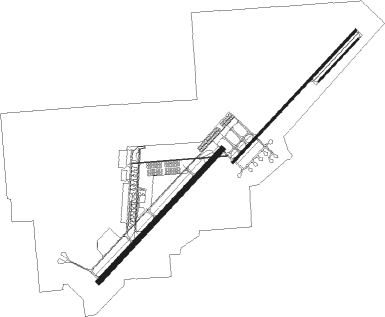
Runway info
Runway 3L / 21R  | ||
| length | 3356m (11010ft) | |
| bearing | 54° / 234° | |
| width | 91m (300ft) | |
| surface | asphalt | |
| blast zone | 255m (837ft) / 42m (138ft) | |
| Runway 3R / 21L | ||
| length | 3355m (11007ft) | |
| bearing | 54° / 234° | |
| width | 46m (150ft) | |
| surface | concrete | |
| blast zone | 255m (837ft) / 255m (837ft) | |
| Runway 4 / 22 | ||
| length | 1068m (3504ft) | |
| bearing | 54° / 234° | |
| width | 27m (90ft) | |
| surface | concrete | |
Nearby beacons
| code | identifier | dist | bearing | frequency |
|---|---|---|---|---|
| SUU | TRAVIS (FAIRFIELD) TACAN | 1.5 | 228° | 116.60 |
| CCR | CONCORD VOR/DME | 14.3 | 209° | 117 |
| SAC | SACRAMENTO VORTAC | 20.5 | 64° | 115.20 |
| SGD | SCAGGS ISLAND (NAPA) VORTAC | 21.7 | 259° | 112.10 |
| MCC | MC CLELLAN (SACRAMENTO) VOR/DME | 34.3 | 52° | 109.20 |
| OAK | OAKLAND VOR/DME | 35.3 | 209° | 116.80 |
| LV | REIGA (LIVERMORE) NDB | 36.2 | 157° | 374 |
| SAU | SAUSALITO VOR/DME | 37.4 | 236° | 116.20 |
| SFO | SAN FRANCISCO VOR/DME | 44.2 | 215° | 115.80 |
| STS | ROSA DME | 44.2 | 285° | 116.15 |
| LIN | LINDEN VOR/DME | 44.9 | 102° | 114.80 |
| PYE | POINT REYES VOR/DME | 45.9 | 259° | 113.70 |
| ILA | WILLIAMS VORTAC | 48.6 | 353° | 114.40 |
| NUQ | MOFFETT (MOUNTAIN VIEW) TACAN | 50.3 | 189° | 117.60 |
| MYV | MARYSVILLE VOR/DME | 52.7 | 23° | 110.80 |
| SJC | SAN JOSE VOR/DME | 53.4 | 181° | 114.10 |
| OSI | WOODSIDE VOR/DME | 55 | 202° | 113.90 |
| BAB | BEALE (MARYSVILLE) TACAN | 56.9 | 29° | 108.60 |
| MOD | MODESTO VOR/DME | 59.6 | 123° | 114.60 |
Departure and arrival routes
| Transition altitude | 18000ft |
| Transition level | 18000ft |
| SID end points | distance | outbound heading | |
|---|---|---|---|
| RW03 (ALL) | |||
| REJOY1 | 45mi | 102° | |
| BESSA1 | 49mi | 353° | |
| RW21 (ALL) | |||
| REJOY1 | 45mi | 102° | |
| BESSA1 | 49mi | 353° | |
| STAR starting points | distance | inbound heading | |
|---|---|---|---|
| ALL | |||
| SEATO4 | 13.0 | 169° | |
| BMBER1 | 52.7 | 287° | |
| RW03 (ALL) | |||
| SWR3 | 31.4 | 193° | |
| RW03L | |||
| PEBLL1 | 37.1 | 124° | |
| SUTHU1 | 22.9 | 166° | |
| WEBGO1 | 22.2 | 182° | |
| RW21 (ALL) | |||
| SWR3 | 31.4 | 193° | |
| RW21R | |||
| PEBLL1 | 37.1 | 124° | |
| SUTHU1 | 22.9 | 166° | |
| WEBGO1 | 22.2 | 182° | |
Instrument approach procedures
| runway | airway (heading) | route (dist, bearing) |
|---|---|---|
| RW21L | IGGEY (209°) | IGGEY 2000ft HILLT (7mi, 152°) 2000ft |
| RNAV | HILLT 2000ft SOPEE (6mi, 235°) 1500ft KSUU (6mi, 235°) 107ft (6878mi, 107°) 2200ft SEATO (6876mi, 288°) 4400ft SEATO (turn) 10000ft | |
| RW21R | IGGEY (209°) | IGGEY 2000ft HILLT (7mi, 152°) 2000ft |
| RNAV | HILLT 2000ft JORAT (6mi, 236°) 1800ft KSUU (6mi, 233°) 102ft (6878mi, 107°) 2100ft SEATO (6876mi, 288°) 4400ft SEATO (turn) 10000ft |
Holding patterns
| STAR name | hold at | type | turn | heading* | altitude | leg | speed limit |
|---|---|---|---|---|---|---|---|
| PEBLL1 | SEATO | VHF | left | 339 (159)° | 1.0min timed | ICAO rules | |
| SEATO4 | ENI | NDB | right | 202 (22)° | 1.0min timed | ICAO rules | |
| SEATO4 | SEATO | VHF | left | 339 (159)° | 1.0min timed | ICAO rules | |
| SUTHU1 | SEATO | VHF | left | 339 (159)° | 1.0min timed | ICAO rules | |
| WEBGO1 | SEATO | VHF | left | 339 (159)° | 1.0min timed | ICAO rules | |
| *) magnetic outbound (inbound) holding course | |||||||
Disclaimer
The information on this website is not for real aviation. Use this data with the X-Plane flight simulator only! Data taken with kind consent from X-Plane 12 source code and data files. Content is subject to change without notice.