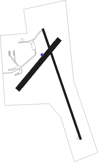
Dodge Center
Airport details
| Country | United States of America |
| State | Minnesota |
| Region | K3 |
| Airspace | Minneapolis Ctr |
| Municipality | Dodge Center |
| Elevation | 1305ft (398m) |
| Timezone | GMT -6 |
| Coordinates | 44.01799, -92.83162 |
| Magnetic var | |
| Type | land |
| Available since | X-Plane v10.40 |
| ICAO code | KTOB |
| IATA code | n/a |
| FAA code | TOB |
Communication
| Dodge Center AWOS 3 | 119.075 |
| Dodge Center CTAF | 122.900 |
| Dodge Center ROCHESTER Approach/Departure | 119.800 |
Nearby Points of Interest:
Kasson Public School
-Kasson Municipal Building
-Mantorville
-Ole Carlson House
-Perry Nelson House
-George Stoppel Farmstead
-Pill Hill, Rochester, Minnesota
-Dr. William J. Mayo House
-Conley–Maass–Downs Building
-Hauge Lutheran Church
-Pillsbury Baptist Bible College
-Ezra Abbott House
-Dr. John H. Adair House
-Owatonna Public Library
-Steele County Courthouse
-Owatonna City and Firemen's Hall
-Owatonna Commercial Historic District
-First Congregational Church of Zumbrota
-Minnesota State Public School for Dependent and Neglected Children
-Holden Lutheran Church Parsonage
-Walnut Street Bridge
-Pleasant Grove Masonic Lodge
-Hormel Historic Home
-Exchange State Bank
-Grand Army of the Republic Hall
Nearby beacons
| code | identifier | dist | bearing | frequency |
|---|---|---|---|---|
| OW | TONNA (OWATONNA) NDB | 14.3 | 280° | 379 |
| RST | ROCHESTER VOR/DME | 17.3 | 135° | 112 |
| FOW | HALFWAY (MORRISTOWN) VOR/DME | 25.7 | 289° | 111.20 |
| JAY | AUSTIN VOR/DME | 26.7 | 191° | 108.20 |
| AEL | ALBERT LEA VOR/DME | 30.8 | 238° | 109.80 |
| RG | REGUE (RED WING) NDB | 35.7 | 18° | 274 |
| FGT | FARMINGTON VORTAC | 39.7 | 330° | 115.70 |
| IY | CHUKK (CHARLES CITY) NDB | 53.2 | 173° | 417 |
| FCM | FLYING CLOUD (MINNEAPOLIS VOR/DME | 55.1 | 323° | 117.70 |
| MSP | MINNEAPOLIS VOR/DME | 55.5 | 335° | 115.30 |
| MCW | MASON CITY VOR/DME | 59.5 | 208° | 114.90 |
| MC | SURFF (MASON CITY) NDB | 61.8 | 207° | 348 |
Instrument approach procedures
| runway | airway (heading) | route (dist, bearing) |
|---|---|---|
| RW16 | ALMAY (93°) | ALMAY YINUR (23mi, 77°) 3000ft JOPSU (8mi, 80°) 3000ft |
| RW16 | FOBUG (153°) | FOBUG JOPSU (14mi, 147°) 3000ft |
| RW16 | JOPSU (161°) | JOPSU 3000ft |
| RW16 | RST (315°) | RST HOMLU (22mi, 2°) 3000ft WOKAB (8mi, 306°) 3000ft JOPSU (8mi, 259°) 3000ft |
| RNAV | JOPSU 3000ft WEDAM (6mi, 160°) 3000ft VEYVU (2mi, 160°) 2220ft KTOB (3mi, 161°) 1339ft (5527mi, 115°) 1549ft TUSZL (5525mi, 295°) 3000ft TUSZL (turn) | |
| RW34 | ALMAY (93°) | ALMAY UTOZA (32mi, 112°) 3000ft TUSZL (8mi, 79°) 3000ft |
| RW34 | FOBUG (153°) | FOBUG TUSZL (37mi, 155°) 3000ft TUSZL (turn) 3000ft |
| RW34 | NEWRY (57°) | NEWRY UTOZA (15mi, 79°) 3000ft TUSZL (8mi, 79°) 3000ft |
| RW34 | RST (315°) | RST TUSZL (8mi, 286°) 3000ft |
| RNAV | TUSZL 3000ft RMSTD (6mi, 341°) 3000ft ZERAP (4mi, 340°) 1880ft KTOB (2mi, 339°) 1344ft (5527mi, 115°) 1554ft JOPSU (5530mi, 295°) 3000ft JOPSU (turn) |
Disclaimer
The information on this website is not for real aviation. Use this data with the X-Plane flight simulator only! Data taken with kind consent from X-Plane 12 source code and data files. Content is subject to change without notice.

