Scott City - Scott City Muni
Airport details
| Country | United States of America |
| State | Kansas |
| Region | K3 |
| Airspace | Denver Ctr |
| Municipality | Scott City |
| Elevation | 2967ft (904m) |
| Timezone | GMT -5 |
| Coordinates | 38.47503, -100.88445 |
| Magnetic var | |
| Type | land |
| Available since | X-Plane v10.40 |
| ICAO code | KTQK |
| IATA code | n/a |
| FAA code | TQK |
Communication
| Scott City Muni AWOS 3 | 120.000 |
| Scott City Muni CTAF/UNICOM | 122.800 |
Nearby Points of Interest:
Lane County Community High School
-William B. and Julia Washington House
-Garden City High School
-Old Logan County Courthouse
-Bungalow Historic District
-Sen. William H. Thompson House
-Hope House
-Cedar Cliff
-Windsor Hotel
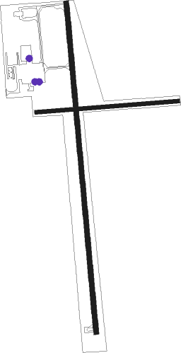
Runway info
Runway 17 / 35  | ||
| length | 1526m (5007ft) | |
| bearing | 179° / 359° | |
| width | 23m (75ft) | |
| surface | asphalt | |
| Runway 08 / 26 | ||
| length | 654m (2146ft) | |
| bearing | 90° / 270° | |
| width | 18m (60ft) | |
| surface | grass | |
Nearby beacons
| code | identifier | dist | bearing | frequency |
|---|---|---|---|---|
| GCK | GARDEN CITY VORTAC | 34.2 | 164° | 113.30 |
| OEL | OAKLEY NDB | 38.4 | 6° | 380 |
| GC | PIEVE (GARDEN CITY) NDB | 39.5 | 166° | 347 |
| DDC | DODGE CITY VORTAC | 55.9 | 125° | 108.20 |
| HLC | HILL CITY VORTAC | 56.2 | 40° | 113.70 |
| ULS | ULYSSES NDB | 57.4 | 209° | 395 |
| GL | SHUGR (GOODLAND) NDB | 59.4 | 319° | 414 |
| GLD | GOODLAND VORTAC | 66.5 | 318° | 115.10 |
Instrument approach procedures
| runway | airway (heading) | route (dist, bearing) |
|---|---|---|
| RW17 | COFFE (99°) | COFFE KABFU (11mi, 37°) 5000ft GAGSY (5mi, 89°) 5000ft |
| RW17 | GAGSY (179°) | GAGSY 5000ft |
| RW17 | ZAMPO (252°) | ZAMPO NERYI (22mi, 271°) 5000ft GAGSY (5mi, 270°) 5000ft |
| RNAV | GAGSY 5000ft IMPAY (6mi, 179°) 4600ft OSBIE (3mi, 179°) 3660ft KTQK (2mi, 178°) 2998ft (5916mi, 111°) 3369ft PUZLO (5917mi, 291°) 5000ft PUZLO (turn) | |
| RW35 | COFFE (99°) | COFFE HOEME (15mi, 152°) 5000ft PUZLO (5mi, 89°) 5000ft |
| RW35 | GCK (344°) | GCK PUZLO (23mi, 337°) 5000ft |
| RW35 | PUZLO (359°) | PUZLO 5000ft |
| RW35 | WAMIP (271°) | WAMIP YELLU (42mi, 260°) 5000ft PUZLO (5mi, 269°) 5000ft |
| RNAV | PUZLO 5000ft YOHUP (6mi, 359°) 4500ft KTQK (5mi, 359°) 2996ft (5916mi, 111°) 3212ft GAGSY (5915mi, 291°) 5000ft GAGSY (turn) |
Disclaimer
The information on this website is not for real aviation. Use this data with the X-Plane flight simulator only! Data taken with kind consent from X-Plane 12 source code and data files. Content is subject to change without notice.