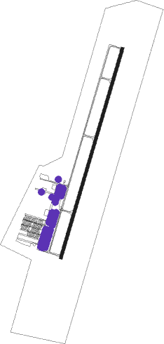
Sanford - Raleigh Exec Jetport
Airport details
| Country | United States of America |
| State | North Carolina |
| Region | K7 |
| Airspace | Washington Ctr |
| Municipality | Lee County |
| Elevation | 246ft (75m) |
| Timezone | GMT -5 |
| Coordinates | 35.58027, -79.10435 |
| Magnetic var | |
| Type | land |
| Available since | X-Plane v10.40 |
| ICAO code | KTTA |
| IATA code | n/a |
| FAA code | TTA |
Communication
| Raleigh Exec Jetport AWOS 3 | 120.625 |
| Raleigh Exec Jetport CTAF/UNICOM | 123.075 |
| Raleigh Exec Jetport RALEIGH Approach Departure | 125.300 |
Approach frequencies
| ILS-cat-I | RW03 | 110.75 | 18.00mi |
| 3° GS | RW03 | 110.75 | 18.00mi |
Nearby Points of Interest:
Lockville Dam, Canal and Powerhouse
-Hawkins Avenue Historic District
-East Sanford Historic District
-Sanford High School, Former
-Railroad House
-Temple Theater
-Downtown Sanford Historic District
-Rosemount-McIver Park Historic District
-John D. McIver Farm
-Lee County Courthouse
-Lee County Training School
-Luther Clegg House
-Lee Avenue Historic District
-Patrick St. Lawrence House
-McClenahan House
-Pittsboro Masonic Lodge
-Chatham County Courthouse
-Hall-London House
-A. P. Terry House
-Sheriff Stephen Wiley Brewer Farmstead
-Pittsboro Historic District
-Lewis Freeman House
-Reid House
-Henry Adolphus London House
-London Cottage
Nearby beacons
| code | identifier | dist | bearing | frequency |
|---|---|---|---|---|
| POB | POPE (FAYETTEVILLE) NDB | 22.4 | 157° | 338 |
| HQT | HARNETT (ERWIN) NDB | 22.7 | 109° | 417 |
| RDU | RALEIGH-DURHAM VORTAC | 23.5 | 48° | 117.20 |
| POB | POPE (FAYETTEVILLE) TACAN | 25 | 168° | 113.80 |
| LE | LEEVY (RALEIGH/DURHAM) NDB | 27.9 | 48° | 350 |
| LIB | LIBERTY VORTAC | 28.4 | 294° | 113 |
| FGP | FORT BRAGG NDB | 30.1 | 147° | 393 |
| SDZ | SANDHILLS (SOUTHERN PINES VORTAC | 32.2 | 233° | 111.80 |
| HB | ALAMM NDB | 33.4 | 310° | 361 |
| JN | JURLY (SMITHFIELD) NDB | 33.7 | 99° | 263 |
| FAY | FAYETTEVILLE VOR/DME | 37.4 | 159° | 108.80 |
| HUR | PERSON (ROXBORO) NDB | 39.2 | 3° | 220 |
| VU | ALLER (ALBEMARLE) NDB | 48.1 | 265° | 346 |
| HXO | HUNTSBORO (OXFORD) NDB | 49.3 | 34° | 271 |
| GSO | GREENSBORO VORTAC | 50.8 | 298° | 116.20 |
| CTZ | CLINTON NDB | 51.4 | 129° | 412 |
| ME | MAXTN (MAXTON) NDB | 53.5 | 202° | 257 |
| SIF | SLAMMER (REIDSVILLE) NDB | 57.7 | 321° | 423 |
| DAN | DANVILLE VOR | 60.4 | 347° | 113.10 |
| BES | BENNETTSVILLE NDB | 65.4 | 213° | 230 |
Instrument approach procedures
| runway | airway (heading) | route (dist, bearing) |
|---|---|---|
| RW03 | DENIL (313°) | DENIL EWOLO (12mi, 270°) 2100ft IKTOW (6mi, 306°) 2100ft |
| RW03 | IKTOW (25°) | IKTOW 2100ft |
| RW03 | OCHOC (55°) | OCHOC IKTOW (9mi, 90°) 2100ft |
| RNAV | IKTOW 2100ft HEDYY (5mi, 25°) 2100ft AMIRS (4mi, 25°) 860ft KTTA (2mi, 22°) 291ft (4874mi, 114°) 1300ft IKTOW (4877mi, 294°) 2100ft IKTOW (turn) | |
| RW21 | GUSES (158°) | GUSES OZOPE (6mi, 91°) 3100ft YUXSI (6mi, 134°) 2200ft |
| RNAV | YUXSI 2200ft WIZNY (6mi, 205°) 2000ft OQBOK (3mi, 205°) 1060ft KTTA (3mi, 207°) 269ft (4874mi, 114°) 480ft IKTOW (4877mi, 294°) 2100ft IKTOW (turn) |
Disclaimer
The information on this website is not for real aviation. Use this data with the X-Plane flight simulator only! Data taken with kind consent from X-Plane 12 source code and data files. Content is subject to change without notice.
