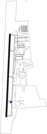
Aurora - Aurora State
Airport details
| Country | United States of America |
| State | Oregon |
| Region | K1 |
| Airspace | Seattle Ctr |
| Municipality | Marion County |
| Elevation | 200ft (61m) |
| Timezone | GMT -8 |
| Coordinates | 45.24714, -122.77006 |
| Magnetic var | |
| Type | land |
| Available since | X-Plane v10.32 |
| ICAO code | KUAO |
| IATA code | n/a |
| FAA code | UAO |
Communication
| Aurora State ASOS | 118.525 |
| Aurora State CTAF/UNICOM | 122.700 |
| Aurora State PORTLAND Clearance DEL | 119.950 |
| Aurora State GROUND | 119.150 |
| Aurora State TOWER | 120.350 |
| Aurora State PORTLAND Approach/Departure | 126.000 |
Approach frequencies
| LOC | RW17 | 111.15 | 18.00mi |
Nearby Points of Interest:
Aurora Colony
-William Barlow House
-John Sweek House
-Capt. John C. Ainsworth House
-Morton Matthew McCarver House
-Jesse Edwards House
-Minthorn Hall
-William L. Holmes House
-J. C. Penney Building (Newberg, Oregon)
-Shaver–Bilyeu House
-James Milne House
-Oregon City Municipal Elevator
-Oregon City Public Library
-Richard B. Petzold Building
-Harvey Cross House
-John M. and Elizabeth Bates House No. 4
-Sam Brown House
-John Tigard House
-Fred Vonder Ahe House
-Horace L. Dibble House
-St. Mary's Roman Catholic Church
-Oregon Iron Company Furnace
-George Rogers House
-Lake Oswego Odd Fellows Hall
-Elliott R. Corbett House
Nearby beacons
| code | identifier | dist | bearing | frequency |
|---|---|---|---|---|
| UBG | NEWBERG VOR/DME | 10.8 | 297° | 117.40 |
| CBU | COLUMBIA (PORTLAND) TACAN | 21.5 | 25° | 109.20 |
| SL | TURNO (SALEM) NDB | 25.2 | 204° | 266 |
| PND | BANKS (PORTLAND) NDB | 25.7 | 324° | 356 |
| BTG | BATTLE GROUND VORTAC | 30.9 | 20° | 116.60 |
| LWG | LEWISBURG (CORVALLIS) NDB | 43.5 | 218° | 225 |
| CVO | CORVALLIS VOR/DME | 50.1 | 215° | 115.40 |
Departure and arrival routes
| Transition altitude | 18000ft |
| Transition level | 18000ft |
| SID end points | distance | outbound heading | |
|---|---|---|---|
| RW17 | |||
| UBG2 | 11mi | 297° | |
| RW35 | |||
| UBG2 | 11mi | 297° | |
| STAR starting points | distance | inbound heading | |
|---|---|---|---|
| RW17 | |||
| HELNS6 | 30.9 | 200° | |
| RW35 | |||
| HELNS6 | 30.9 | 200° | |
Instrument approach procedures
| runway | airway (heading) | route (dist, bearing) |
|---|---|---|
| RW17 | UBG (117°) | UBG MOKIY (13mi, 65°) 4000ft MOKIY (turn) 4000ft |
| RNAV | MOKIY 4000ft LUTZZ (6mi, 190°) 2500ft FIDOV (5mi, 190°) 1060ft KUAO (3mi, 190°) 240ft (6750mi, 110°) 511ft DUBMY (6757mi, 290°) 3900ft DUBMY (turn) 3900ft | |
| RW35 | EMADE (24°) | EMADE DUBMY (8mi, 45°) 3700ft |
| RW35 | UBG (117°) | UBG DUBMY (21mi, 152°) 3700ft DUBMY (turn) 3700ft |
| RNAV | DUBMY 3700ft HITAK (5mi, 10°) 2500ft CIGRU (3mi, 10°) 1700ft TAZZE (3mi, 10°) 860ft KUAO (2mi, 10°) 236ft (6750mi, 110°) 452ft LUTZZ (6747mi, 290°) 2500ft LUTZZ (turn) |
Holding patterns
| STAR name | hold at | type | turn | heading* | altitude | leg | speed limit |
|---|---|---|---|---|---|---|---|
| HELNS6 | HELNS | VHF | left | 360 (180)° | < 17999ft | 1.0min timed | ICAO rules |
| *) magnetic outbound (inbound) holding course | |||||||
Disclaimer
The information on this website is not for real aviation. Use this data with the X-Plane flight simulator only! Data taken with kind consent from X-Plane 12 source code and data files. Content is subject to change without notice.