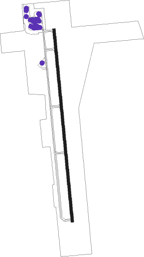
Vernal - Vernal Regl
Airport details
| Country | United States of America |
| State | Utah |
| Region | K2 |
| Airspace | Salt Lake City Ctr |
| Municipality | Uintah County |
| Elevation | 5278ft (1609m) |
| Timezone | GMT -7 |
| Coordinates | 40.44555, -109.51421 |
| Magnetic var | |
| Type | land |
| Available since | X-Plane v10.40 |
| ICAO code | KVEL |
| IATA code | VEL |
| FAA code | VEL |
Communication
| Vernal Regl ASOS | 135.175 |
| Vernal Regl CTAF/UNICOM | 122.700 |
Nearby Points of Interest:
Vernal Tithing Office
-Josie Bassett Morris Ranch Complex
-Rial Chew Ranch Complex
Nearby beacons
| code | identifier | dist | bearing | frequency |
|---|---|---|---|---|
| VEL | VERNAL VOR/DME | 4.1 | 163° | 108.20 |
| MTU | MYTON VOR/DME | 33.2 | 244° | 112.70 |
| FBR | FORT BRIDGER VOR/DME | 69.5 | 316° | 114.45 |
Instrument approach procedures
| runway | airway (heading) | route (dist, bearing) |
|---|---|---|
| RW35-Y | VEL (343°) | VEL OHAPE (15mi, 174°) 10000ft OHAPE (turn) 10000ft |
| RW35-Y | ZIKOS (333°) | ZIKOS OHAPE (13mi, 310°) 10000ft |
| RNAV | OHAPE 10000ft RIYAJ (12mi, 348°) 7200ft WAGUG (2mi, 359°) 6440ft KVEL (5mi, 357°) 5334ft (6290mi, 110°) 7000ft OHAPE (6292mi, 290°) 10000ft OHAPE (turn) | |
| RW35-Z | VEL (343°) | VEL OHAPE (15mi, 174°) 10000ft OHAPE (turn) 10000ft |
| RW35-Z | ZIKOS (333°) | ZIKOS OHAPE (13mi, 310°) 10000ft |
| RNAV | OHAPE 10000ft RIYAJ (12mi, 348°) 7200ft KVEL (7mi, 357°) 5334ft (6290mi, 110°) 7000ft OHAPE (6292mi, 290°) 10000ft OHAPE (turn) |
Disclaimer
The information on this website is not for real aviation. Use this data with the X-Plane flight simulator only! Data taken with kind consent from X-Plane 12 source code and data files. Content is subject to change without notice.
