Valparaiso - Porter Co Muni
Airport details
| Country | United States of America |
| State | Indiana |
| Region | K5 |
| Airspace | Chicago Ctr |
| Municipality | Porter County |
| Elevation | 770ft (235m) |
| Timezone | GMT -5 |
| Coordinates | 41.45397, -87.00708 |
| Magnetic var | |
| Type | land |
| Available since | X-Plane v10.40 |
| ICAO code | KVPZ |
| IATA code | VPZ |
| FAA code | VPZ |
Communication
| Porter Co Muni ASOS | 125.875 |
| Porter Co Muni CTAF | 122.725 |
| Porter Co Muni UNICOM | 122.725 |
| Porter Co Muni SOUTH BEND Approach/Departure | 132.050 |
Approach frequencies
| ILS-cat-I | RW27 | 109.7 | 18.00mi |
| 3° GS | RW27 | 109.7 | 18.00mi |
Nearby Points of Interest:
David Garland Rose House
-Heritage Hall
-Conrad and Catherine Bloch House
-William McCallum House
-Porter County Memorial Opera Hall
-Porter County Jail and Sheriff's House
-Haste-Crumpacker House
-Valparaiso Downtown Commercial District
-Dr. David J. Loring Residence and Clinic
-DeForest Skinner House
-Charles S. and Mary McGill House
-Everel S. Smith House
-Josephus Wolf House
-Pinhook Methodist Church and Cemetery
-George Brown Mansion
-Martin Young House
-Norris and Harriet Coambs Lustron House
-Chesterton Residential Historic District
-Weller House
-Chesterton Commercial Historic District
-New York Central Railroad Passenger Depot, Chesterton, Indiana
-John Wood Old Mill
-Clinton D. Gilson Barn
-Porter Town Hall
-Good Fellow Club Youth Camp
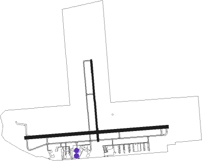
Runway info
Runway 9 / 27  | ||
| length | 2131m (6991ft) | |
| bearing | 90° / 270° | |
| width | 46m (150ft) | |
| surface | asphalt | |
| displ threshold | 152m (499ft) / 0m (0ft) | |
| Runway 18 / 36 | ||
| length | 1221m (4006ft) | |
| bearing | 180° / 360° | |
| width | 23m (75ft) | |
| surface | asphalt | |
Nearby beacons
| code | identifier | dist | bearing | frequency |
|---|---|---|---|---|
| VP | SEDLY (VALPARAISO) NDB | 5.8 | 91° | 212 |
| GY | GARIE (GARY) NDB | 16 | 290° | 236 |
| OXI | KNOX VOR/DME | 17.9 | 110° | 115.60 |
| CGT | CHICAGO HEIGHTS VORTAC | 25.6 | 276° | 114.20 |
| MX | KEDZI (CHICAGO) NDB | 35.1 | 293° | 248 |
| GIJ | GIPPER (NILES) VORTAC | 36.2 | 65° | 115.40 |
| EON | PEOTONE VORTAC | 37 | 257° | 113.20 |
| SB | MISHA (SOUTH BEND) NDB | 38.4 | 72° | 341 |
| GSH | GOSHEN VORTAC | 44.2 | 86° | 113.70 |
| IKK | DME | 44.3 | 246° | 111.60 |
| IK | LUKOW (KANKAKEE) NDB | 48.2 | 244° | 272 |
| GCO | DME | 51.5 | 301° | 108.25 |
| BVT | BOILER (LAFAYETTE) VORTAC | 53.9 | 184° | 115.10 |
| ELX | KEELER VOR/DME | 57.3 | 52° | 116.60 |
| GUS | GRISSOM (PERU) VORTAC | 62.1 | 133° | 108.45 |
| OBK | NORTHBROOK VOR/DME | 62.5 | 309° | 113 |
| OKK | KOKOMO VORTAC | 70.3 | 134° | 113.50 |
Instrument approach procedures
| runway | airway (heading) | route (dist, bearing) |
|---|---|---|
| RW09 | FLABE (90°) | FLABE 6000ft FLABE (turn) 2800ft |
| RW09 | ZONYU (72°) | ZONYU FLABE (5mi, 360°) 2800ft |
| RNAV | FLABE 2800ft OCAVE (6mi, 90°) 2400ft KVPZ (5mi, 89°) 814ft (5270mi, 115°) 1038ft FEVIX (5258mi, 296°) 2600ft FEVIX (turn) | |
| RW18 | CHETT (171°) | CHETT RODLE (8mi, 157°) 2600ft |
| RW18 | OXI (290°) | OXI RODLE (26mi, 313°) 2600ft RODLE (turn) 2600ft |
| RNAV | RODLE 2600ft SIPTE (6mi, 179°) 2600ft LABSE (3mi, 180°) 1660ft KVPZ (3mi, 180°) 810ft (5270mi, 115°) 1120ft CUKIK (5270mi, 295°) OXI (17mi, 100°) 2600ft OXI (turn) | |
| RW27 | CGT (96°) | CGT FEVIX (38mi, 94°) 2600ft FEVIX (turn) 2600ft |
| RW27 | NOMES (262°) | NOMES FEVIX (11mi, 253°) 2600ft |
| RW27 | OXI (290°) | OXI FEVIX (9mi, 325°) 2600ft |
| RNAV | FEVIX 2600ft POYIN (6mi, 270°) 2600ft COLBI (4mi, 270°) 1320ft KVPZ (2mi, 272°) 819ft (5270mi, 115°) 1020ft KEYVE (5274mi, 295°) LERGE (8mi, 180°) LECIL (8mi, 90°) FEVIX (11mi, 56°) 2600ft FEVIX (turn) |
Disclaimer
The information on this website is not for real aviation. Use this data with the X-Plane flight simulator only! Data taken with kind consent from X-Plane 12 source code and data files. Content is subject to change without notice.