Vero Beach - Vero Beach Municipal
Airport details
| Country | United States of America |
| State | Florida |
| Region | K7 |
| Airspace | Miami Oceanic Ctr |
| Municipality | Vero Beach |
| Elevation | 20ft (6m) |
| Timezone | GMT -5 |
| Coordinates | 27.65350, -80.40677 |
| Magnetic var | |
| Type | land |
| Available since | X-Plane v10.40 |
| ICAO code | KVRB |
| IATA code | VRB |
| FAA code | VRB |
Communication
| Vero Beach Municipal ATIS | 132.500 |
| Vero Beach Municipal CTAF | 126.300 |
| Vero Beach Municipal UNICOM | 122.950 |
| Vero Beach Municipal Clearance DEL | 134.975 |
| Vero Beach Municipal Ground Control | 127.450 |
| Vero Beach Municipal Tower | 126.300 |
| Vero Beach Municipal PALM BEACH ApproachROACH | 123.625 |
| Vero Beach Municipal PALM BEACH DepartureARTURE | 123.625 |
Nearby Points of Interest:
Old Vero Beach Community Building
-Old Indian River County Courthouse
-Maher Building
-Osceola Park Historic Residential District
-Judge Henry F. Gregory House
-Vero Beach Diesel Power Plant
-Theodore Hausmann Estate
-Treasure Hammock Ranch Farmstead
-Pelican Island National Wildlife Refuge
-Bamma Vickers Lawson House
-Old Town Sebastian Historic District, East
-Immokolee
-Old Town Sebastian Historic District, West
-St. Lucie Village Historic District
-Casa Caprona
-Archie Smith Wholesale Fish Company
-Zora Neale Hurston House
-First Methodist Episcopal Church
-Marian Fell Library
-Old St. Anastasia Catholic School
-Old Fort Pierce City Hall
-Old Fort Pierce Post Office
-Arcade Building
-St. Lucie High School
-Boston House
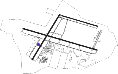
Runway info
Runway 4 / 22  | ||
| length | 1517m (4977ft) | |
| bearing | 39° / 219° | |
| width | 30m (98ft) | |
| surface | asphalt | |
| Runway 12L / 30R | ||
| length | 1075m (3527ft) | |
| bearing | 109° / 289° | |
| width | 23m (75ft) | |
| surface | asphalt | |
| displ threshold | 4m (13ft) / 9m (30ft) | |
| Runway 12R / 30L | ||
| length | 2224m (7297ft) | |
| bearing | 109° / 289° | |
| width | 30m (98ft) | |
| surface | asphalt | |
| blast zone | 61m (200ft) / 63m (207ft) | |
Nearby beacons
| code | identifier | dist | bearing | frequency |
|---|---|---|---|---|
| TRV | TREASURE (VERO BEACH) VORTAC | 4.6 | 287° | 117.30 |
| FPR | FORT PIERCE NDB | 10.1 | 169° | 275 |
| MLB | MELBOURNE VOR/DME | 29.7 | 333° | 115.85 |
| COF | PATRICK (COCOA) TACAN | 36.7 | 341° | 115 |
| UTX | UNITED NDB | 44.9 | 175° | 405 |
| PHK | PAHOKEE VOR/DME | 54.4 | 198° | 115.40 |
| PBI | PALM BEACH VORTAC | 60.9 | 162° | 115.70 |
| LBV | LA BELLE VORTAC | 72.2 | 230° | 110.40 |
| ORL | ORLANDO VORTAC | 72.5 | 314° | 112.20 |
Instrument approach procedures
| runway | airway (heading) | route (dist, bearing) |
|---|---|---|
| RW04 | EPLOW (66°) | EPLOW 2000ft JINSO (5mi, 123°) 2000ft |
| RW04 | FFAIR (17°) | FFAIR 2000ft JINSO (5mi, 303°) 2000ft |
| RW04 | JINSO (43°) | JINSO 2000ft |
| RNAV | JINSO 2000ft NOLBE (6mi, 39°) 1500ft KVRB (5mi, 47°) 63ft (4895mi, 109°) 424ft OJEMY (4890mi, 289°) 2000ft OJEMY (turn) | |
| RW12R | BLDOG (87°) | BLDOG 2000ft HOCKI (5mi, 23°) 2000ft |
| RW12R | HOCKI (108°) | HOCKI 2000ft |
| RW12R | MRINO (130°) | MRINO 2000ft HOCKI (5mi, 203°) 2000ft |
| RNAV | HOCKI 2000ft MUDDS (6mi, 108°) 1500ft ZAPES (3mi, 108°) 500ft KVRB (3mi, 105°) 65ft (4895mi, 109°) 279ft PUUMA (4885mi, 289°) 2000ft PUUMA (turn) | |
| RW22 | HAMVA (241°) | HAMVA 2000ft OJEMY (5mi, 303°) 2000ft |
| RW22 | IPINE (188°) | IPINE 2000ft OJEMY (5mi, 123°) 2000ft |
| RW22 | OJEMY (215°) | OJEMY 2000ft |
| RNAV | OJEMY 2000ft TATUW (6mi, 219°) 1500ft KVRB (5mi, 210°) 63ft (4895mi, 109°) 338ft JINSO (4902mi, 289°) 2000ft JINSO (turn) | |
| RW30L | HULLA (266°) | HULLA 2000ft PUUMA (5mi, 203°) 2000ft |
| RW30L | PUUMA (289°) | PUUMA 2000ft |
| RW30L | SUNDY (314°) | SUNDY 2000ft PUUMA (5mi, 23°) 2000ft |
| RNAV | PUUMA 2000ft ZOROE (6mi, 289°) 1500ft KVRB (4mi, 290°) 78ft (4895mi, 109°) 220ft HOCKI (4907mi, 289°) 2000ft HOCKI (turn) |
Disclaimer
The information on this website is not for real aviation. Use this data with the X-Plane flight simulator only! Data taken with kind consent from X-Plane 12 source code and data files. Content is subject to change without notice.