Detroit - Willow Run
Airport details
| Country | United States of America |
| State | Michigan |
| Region | K5 |
| Airspace | Cleveland Ctr |
| Municipality | Van Buren Township |
| Elevation | 712ft (217m) |
| Timezone | GMT -5 |
| Coordinates | 42.24003, -83.53089 |
| Magnetic var | |
| Type | land |
| Available since | X-Plane v10.40 |
| ICAO code | KYIP |
| IATA code | YIP |
| FAA code | YIP |
Communication
| Willow Run ATIS | 127.450 |
| Willow Run UNICOM | 122.950 |
| Willow Run Ground Control | 121.750 |
| Willow Run Tower | 125.275 |
| Willow Run DETROIT Approach/Departure | 118.950 |
Approach frequencies
| ILS-cat-I | RW23L | 109.5 | 18.00mi |
| ILS-cat-I | RW05R | 109.5 | 18.00mi |
| 3° GS | RW23L | 109.5 | 18.00mi |
| 3° GS | RW05R | 109.5 | 18.00mi |
Nearby Points of Interest:
John and Edna Truesdell Fischer Farmstead
-David and Elizabeth Bell Boldman House
-Sheldon Inn
-George and Mary Pine Smith House
-Thomas and Isabella Moore Clyde House
-Brinkerhoff-Becker House
-Thomas and Maria Blackman Bartlett House
-Starkweather Hall
-McKenny Hall
-Ephraim and Emma Woodworth Truesdell House
-John and Eliza Barr Patterson House
-Corktown Lofts
-Benjamin and Mary Ann Bradford House
-Phillip and Maria Hasselbach Dingledey House
-Orrin and Roxanne Fairman Kinyon House
-Parker Mill
-Tivadar and Dorothy Balogh House
-Dixboro United Methodist Church
-Sutherland House
-Orrin White House
-Arnold and Gertrude Goss House
-Robert C. and Bettie J. (Sponseller) Metcalf House
-William and Elizabeth (Bodanzky) Muschenheim House
-Tuomy Hills Service Station
-Henry W. Baker House
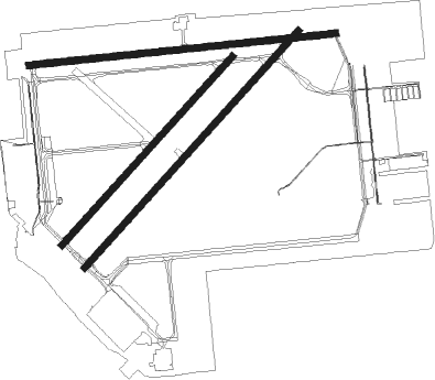
Runway info
Runway 5R / 23L  | ||
| length | 2292m (7520ft) | |
| bearing | 55° / 235° | |
| width | 46m (151ft) | |
| surface | concrete | |
| blast zone | 61m (200ft) / 61m (200ft) | |
| Runway 9 / 27 | ||
| length | 2218m (7277ft) | |
| bearing | 89° / 269° | |
| width | 49m (161ft) | |
| surface | asphalt | |
| displ threshold | 176m (577ft) / 0m (0ft) | |
| Runway 5L / 23R | ||
| length | 1824m (5984ft) | |
| bearing | 55° / 235° | |
| width | 49m (161ft) | |
| surface | asphalt | |
| blast zone | 0m (0ft) / 31m (102ft) | |
Nearby beacons
| code | identifier | dist | bearing | frequency |
|---|---|---|---|---|
| DXO | DETROIT VOR/DME | 7.4 | 99° | 113.40 |
| DT | REVUP (DETROIT) NDB | 8.4 | 140° | 388 |
| SVM | SALEM VORTAC | 10.5 | 340° | 114.30 |
| CRL | CARLETON VOR/DME | 11.9 | 159° | 115.70 |
| DM | SPENC (DETROIT) NDB | 14.6 | 93° | 223 |
| RYS | GROSSE ILE (DETROIT) NDB | 18.7 | 110° | 419 |
| TCU | TECUMSEH NDB | 20 | 240° | 239 |
| PSI | DME | 27.6 | 360° | 111 |
| QG | WINDSOR NDB | 29.7 | 84° | 353 |
| ADG | ADRIAN NDB | 32.9 | 236° | 278 |
| MTC | SELFRIDGE (MOUNT CLEMENS) TACAN | 38.2 | 62° | 133.70 |
| TOL | TOLEDO TACAN | 40.6 | 203° | 112.50 |
| JXN | DME | 41.2 | 271° | 115.45 |
| FNT | FLINT VORTAC | 44.6 | 343° | 116.90 |
| TO | TOPHR (TOLEDO) NDB | 44.7 | 210° | 219 |
| PCW | PORT CLINTON NDB | 52.4 | 137° | 423 |
| PH | PHURN (PORT HURON) NDB | 54.9 | 57° | 332 |
Departure and arrival routes
| Transition altitude | 18000ft |
| Transition level | 18000ft |
| SID end points | distance | outbound heading | |
|---|---|---|---|
| ALL | |||
| METRO3 | 43mi | 31° | |
| RW05 (ALL) | |||
| ZETTR3 | 69mi | 56° | |
| HHOWE3 | 90mi | 90° | |
| PAVYL2 | 87mi | 94° | |
| LIDDS2 | 125mi | 117° | |
| CLVIN2 | 200mi | 191° | |
| BARII2 | 114mi | 206° | |
| SNDRS2 | 98mi | 211° | |
| CCOBB2 | 69mi | 270° | |
| KAYLN2 | 116mi | 275° | |
| MIGGY2 | 96mi | 311° | |
| TRMML3 | 89mi | 355° | |
| RW09 | |||
| ZETTR3 | 69mi | 56° | |
| HHOWE3 | 90mi | 90° | |
| PAVYL2 | 87mi | 94° | |
| LIDDS2 | 125mi | 117° | |
| CLVIN2 | 200mi | 191° | |
| BARII2 | 114mi | 206° | |
| SNDRS2 | 98mi | 211° | |
| CCOBB2 | 69mi | 270° | |
| KAYLN2 | 116mi | 275° | |
| MIGGY2 | 96mi | 311° | |
| TRMML3 | 89mi | 355° | |
| RW23 (ALL) | |||
| ZETTR3 | 69mi | 56° | |
| HHOWE3 | 90mi | 90° | |
| PAVYL2 | 87mi | 94° | |
| LIDDS2 | 125mi | 117° | |
| CLVIN2 | 200mi | 191° | |
| BARII2 | 114mi | 206° | |
| SNDRS2 | 98mi | 211° | |
| CCOBB2 | 69mi | 270° | |
| KAYLN2 | 116mi | 275° | |
| MIGGY2 | 96mi | 311° | |
| TRMML3 | 89mi | 355° | |
| RW27 | |||
| ZETTR3 | 69mi | 56° | |
| HHOWE3 | 90mi | 90° | |
| PAVYL2 | 87mi | 94° | |
| LIDDS2 | 125mi | 117° | |
| CLVIN2 | 200mi | 191° | |
| BARII2 | 114mi | 206° | |
| SNDRS2 | 98mi | 211° | |
| CCOBB2 | 69mi | 270° | |
| KAYLN2 | 116mi | 275° | |
| MIGGY2 | 96mi | 311° | |
| TRMML3 | 89mi | 355° | |
| STAR starting points | distance | inbound heading | |
|---|---|---|---|
| ALL | |||
| PETTE2 | 37.4 | 79° | |
| RRALF3 | 31.2 | 117° | |
| OKLND1 | 77.1 | 249° | |
| FOREY2 | 45.3 | 295° | |
Instrument approach procedures
| runway | airway (heading) | route (dist, bearing) |
|---|---|---|
| RW05R | HEDUM (80°) | HEDUM ICADE (8mi, 128°) 3000ft |
| RW05R | ICADE (54°) | ICADE 3000ft |
| RNAV | ICADE 3000ft TABUY (8mi, 55°) 2400ft KYIP (6mi, 54°) 773ft (5118mi, 117°) 1200ft SVM (5121mi, 297°) 3000ft SVM (turn) | |
| RW09 | CIGAL (90°) | CIGAL 4000ft |
| RNAV | CIGAL 4000ft ATOYE (5mi, 89°) 2600ft NOCIN (3mi, 89°) 1560ft KYIP (3mi, 93°) 765ft (5118mi, 117°) 1900ft CIGAL (5129mi, 297°) 4000ft CIGAL (turn) | |
| RW23L | KUPNE (204°) | KUPNE PLYMT (5mi, 140°) 2400ft |
| RNAV | PLYMT 2400ft FELUS (6mi, 220°) 2000ft KYIP (4mi, 237°) 759ft (5118mi, 117°) 959ft ZAVEX (5124mi, 297°) 3000ft ZAVEX (turn) |
Holding patterns
| STAR name | hold at | type | turn | heading* | altitude | leg | speed limit |
|---|---|---|---|---|---|---|---|
| FOREY2 | FOREY | VHF | right | 144 (324)° | DME 10.0mi | ICAO rules | |
| PETTE2 | PETTE | VHF | left | 241 (61)° | DME 10.0mi | ICAO rules | |
| RRALF3 | KILTT | VHF | right | 313 (133)° | DME 10.0mi | ICAO rules | |
| *) magnetic outbound (inbound) holding course | |||||||
Disclaimer
The information on this website is not for real aviation. Use this data with the X-Plane flight simulator only! Data taken with kind consent from X-Plane 12 source code and data files. Content is subject to change without notice.