Youngstown/warren - Youngstown Warren Rgnl
Airport details
| Country | United States of America |
| State | Ohio |
| Region | K5 |
| Airspace | Cleveland Ctr |
| Municipality | Trumbull County |
| Elevation | 1191ft (363m) |
| Timezone | GMT -5 |
| Coordinates | 41.26159, -80.68036 |
| Magnetic var | |
| Type | land |
| Available since | X-Plane v10.40 |
| ICAO code | KYNG |
| IATA code | YNG |
| FAA code | YNG |
Communication
| Youngstown Warren Rgnl ATIS | 123.750 |
| Youngstown Warren Rgnl UNICOM | 122.950 |
| Youngstown Warren Rgnl Clearance DEL | 118.250 |
| Youngstown Warren Rgnl Ground Control | 121.900 |
| Youngstown Warren Rgnl Tower | 119.500 |
| Youngstown Warren Rgnl Approach/Departure | 127.150 |
Approach frequencies
| ILS-cat-I | RW14 | 110.1 | 18.00mi |
| ILS-cat-I | RW32 | 110.1 | 18.00mi |
| 3° GS | RW14 | 110.1 | 18.00mi |
| 3° GS | RW32 | 110.1 | 18.00mi |
Nearby Points of Interest:
Niles Masonic Temple
-Harriet Taylor Upton House
-Frank H. Buhl Mansion
-Stambaugh Auditorium
-George J. Renner, Jr. House
-First Universalist Church of Sharpsville
-Arlington Avenue District
-Jonas J. Pierce House
-Youngstown station
-YWCA Youngstown
-Masonic Temple
-Liberty Theatre
-Wick Building
-Metropolitan Tower
-William H. McGuffey Boyhood Home Site
-Congregational-Presbyterian Church
-Clarence Darrow Octagon House
-Dr. Peter Allen House
-Austintown Log House
-Greenville Commercial Historic District
-New Hamburg Historical Area
-Big Bend Historical Area
-Gibson House
-S.R. Thompson House
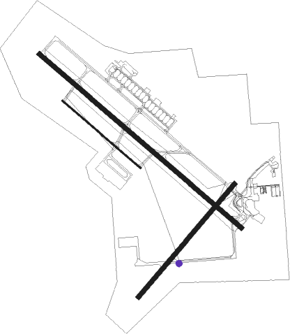
Runway info
Runway 14 / 32  | ||
| length | 2750m (9022ft) | |
| bearing | 127° / 307° | |
| width | 46m (150ft) | |
| surface | asphalt | |
| blast zone | 61m (200ft) / 61m (200ft) | |
| Runway 5 / 23 | ||
| length | 1525m (5003ft) | |
| bearing | 53° / 233° | |
| width | 46m (150ft) | |
| surface | asphalt | |
| Runway 14R / 32L | ||
| length | 1065m (3494ft) | |
| bearing | 127° / 307° | |
| width | 18m (60ft) | |
| surface | asphalt | |
| blast zone | 91m (299ft) / 91m (299ft) | |
Nearby beacons
| code | identifier | dist | bearing | frequency |
|---|---|---|---|---|
| YNG | YOUNGSTOWN VORTAC | 4.1 | 5° | 109 |
| YN | FETCH (YOUNGSTOWN/WARREN) NDB | 5.2 | 126° | 338 |
| UCP | CASTLE (NEW CASTLE) NDB | 18.6 | 132° | 272 |
| ACO | AKRON VOR/DME | 25.2 | 254° | 114.40 |
| CXR | CHARDON VOR/DME | 26.6 | 298° | 112.70 |
| JFN | JEFFERSON VOR/DME | 30 | 352° | 115.20 |
| EWC | ELLWOOD CITY VOR/DME | 33.7 | 133° | 115.80 |
| AK | AKRON NDB | 33.9 | 255° | 362 |
| FKL | FRANKLIN VOR | 38.6 | 78° | 109.60 |
| LQL | LAKELAND (WILLOUGHBY) NDB | 40.3 | 301° | 263 |
| BF | TABEY (CLEVELAND) NDB | 44.2 | 289° | 248 |
| BSV | BRIGGS VOR/DME | 46.2 | 235° | 112.40 |
| ERI | ERIE VORTAC | 48.6 | 27° | 109.40 |
| MMJ | (PITTSBURGH) DME | 51.4 | 148° | 112 |
| AGC | ALLEGHENY (PITTSBURGH) VOR/DME | 65.8 | 147° | 110 |
Instrument approach procedures
| runway | airway (heading) | route (dist, bearing) |
|---|---|---|
| RW14 | YNG (185°) | YNG OTNOE (10mi, 291°) 2900ft OTNOE (turn) 2900ft |
| RNAV | OTNOE 2900ft ZAVIB (6mi, 127°) 2900ft KYNG (6mi, 128°) 1164ft UNERE (12mi, 127°) 2900ft UNERE (turn) | |
| RW32 | YNG (185°) | YNG UNERE (15mi, 139°) 2900ft UNERE (turn) 2900ft |
| RNAV | UNERE 2900ft WHYSU (6mi, 307°) 2800ft SUYOT (2mi, 307°) 2040ft KYNG (3mi, 305°) 1221ft (4985mi, 117°) 1457ft OTNOE (4995mi, 297°) 2900ft OTNOE (turn) |
Disclaimer
The information on this website is not for real aviation. Use this data with the X-Plane flight simulator only! Data taken with kind consent from X-Plane 12 source code and data files. Content is subject to change without notice.