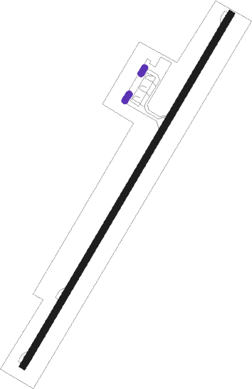
Brač Island - Brac
Airport details
| Country | Croatia |
| State | Split-Dalmatia County |
| Region | LD |
| Airspace | Zagreb Ctr |
| Municipality | Općina Pučišća |
| Elevation | 1780ft (543m) |
| Timezone | GMT +1 |
| Coordinates | 43.28572, 16.67972 |
| Magnetic var | |
| Type | land |
| Available since | X-Plane v10.30 |
| ICAO code | LDSB |
| IATA code | BWK |
| FAA code | n/a |
Communication
| Brac Brac Tower | 118.025 |
| Brac Split Radar | 120.875 |
Nearby Points of Interest:
Historical Complex of Split with the Palace of Diocletian
-Splitska sinagoga
-Crljivica
Nearby beacons
| code | identifier | dist | bearing | frequency |
|---|---|---|---|---|
| HUM | HUMAC (BRAC) NDB | 0.1 | 319° | 412 |
| BRC | DME | 2.5 | 267° | 115.45 |
| SPL | SPLIT VOR/DME | 20.6 | 299° | 115.70 |
| TRI | TROGIR NDB | 23.6 | 295° | 378 |
| DVN | DRVENIK NDB | 25.3 | 287° | 418 |
| VRL | VRLIKA NDB | 40.3 | 339° | 283 |
Departure and arrival routes
| Transition altitude | 9500ft |
| SID end points | distance | outbound heading | |
|---|---|---|---|
| RW03 | |||
| SIPA7S, SIPA1Q | 19mi | 111° | |
| SPL1Q, SPL5T, SPL6U, SPL7S | 21mi | 299° | |
| RW21 | |||
| SIPA1T, SIPA6R | 19mi | 111° | |
| SPL1M, SPL5R | 21mi | 299° | |
| STAR starting points | distance | inbound heading | |
|---|---|---|---|
| ALL | |||
| SPL1P, SPL6N | 20.6 | 119° | |
| SIPA1X, SIPA6N, SIPA6P | 19.4 | 291° | |
| ORAK1X | 50.4 | 325° | |
| RILI1X | 38.1 | 348° | |
Instrument approach procedures
| runway | airway (heading) | route (dist, bearing) |
|---|---|---|
| RW03 | HUM (139°) | HUM 5000ft SB511 (5mi, 117°) 4000ft SB510 (10mi, 224°) 4000ft SB509 (5mi, 297°) 3600ft |
| RW03 | PERIP (321°) | PERIP 5000ft SB510 (9mi, 275°) 4000ft SB509 (5mi, 297°) 3600ft |
| RNAV | SB509 3600ft DAFRO (4mi, 44°) 3500ft LDSB (6mi, 44°) 1829ft SB508 (4mi, 44°) SB507 (6mi, 111°) SB506 (9mi, 224°) PERIP (7mi, 128°) 5000ft PERIP (turn) 5000ft | |
| RW21 | HUM (139°) | HUM 5000ft SB408 (6mi, 115°) 4000ft SB409 (8mi, 40°) 4000ft SB410 (5mi, 285°) 3000ft |
| RW21 | PERIP (321°) | PERIP 5000ft SB408 (9mi, 340°) 4000ft SB409 (8mi, 40°) 4000ft SB410 (5mi, 285°) 3000ft |
| RNAV | SB410 3000ft SAJLO (3mi, 224°) 2800ft LDSB (4mi, 224°) 1751ft SB407 (3mi, 224°) PERIP (13mi, 128°) 5000ft PERIP (turn) 5000ft |
Holding patterns
| STAR name | hold at | type | turn | heading* | altitude | leg | speed limit |
|---|---|---|---|---|---|---|---|
| ORAK1X | PERIP | VHF | left | 132 (312)° | > 5000ft | 1.0min timed | 190 |
| RILI1X | PERIP | VHF | left | 132 (312)° | > 5000ft | 1.0min timed | 190 |
| SIPA1X | PERIP | VHF | left | 132 (312)° | > 5000ft | 1.0min timed | 190 |
| SIPA6N | HUM | FIX | right | 207 (27)° | > 4000ft | 1.0min timed | 190 |
| SIPA6P | FF124 | VHF | right | 303 (123)° | > 5000ft | 1.0min timed | 190 |
| SPL1P | HUM | FIX | right | 207 (27)° | > 4000ft | 1.0min timed | 190 |
| SPL6N | FF124 | VHF | right | 303 (123)° | > 5000ft | 1.0min timed | 190 |
| SPL6N | HUM | FIX | right | 207 (27)° | > 4000ft | 1.0min timed | 190 |
| *) magnetic outbound (inbound) holding course | |||||||
Disclaimer
The information on this website is not for real aviation. Use this data with the X-Plane flight simulator only! Data taken with kind consent from X-Plane 12 source code and data files. Content is subject to change without notice.
