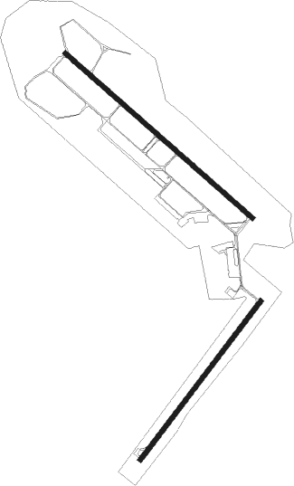
Zadar
Airport details
| Country | Croatia |
| State | Zadar County |
| Region | LD |
| Airspace | Zagreb Ctr |
| Municipality | Općina Zemunik Donji |
| Elevation | 289ft (88m) |
| Timezone | GMT +1 |
| Coordinates | 44.10827, 15.34670 |
| Magnetic var | |
| Type | land |
| Available since | X-Plane v10.40 |
| ICAO code | LDZD |
| IATA code | ZAD |
| FAA code | n/a |
Communication
| Zadar Tower | 123.700 |
| Zadar Approach | 118.600 |
Approach frequencies
| ILS-cat-I | RW13 | 110.1 | 18.00mi |
| 3° GS | RW13 | 110.1 | 18.00mi |
Nearby Points of Interest:
Masters Road
-Velebit

Nearby beacons
| code | identifier | dist | bearing | frequency |
|---|---|---|---|---|
| ZDA | ZADAR VOR/DME | 1 | 126° | 108.60 |
| ZK | ZADAR NDB | 1.1 | 127° | 348 |
| BO | BOKANJAC NDB | 5.1 | 306° | 385 |
| ZRA | KAKMA NDB | 9.2 | 127° | 330 |
| SAL | SALI NDB | 12.8 | 226° | 421 |
| LSJ | DME | 44.1 | 295° | 108.45 |
| LOS | LOSINJ NDB | 45.1 | 296° | 429 |
| NTL | LOSINJ VOR/DME | 49.4 | 296° | 117.35 |
| DVN | DRVENIK NDB | 52.6 | 130° | 418 |
| TRI | TROGIR NDB | 52.8 | 125° | 378 |
| SPL | SPLIT VOR/DME | 55.4 | 123° | 115.70 |
| CRE | CRES NDB | 62.1 | 311° | 433 |
Departure and arrival routes
| Transition altitude | 10000ft |
| SID end points | distance | outbound heading | |
|---|---|---|---|
| RW04 | |||
| PALE2A, PALE2W | 29mi | 22° | |
| SPL3W, SPL5F | 55mi | 123° | |
| RAVN2A, RAVN2W | 33mi | 311° | |
| RW13 | |||
| PALE1X, PALE1V, PALE1B | 29mi | 22° | |
| SPL4D, SPL1V | 55mi | 123° | |
| RAVN1X, RAVN1V, RAVN1B | 33mi | 311° | |
| RW22 | |||
| PALE1C, PALE2U | 29mi | 22° | |
| SPL3G, SPL1U | 55mi | 123° | |
| RAVN1U, RAVN1C | 33mi | 311° | |
| RW31 | |||
| PALE1D, PALE2T | 29mi | 22° | |
| SPL1T, SPL5E | 55mi | 123° | |
| RAVN1D, RAVN1T | 33mi | 311° | |
| STAR starting points | distance | inbound heading | |
|---|---|---|---|
| ALL | |||
| KUDU1A, KUDU1B | 35.8 | 153° | |
| SPL6B | 55.4 | 303° | |
| RW04 | |||
| ELGU1Z | 37.4 | 34° | |
| KUDU1Z | 35.8 | 153° | |
| SPL2Z | 55.4 | 303° | |
| RW13 | |||
| ELGU1Y | 37.4 | 34° | |
| KUDU1Y | 35.8 | 153° | |
| SPL2Y | 55.4 | 303° | |
| RW31 | |||
| ELGU1X | 37.4 | 34° | |
| KUDU1X | 35.8 | 153° | |
| SPL2X | 55.4 | 303° | |
Instrument approach procedures
| runway | airway (heading) | route (dist, bearing) |
|---|---|---|
| RW04 | OSTAK (79°) | OSTAK 4000ft ZD401 (7mi, 123°) 2200ft |
| RW04 | RIMUG (2°) | RIMUG 4000ft ZD401 (7mi, 303°) 2200ft |
| RW04 | SOGRA (47°) | SOGRA 3000ft ZD401 (7mi, 51°) 2200ft |
| RNAV | ZD401 2200ft DINKO (4mi, 51°) 1700ft LDZD (6mi, 41°) 339ft (2773mi, 199°) 1000ft ZRA (2769mi, 19°) RODGO (5mi, 127°) 4000ft RODGO (turn) 4000ft | |
| RW13-Y | EDADI (349°) | EDADI 4000ft ZD502 (23mi, 306°) ZD503 (7mi, 55°) 3000ft |
| RNAV | ZD503 3000ft LEBDI (5mi, 126°) 3000ft LDZD (9mi, 126°) 295ft ZD504 (4mi, 126°) 1100ft SAL (13mi, 244°) SOGRA (3mi, 231°) 3000ft SOGRA (turn) 3000ft | |
| RW13-Z | NEDID (146°) | NEDID 8000ft LUKAV (7mi, 235°) 6000ft |
| RW13-Z | NOBRU (110°) | NOBRU 6000ft LUKAV (7mi, 55°) 6000ft |
| RNAV | LUKAV 6000ft LEBDI (12mi, 126°) 3000ft LDZD (9mi, 126°) 295ft ZD504 (4mi, 126°) 1100ft SAL (13mi, 244°) SOGRA (3mi, 231°) 3000ft SOGRA (turn) 3000ft | |
| RW31 | ANAKO (336°) | ANAKO 5000ft RODGO (7mi, 55°) 4000ft |
| RW31 | BEPTU (284°) | BEPTU 6000ft RODGO (7mi, 235°) 4000ft |
| RW31 | RODGO (307°) | RODGO 4000ft |
| RNAV | RODGO 4000ft LEVPA (5mi, 307°) 3000ft LDZD (9mi, 307°) 308ft BO (5mi, 306°) 1300ft SAL (14mi, 203°) SOGRA (3mi, 231°) 3000ft SOGRA (turn) 3000ft |
Holding patterns
| STAR name | hold at | type | turn | heading* | altitude | leg | speed limit |
|---|---|---|---|---|---|---|---|
| ELGU1X | RODGO | VHF | right | 132 (312)° | > 4000ft | 1.0min timed | 210 |
| ELGU1Y | EDADI | VHF | right | 132 (312)° | > 4000ft | 1.0min timed | 230 |
| ELGU1Z | SOGRA | VHF | right | 217 (37)° | > 3000ft | 1.0min timed | 210 |
| KUDU1A | LUKAV | VHF | right | 312 (132)° | > 6000ft | DME 5.0mi | 250 |
| KUDU1B | ZRA | FIX | left | 132 (312)° | > 3000ft | DME 4.0mi | ICAO rules |
| KUDU1X | KUDUL | VHF | right | 5 (185)° | > 9000ft | 1.0min timed | 250 |
| KUDU1X | RODGO | VHF | right | 132 (312)° | > 4000ft | 1.0min timed | 210 |
| KUDU1Y | KUDUL | VHF | right | 5 (185)° | > 9000ft | 1.0min timed | 250 |
| KUDU1Y | LUKAV | VHF | right | 312 (132)° | > 6000ft | DME 5.0mi | 250 |
| KUDU1Z | KUDUL | VHF | right | 5 (185)° | > 9000ft | 1.0min timed | 250 |
| KUDU1Z | SOGRA | VHF | right | 217 (37)° | > 3000ft | 1.0min timed | 210 |
| LOS2X | MINTU | VHF | right | 315 (135)° | > 6000ft | 1.0min timed | 250 |
| LOS2X | RODGO | VHF | right | 132 (312)° | > 4000ft | 1.0min timed | 210 |
| LOS2Y | LUKAV | VHF | right | 312 (132)° | > 6000ft | DME 5.0mi | 250 |
| LOS2Y | MINTU | VHF | right | 315 (135)° | > 6000ft | 1.0min timed | 250 |
| LOS2Z | MINTU | VHF | right | 315 (135)° | > 6000ft | 1.0min timed | 250 |
| LOS2Z | SOGRA | VHF | right | 217 (37)° | > 3000ft | 1.0min timed | 210 |
| LOS6A | LUKAV | VHF | right | 312 (132)° | > 6000ft | DME 5.0mi | 250 |
| SPL2X | RODGO | VHF | right | 132 (312)° | > 4000ft | 1.0min timed | 210 |
| SPL2Y | EDADI | VHF | right | 132 (312)° | > 4000ft | 1.0min timed | 230 |
| SPL2Z | SOGRA | VHF | right | 217 (37)° | > 3000ft | 1.0min timed | 210 |
| SPL6B | ZRA | FIX | left | 132 (312)° | > 3000ft | DME 4.0mi | ICAO rules |
| *) magnetic outbound (inbound) holding course | |||||||
Disclaimer
The information on this website is not for real aviation. Use this data with the X-Plane flight simulator only! Data taken with kind consent from X-Plane 12 source code and data files. Content is subject to change without notice.