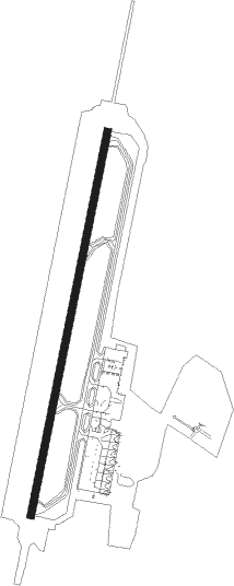
Girona
Airport details
| Country | Spain |
| State | Catalonia |
| Region | LE |
| Airspace | Barcelona Ctr |
| Municipality | Vilobí d'Onyar |
| Elevation | 469ft (143m) |
| Timezone | GMT +1 |
| Coordinates | 41.90083, 2.76056 |
| Magnetic var | |
| Type | land |
| Available since | X-Plane v10.40 |
| ICAO code | LEGE |
| IATA code | GRO |
| FAA code | n/a |
Communication
| Girona ATIS | 128.750 |
| Girona Ground Control | 121.700 |
| Girona Tower | 118.500 |
| Girona Approach | 120.900 |
| Girona Tower | 121.700 |
Approach frequencies
| ILS-cat-III | RW19 | 109.9 | 18.00mi |
| 3° GS | RW19 | 109.9 | 18.00mi |
Nearby Points of Interest:
can Pascol
-Can Granic
-can Gras
-Can Carreter de la Dent
-Rectoria de Salitja
-Can Planellas
-Mas Aloart (Vilobí d'Onyar)
-Els Delmes
-Can Bes
-Cal Ferrer Pagès (Vilobí d'Onyar)
-Can Saus
-L'Hostal Nou
-Can Vivolas
-Cal Teixidor
-Can Benet
-Travessia antiga de Cal Metge, 1-3
-Rectoria de Vilobí d'Onyar
-Can Roscada
-Plaça Vella
-Fusteria (Vilobí d'Onyar)
-Eixample de Vilobí
-Cal Rajoler
-Can Valls
-Escoles Velles
-Can Tries
Nearby beacons
| code | identifier | dist | bearing | frequency |
|---|---|---|---|---|
| G | GIRONA NDB | 1.5 | 21° | 330 |
| GIR | GERONA (GIRONA) VOR/DME | 1.8 | 20° | 114.10 |
| GRN | GERONA (GIRONA) NDB | 7.7 | 21° | 412 |
| CLE | CALELLA VOR/DME | 16.6 | 206° | 115.35 |
| BGR | BAGUR VOR/DME | 20.2 | 84° | 112.20 |
| SLL | SABADELL VOR/DME | 37 | 240° | 112 |
| BCN | BARCELONA VOR/DME | 46.1 | 228° | 116.70 |
| SAL | SAINTE LEOCADIE NDB | 46.7 | 306° | 418 |
| PL | RIVESALTES (PERPIGNAN) NDB | 47.3 | 12° | 351 |
| PRA | EL PRAT VOR/DME | 48 | 228° | 114.30 |
| PPG | PERPIGNAN RIVESALTES VOR/DME | 51.1 | 7° | 117.20 |
Departure and arrival routes
| Transition altitude | 6000ft |
| SID end points | distance | outbound heading | |
|---|---|---|---|
| RW01 | |||
| BGR4Z, BGR6G | 20mi | 84° | |
| MAMU2G | 31mi | 265° | |
| GEAN2G | 40mi | 314° | |
| RW19 | |||
| BGR5H | 20mi | 84° | |
| MAMU3H | 31mi | 265° | |
| GEAN1H | 40mi | 314° | |
| STAR starting points | distance | inbound heading | |
|---|---|---|---|
| RW01 | |||
| MAMU1Y, MAMU2K | 31.0 | 85° | |
| KANI3K | 36.1 | 201° | |
| BGR3K | 20.2 | 264° | |
| RW19 | |||
| MAMU2L, MAMU2F | 31.0 | 85° | |
| KANI2F | 36.1 | 201° | |
| BGR4F | 20.2 | 264° | |
Holding patterns
| STAR name | hold at | type | turn | heading* | altitude | leg | speed limit |
|---|---|---|---|---|---|---|---|
| BGR3K | OKETA | VHF | left | 71 (251)° | > 5000ft | DME 5.0mi | ICAO rules |
| BGR4F | BANOL | VHF | left | 15 (195)° | > 4500ft | DME 4.8mi | ICAO rules |
| KANI2F | BANOL | VHF | left | 15 (195)° | > 4500ft | DME 4.8mi | ICAO rules |
| KANI3K | GIR | NDB | left | 15 (195)° | > 5000ft | 1.0min timed | ICAO rules |
| KANI3K | OKETA | VHF | left | 71 (251)° | > 5000ft | DME 5.0mi | ICAO rules |
| MAMU1Y | CLE | NDB | left | 10 (190)° | 7000ft - 10000ft | 1.0min timed | ICAO rules |
| MAMU2F | BANOL | VHF | left | 15 (195)° | > 4500ft | DME 4.8mi | ICAO rules |
| MAMU2F | GRN | FIX | left | 15 (195)° | > 5000ft | 1.0min timed | ICAO rules |
| MAMU2K | GIR | NDB | left | 15 (195)° | > 5000ft | 1.0min timed | ICAO rules |
| MAMU2K | OKETA | VHF | left | 71 (251)° | > 5000ft | DME 5.0mi | ICAO rules |
| MAMU2L | BANOL | VHF | left | 15 (195)° | > 4500ft | DME 4.8mi | ICAO rules |
| MAMU2L | GIR | NDB | left | 15 (195)° | > 5000ft | 1.0min timed | ICAO rules |
| *) magnetic outbound (inbound) holding course | |||||||
Disclaimer
The information on this website is not for real aviation. Use this data with the X-Plane flight simulator only! Data taken with kind consent from X-Plane 12 source code and data files. Content is subject to change without notice.