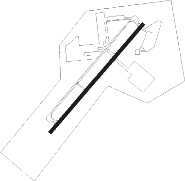
Getafe
Airport details
| Country | Spain |
| State | Community of Madrid |
| Region | LE |
| Airspace | Madrid Ctr |
| Municipality | Getafe |
| Elevation | 2027ft (618m) |
| Timezone | GMT +1 |
| Coordinates | 40.29762, -3.71496 |
| Magnetic var | |
| Type | land |
| Available since | X-Plane v10.40 |
| ICAO code | LEGT |
| IATA code | n/a |
| FAA code | n/a |
Communication
| Getafe Approach | 119.950 |
| Getafe Approach | 127.100 |
| Getafe MADRID Departure | 127.100 |
Approach frequencies
| ILS-cat-I | RW05 | 110.9 | 18.00mi |
| 3° GS | RW05 | 110.9 | 18.00mi |
Nearby Points of Interest:
Cathedral of La Magdalena
-Zona arqueológica Los Granados
-Convent of Nuestra Señora de la Asunción
-Real Canal de Manzanares
-Forest of Saint Joseph
-Terrazas del Manzanares
-Osram factory
-Fábrica de Tabacos
-Escuelas Pías de San Fernando
-House of Sombrerete
-Pacífico Power Plant
-Hospital of la Venerable Orden Tercera
-La Fuentecilla
-Royal Observatory of Madrid
-Old Medicine School of San Carlos
-Palacio del Duque del Infantado, Madrid
-Hospitalillo del Carmen
-Royal Gate
-Christian Walls of Madrid
-Palacio del Marqués de Perales, Madrid
-Capilla de la Cuadra de San Isidro
-Hermitage of Nuestra Señora de los Santos
-Palace of the Marquis of Molins
-Nuevo Rezado
-Casa de Enrique Pérez Villaamil, Madrid
Nearby beacons
| code | identifier | dist | bearing | frequency |
|---|---|---|---|---|
| VGE | GETAFE (MADRID) VORTAC | 0.6 | 235° | 112.05 |
| CVT | CUATRO VIENTOS NDB | 4.9 | 320° | 417 |
| GE | GETAFE (MADRID) NDB | 8.3 | 233° | 421 |
| BRA | BARAJAS VOR/DME | 12.5 | 43° | 116.45 |
| VTZ | TORREJON (MADRID) VOR/DME | 15.4 | 54° | 115.10 |
| SSY | S.S.REYES VOR/DME | 16.2 | 29° | 117.85 |
| PDT | PERALES VOR/DME | 17 | 97° | 116.95 |
| TJZ | TORREJON (MADRID) TACAN | 17.2 | 53° | 112.50 |
| CNR | COLMENAR VIEJO VOR/DME | 20.9 | 357° | 117.30 |
| ECV | COLMENAR VIEJO NDB | 24.2 | 353° | 319 |
| NVS | NAVAS DEL REY VOR/DME | 24.8 | 278° | 114.95 |
| VTB | VILLATOBAS VOR/DME | 33.1 | 154° | 112.70 |
| TLD | TOLEDO VOR/DME | 34.7 | 242° | 113.20 |
| RBO | ROBLEDILLO VOR/DME | 39.6 | 40° | 113.95 |
| SIE | SOMOSIERRA VOR/DME | 51.5 | 7° | 115.40 |
Departure and arrival routes
| Transition altitude | 13000ft |
| SID end points | distance | outbound heading | |
|---|---|---|---|
| RW05 | |||
| SIE2J | 52mi | 7° | |
| RBO1J | 40mi | 40° | |
| PINA2J | 65mi | 59° | |
| VTB2H | 33mi | 154° | |
| TLD2H | 35mi | 242° | |
| NVS2H | 25mi | 278° | |
| RW23 | |||
| SIE2J | 52mi | 7° | |
| RBO1J | 40mi | 40° | |
| PINA2J | 65mi | 59° | |
| VTB2H | 33mi | 154° | |
| TLD2H | 35mi | 242° | |
| NVS2H | 25mi | 278° | |
| STAR starting points | distance | inbound heading | |
|---|---|---|---|
| ALL | |||
| TLD1X | 34.7 | 62° | |
| NVS2Y | 24.8 | 98° | |
| VTB1Y | 33.1 | 334° | |
Holding patterns
| STAR name | hold at | type | turn | heading* | altitude | leg | speed limit |
|---|---|---|---|---|---|---|---|
| CJN3Y | CJN | NDB | right | 145 (325)° | > 17000ft | 1.0min timed | ICAO rules |
| CJN3Y | GE | FIX | right | 226 (46)° | > 4000ft | 1.0min timed | ICAO rules |
| NVS2Y | GE | FIX | right | 226 (46)° | > 4000ft | 1.0min timed | ICAO rules |
| NVS2Y | NVS | NDB | right | 289 (109)° | 9000ft - 24000ft | 1.0min timed | ICAO rules |
| TLD1X | GE | FIX | right | 226 (46)° | > 4000ft | 1.0min timed | ICAO rules |
| TLD1X | TLD | NDB | right | 256 (76)° | > 17000ft | 1.0min timed | ICAO rules |
| VTB1Y | GE | FIX | right | 226 (46)° | > 4000ft | 1.0min timed | ICAO rules |
| VTB1Y | VTB | NDB | right | 186 (6)° | 10000ft - 24000ft | 1.0min timed | ICAO rules |
| *) magnetic outbound (inbound) holding course | |||||||
Disclaimer
The information on this website is not for real aviation. Use this data with the X-Plane flight simulator only! Data taken with kind consent from X-Plane 12 source code and data files. Content is subject to change without notice.
