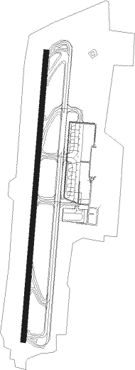
Menorca Island - Menorca
Airport details
| Country | Spain |
| State | Balearic Islands |
| Region | LE |
| Airspace | Barcelona Ctr |
| Municipality | Maó |
| Elevation | 298ft (91m) |
| Timezone | GMT +1 |
| Coordinates | 39.86250, 4.21861 |
| Magnetic var | |
| Type | land |
| Available since | X-Plane v10.40 |
| ICAO code | LEMH |
| IATA code | MAH |
| FAA code | n/a |
Communication
| Menorca ATIS | 129.150 |
| Menorca Tower | 121.750 |
| Menorca Approach | 119.650 |
| Menorca Departure | 118.200 |
Approach frequencies
| ILS-cat-I | RW01 | 110.3 | 18.00mi |
| ILS-cat-I | RW19 | 111.5 | 18.00mi |
| 3° GS | RW01 | 110.3 | 18.00mi |
| 3° GS | RW19 | 111.5 | 18.00mi |
Nearby beacons
| code | identifier | dist | bearing | frequency |
|---|---|---|---|---|
| MHN | MENORCA VOR/DME | 0.1 | 296° | 112.60 |
| MN | MENORCA NDB | 1.5 | 192° | 344 |
| CDP | CAPDEPERA VOR/DME | 37.5 | 258° | 112.90 |
| PTC | PORTO COLOM NDB | 51.5 | 246° | 401 |
Departure and arrival routes
| Transition altitude | 6000ft |
| SID end points | distance | outbound heading | |
|---|---|---|---|
| RW01 | |||
| MERO2C | 39mi | 13° | |
| ISTE2C | 24mi | 66° | |
| MORS3C | 21mi | 78° | |
| NEVI1C, NEVI1H | 48mi | 236° | |
| MAME1C, MAME1H | 12mi | 246° | |
| MJV4H, MJV4C | 72mi | 254° | |
| BAVE2C, BAVE2H | 175mi | 255° | |
| EDUL2C, EDUL2H | 88mi | 256° | |
| EPAM2H, EPAM2C | 132mi | 265° | |
| LUNI3C | 51mi | 305° | |
| SARG3C | 40mi | 340° | |
| RW19 | |||
| MERO3D | 39mi | 13° | |
| ISTE2D | 24mi | 66° | |
| MORS3D | 21mi | 78° | |
| NEVI1D | 48mi | 236° | |
| MAME1D | 12mi | 246° | |
| MJV4D | 72mi | 254° | |
| BAVE2D | 175mi | 255° | |
| EDUL2D | 88mi | 256° | |
| EPAM2D | 132mi | 265° | |
| LUNI3D | 51mi | 305° | |
| SARG3G | 40mi | 340° | |
| STAR starting points | distance | inbound heading | |
|---|---|---|---|
| RW01 | |||
| KABR2B | 72.6 | 60° | |
| PTC2B | 51.5 | 66° | |
| CDP1B | 37.5 | 78° | |
| TONI2B | 44.4 | 85° | |
| SARG3B | 39.6 | 160° | |
| RIXO2B | 37.8 | 220° | |
| MORS3B | 21.4 | 258° | |
| RW19 | |||
| KABR2F | 72.6 | 60° | |
| PTC2F | 51.5 | 66° | |
| CDP1F | 37.5 | 78° | |
| TONI3F | 44.4 | 85° | |
| SARG4F | 39.6 | 160° | |
| RIXO3F | 37.8 | 220° | |
| MORS4F | 21.4 | 258° | |
Holding patterns
| STAR name | hold at | type | turn | heading* | altitude | leg | speed limit |
|---|---|---|---|---|---|---|---|
| CDP1B | BALIO | VHF | right | 186 (6)° | > 3000ft | DME 5.0mi | ICAO rules |
| CDP1F | DONAV | VHF | right | 10 (190)° | > 3000ft | 1.0min timed | ICAO rules |
| KABR2B | BALIO | VHF | right | 186 (6)° | > 3000ft | DME 5.0mi | ICAO rules |
| KABR2F | DONAV | VHF | right | 10 (190)° | > 3000ft | 1.0min timed | ICAO rules |
| MORS3B | BALIO | VHF | right | 186 (6)° | > 3000ft | DME 5.0mi | ICAO rules |
| MORS4F | DONAV | VHF | right | 10 (190)° | > 3000ft | 1.0min timed | ICAO rules |
| PTC2B | BALIO | VHF | right | 186 (6)° | > 3000ft | DME 5.0mi | ICAO rules |
| PTC2F | DONAV | VHF | right | 10 (190)° | > 3000ft | 1.0min timed | ICAO rules |
| RIXO2B | BALIO | VHF | right | 186 (6)° | > 3000ft | DME 5.0mi | ICAO rules |
| RIXO3F | DONAV | VHF | right | 10 (190)° | > 3000ft | 1.0min timed | ICAO rules |
| SARG3B | BALIO | VHF | right | 186 (6)° | > 3000ft | DME 5.0mi | ICAO rules |
| SARG4F | DONAV | VHF | right | 10 (190)° | > 3000ft | 1.0min timed | ICAO rules |
| TONI2B | BALIO | VHF | right | 186 (6)° | > 3000ft | DME 5.0mi | ICAO rules |
| TONI3F | DONAV | VHF | right | 10 (190)° | > 3000ft | 1.0min timed | ICAO rules |
| *) magnetic outbound (inbound) holding course | |||||||
Disclaimer
The information on this website is not for real aviation. Use this data with the X-Plane flight simulator only! Data taken with kind consent from X-Plane 12 source code and data files. Content is subject to change without notice.
