Ontur
Airport details
| Country | Spain |
| State | Castile-La Mancha |
| Region | LE |
| Airspace | Madrid Ctr |
| Municipality | Ontur |
| Elevation | 2198ft (670m) |
| Timezone | GMT +1 |
| Coordinates | 38.61610, -1.52706 |
| Magnetic var | |
| Type | land |
| Available since | X-Plane v10.40 |
| ICAO code | LEOT |
| IATA code | n/a |
| FAA code | n/a |
Communication
| Ontur Ontur Tower | 123.500 |
Nearby Points of Interest:
Arab Baths, Chinchilla de Montearagón
-Santiago Apóstol, Liétor
-Pozo de nieve de Alpera
-Palace of Condes de Cirat
-Biblioteca Pública del Estado en Albacete
-Chalet Fontecha
-Passage of Lodares
-Posada del Rosario
-Archivo Histórico Provincial de Albacete
-Monasterio de la Encarnación (Albacete)
-Fair of Albacete
-Santuario de las Virtudes
-Tortosilla rockshelters
-Cabezo Redondo
-Church of Saint John the Baptist
-Cave of Niño
-Palacio Municipal de Villena
-Ermita de San Antón
-Plaza Mayor
-Conjunto histórico-artístico (Villena)
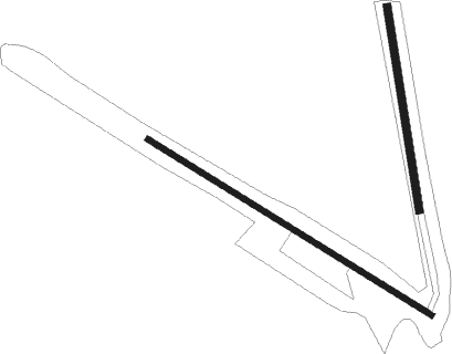
Runway info
Runway 13 / 31  | ||
| length | 760m (2493ft) | |
| bearing | 120° / 300° | |
| width | 12m (39ft) | |
| surface | dirt | |
| Runway 02 / 20 | ||
| length | 466m (1529ft) | |
| bearing | 354° / 174° | |
| width | 18m (59ft) | |
| surface | dirt | |
Nearby beacons
| code | identifier | dist | bearing | frequency |
|---|---|---|---|---|
| TAB | ALBACETE TACAN | 25.2 | 314° | 108 |
| VAB | ALBACETE VOR/DME | 25.2 | 315° | 115.80 |
| YES | YESTE VOR/DME | 41.7 | 253° | 115.20 |
| TRL | ALCANTARILLA (MURCIA) TACAN | 42.3 | 156° | 116.60 |
| AI | ALICANTE NDB | 45 | 110° | 330 |
| ATE | ALICANTE VOR/DME | 48.4 | 109° | 114.65 |
| ALT | ALTET VOR/DME | 49.6 | 110° | 113.80 |
| MUR | MURCIA VOR/DME | 52.5 | 153° | 114.85 |
| VSJ | SAN JAVIER VORTAC | 60.4 | 140° | 113 |
Disclaimer
The information on this website is not for real aviation. Use this data with the X-Plane flight simulator only! Data taken with kind consent from X-Plane 12 source code and data files. Content is subject to change without notice.