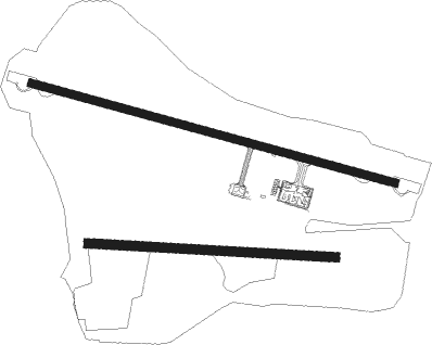
Legrono
Airport details
| Country | Spain |
| State | Rioja |
| Region | LE |
| Airspace | Madrid Ctr |
| Municipality | Agoncillo |
| Elevation | 1151ft (351m) |
| Timezone | GMT +1 |
| Coordinates | 42.46056, -2.32056 |
| Magnetic var | |
| Type | land |
| Available since | X-Plane v10.40 |
| ICAO code | LERJ |
| IATA code | n/a |
| FAA code | n/a |
Communication
| Legrono LERJ_Tower | 118.575 |
| Legrono LERJ_Approach | 118.575 |
| Legrono Dep | 133.000 |
Approach frequencies
| ILS-cat-I | RW29 | 108.35 | 18.00mi |
| 3° GS | RW29 | 108.35 | 18.00mi |
Nearby Points of Interest:
Leza River Bridge
-Iglesia De Santa Maria
-Conjunto histórico del Palacio de la Diputación y El Gran Hotel
-Labraza Walls
-Puerta De La Concepción
-Monasterio de San Prudencio de Monte Laturce
-Wall of Torralba del Río
-Church of Nuestra Señora de la Asunción
-Church of La Asunción de Nuestra Señora, Santa Cruz de Campezo
-Murallas de Zuñiga
-Walls of Antoñana
-Casa Palacio De Los Sodupe
-Iglesia de San Martín
-Chalé de los Sevilla
-Aramendiako Guruztokia
-Barrio de San Pedro la Rúa
-Casco histórico de Estella
-Church of Santa María Jus del Castillo
-Convento de Santo Domingo
-Palacio del Gobernador de Estella
-Nájera
-Church of San Esteban
-Iglesia De San Martin
-Castle of San Vicente de la Sonsierra
-Church of Nuestra Señora de la Asunción, Peñacerrada

Nearby beacons
| code | identifier | dist | bearing | frequency |
|---|---|---|---|---|
| LPA | LOGRONO VOR/DME | 0.2 | 270° | 115.45 |
| EAG | LOGRONO NDB | 0.6 | 147° | 399 |
| DGO | DOMINGO VOR/DME | 24.8 | 269° | 112.60 |
| VRA | VITORIA VOR/DME | 29 | 296° | 116.60 |
| VT | VITORIA NDB | 29.6 | 305° | 308 |
| VFD | VITORIA-FORONDA VOR/DME | 30.8 | 316° | 112.90 |
| PPN | PAMPLONA VOR/DME | 31.8 | 66° | 112.30 |
| PAP | PAMPLONA SOUTH VOR/DME | 32.2 | 71° | 113.55 |
| VTA | VITORIA NDB | 32.2 | 322° | 345 |
| PAM | PAMPLONA NDB | 33.7 | 70° | 422 |
| PP | PAMPLONA NDB | 36.1 | 56° | 354 |
| TBR | BARDENAS REALES TACAN | 40.7 | 107° | 108.60 |
| SSN | SAN SEBASTIAN VOR/DME | 55.4 | 30° | 117.90 |
| BLV | BILBAO VOR/DME | 57.4 | 324° | 115.90 |
| HIG | SAN SEBASTIAN NDB | 60.1 | 30° | 328 |
| B | BILBAO NDB | 63.1 | 322° | 395 |
Departure and arrival routes
| Transition altitude | 6000ft |
| SID end points | distance | outbound heading | |
|---|---|---|---|
| RW11 | |||
| MIRP1N | 13mi | 44° | |
| VEGE3N | 15mi | 66° | |
| GARV3N, GARV1J | 20mi | 140° | |
| RW29 | |||
| MIRP1K | 13mi | 44° | |
| VEGE3K | 15mi | 66° | |
| GARV1L, GARV3K | 20mi | 140° | |
| STAR starting points | distance | inbound heading | |
|---|---|---|---|
| RW11 | |||
| VABA2P | 21.7 | 46° | |
| MIRP1P | 12.5 | 224° | |
| VEGE1P | 15.2 | 246° | |
| GARV1P | 20.4 | 320° | |
| RW29 | |||
| VABA2M | 21.7 | 46° | |
| MIRP1M | 12.5 | 224° | |
| VEGE1M | 15.2 | 246° | |
| GARV1M | 20.4 | 320° | |
Holding patterns
| STAR name | hold at | type | turn | heading* | altitude | leg | speed limit |
|---|---|---|---|---|---|---|---|
| DGO1P | DGO | NDB | left | 291 (111)° | > 6000ft | 1.0min timed | 210 |
| DGO1P | VABUS | VHF | right | 257 (77)° | > 5500ft | 1.0min timed | 210 |
| DGO2M | DGO | NDB | left | 291 (111)° | > 6000ft | 1.0min timed | 210 |
| DGO2M | LPA | NDB | right | 253 (73)° | > 6000ft | 1.0min timed | 210 |
| GARV1M | LPA | NDB | right | 253 (73)° | > 6000ft | 1.0min timed | 210 |
| GARV1P | LPA | NDB | right | 253 (73)° | > 6000ft | 1.0min timed | 210 |
| GARV1P | VABUS | VHF | right | 257 (77)° | > 5500ft | 1.0min timed | 210 |
| MIRP1M | LPA | NDB | right | 253 (73)° | > 6000ft | 1.0min timed | 210 |
| MIRP1P | LPA | NDB | right | 253 (73)° | > 6000ft | 1.0min timed | 210 |
| MIRP1P | VABUS | VHF | right | 257 (77)° | > 5500ft | 1.0min timed | 210 |
| VABA2M | LPA | NDB | right | 253 (73)° | > 6000ft | 1.0min timed | 210 |
| VABA2P | VABUS | VHF | right | 257 (77)° | > 5500ft | 1.0min timed | 210 |
| VEGE1M | LPA | NDB | right | 253 (73)° | > 6000ft | 1.0min timed | 210 |
| VEGE1P | LPA | NDB | right | 253 (73)° | > 6000ft | 1.0min timed | 210 |
| VEGE1P | VABUS | VHF | right | 257 (77)° | > 5500ft | 1.0min timed | 210 |
| *) magnetic outbound (inbound) holding course | |||||||
Disclaimer
The information on this website is not for real aviation. Use this data with the X-Plane flight simulator only! Data taken with kind consent from X-Plane 12 source code and data files. Content is subject to change without notice.