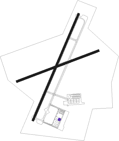
Salamanca
Airport details
| Country | Spain |
| State | Castile and León |
| Region | LE |
| Airspace | Madrid Ctr |
| Municipality | Villagonzalo de Tormes |
| Elevation | 2595ft (791m) |
| Timezone | GMT +1 |
| Coordinates | 40.95204, -5.49519 |
| Magnetic var | |
| Type | land |
| Available since | X-Plane v10.40 |
| ICAO code | LESA |
| IATA code | SLM |
| FAA code | n/a |
Communication
| Salamanca Ground Control | 121.850 |
| Salamanca Tower | 118.100 |
| Salamanca Approach | 124.400 |
Approach frequencies
| ILS-cat-I | RW21 | 110.1 | 18.00mi |
| 3° GS | RW21 | 110.1 | 18.00mi |
Nearby Points of Interest:
Palacio de Figueroa
-Old City of Salamanca
-Church of the Vera Cruz, Salamanca
-Archivo Histórico Provincial de Salamanca
-Abarca's Palace, Salamanca
-Alcázar de Salamanca
-San Leonardo de Alba de Tormes
-Vía de la Plata
-Iglesia de Santa María del Castillo
-iglesia parroquial de Torrecilla de la Orden
-Walls of Madrigal de las Altas Torres
-Monasterio de Nuestra Señora de Gracia
-Castle of Peñausende
-iglesia de la Asunción de Nuestra Señora
-Puente del Congosto castle
-Hermitage of Virgin of las Fuentes, San Juan del Olmo
-Castle of Fuente el Sol
-Castle of Narros de Saldueña
-Castillo de Villatoro
-Conjunto Histórico de la Villa de Piedrahíta
-Casa de Gabriel y Galán
-Church of Saint John the Baptist, San Juan de la Encinilla
Nearby beacons
| code | identifier | dist | bearing | frequency |
|---|---|---|---|---|
| TSC | SALAMANCA TACAN | 0.3 | 294° | 113.30 |
| BBI | SALAMANCA VOR/DME | 4.2 | 31° | 112.20 |
| AL | MATACAN (SALAMANCA) NDB | 5.2 | 31° | 359 |
| ZMR | ZAMORA VOR/DME | 35.3 | 346° | 117.10 |
| NUB | VILLANUBLA (VALLADOLID) VOR/DME | 53.7 | 41° | 113.65 |
Disclaimer
The information on this website is not for real aviation. Use this data with the X-Plane flight simulator only! Data taken with kind consent from X-Plane 12 source code and data files. Content is subject to change without notice.

