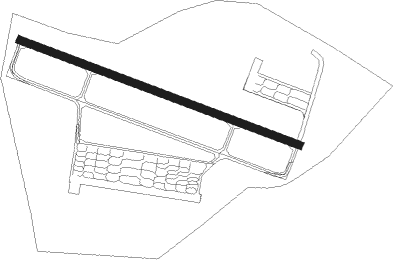
Toulouse/francazal - Francazal Ab
Airport details
| Country | France |
| State | Occitania |
| Region | LF |
| Airspace | Bordeaux Ctr |
| Municipality | Cugnaux |
| Elevation | 535ft (163m) |
| Timezone | GMT +1 |
| Coordinates | 43.54403, 1.36337 |
| Magnetic var | |
| Type | land |
| Available since | X-Plane v10.40 |
| ICAO code | LFBF |
| IATA code | n/a |
| FAA code | n/a |
Communication
| Francazal AB FRANCAZAL Tower | 122.100 |
| Francazal AB LFBF INFO | 118.800 |
| Francazal AB FRANCAZAL Tower | 118.400 |
| Francazal AB FRANCAZAL Approach | 118.800 |
Nearby Points of Interest:
Château de Saint-Simon
-Centre hospitalier Gérard Marchant
-pont Saint-Michel
-Prison Saint-Michel
-Hôpital de La Grave
-Palais de Justice de Toulouse
-Couvent Notre-Dame-de-la-Visitation
-Canal du Midi
-Pigeonnier de la comtesse
-Manufacture des Tabacs
-Ecluse Saint-Pierre
-hôtel d'Olmières
-Hôtel des Ysalguier
-Maison Pierre Delfau
-Hôtel de Pins et hôtel Antonin
-Hôtel Dumay
-Hôtel de Bonnefoy
-Hôtel de Castellane, ancien hôtel de Saint-Jory
-dry docks of Toulouse
-Préfecture de Haute-Garonne
-Notre-Dame du Rempart
-Tour Maurand
-Hôtel Dubarry
-monument aux combattants de la Haute-Garonne
-Bibliothèques de Toulouse
Nearby beacons
| code | identifier | dist | bearing | frequency |
|---|---|---|---|---|
| TS | TOULOUSE NDB | 5.8 | 107° | 423 |
| TLF | FRANCAZAL NDB | 7.3 | 289° | 332 |
| TOU | TOULOUSE BLAGNAC VOR/DME | 8.5 | 339° | 117.70 |
| MUT | MURET NDB | 8.8 | 251° | 350 |
| TOE | TOULOUSE NDB | 14.2 | 101° | 415 |
| TW | TOULOUSE NDB | 14.7 | 268° | 406 |
| TLB | TOULOUSE NDB | 24.4 | 11° | 368 |
| PMR | PAMIERS NDB | 28.9 | 153° | 384 |
| AGN | AGEN VOR/DME | 29.6 | 305° | 114.80 |
| GAI | GAILLAC VOR | 31.7 | 48° | 115.80 |
| LMT | AUCH NDB | 34.6 | 283° | 420 |
| CVU | CASTRES-MAZAMET NDB | 37.1 | 84° | 356 |
| AB | ALBI NDB | 37.6 | 62° | 323 |
| CS | CARCASSONNE SALVAZA NDB | 41.6 | 111° | 345 |
| AG | AGEN NDB | 47.1 | 311° | 400 |
| CL | CAHORS NDB | 50.5 | 4° | 348 |
Departure and arrival routes
| Transition altitude | 5000ft |
| SID end points | distance | outbound heading | |
|---|---|---|---|
| RW11 | |||
| TW1A | 205mi | 60° | |
| RW29 | |||
| TW1B | 205mi | 60° | |
| STAR starting points | distance | inbound heading | |
|---|---|---|---|
| RW11 | |||
| ASPE1S | 36.7 | 35° | |
| TOPT1S | 81.6 | 64° | |
| TBO1S | 54.6 | 80° | |
| LMB1S | 60.3 | 87° | |
| SECH1S, AGN1S | 29.6 | 125° | |
| ESIS1S | 81.0 | 183° | |
| AULO1S | 51.6 | 199° | |
| NARA1S | 48.1 | 207° | |
| MEN1S | 100.5 | 239° | |
| AFRI1S | 66.8 | 261° | |
| ADIM1S | 23.9 | 275° | |
| ORBI1S | 53.7 | 287° | |
| RW29 | |||
| ASPE1N | 36.7 | 35° | |
| TOPT1N | 81.6 | 64° | |
| TBO1N | 54.6 | 80° | |
| LMB1N | 60.3 | 87° | |
| SECH1N, AGN1N | 29.6 | 125° | |
| ESIS1N | 81.0 | 183° | |
| AULO1N | 51.6 | 199° | |
| NARA1N | 48.1 | 207° | |
| MEN1N | 100.5 | 239° | |
| AFRI1N | 66.8 | 261° | |
| ADIM1N | 23.9 | 275° | |
| ORBI1N | 53.7 | 287° | |
Instrument approach procedures
| runway | airway (heading) | route (dist, bearing) |
|---|---|---|
| RW11 | IBF11 (109°) | IBF11 3000ft |
| RW11 | SURAS (108°) | SURAS 4000ft IBF11 (3mi, 105°) 3000ft |
| RNAV | IBF11 3000ft FBF11 (3mi, 108°) 3000ft LFBF (8mi, 110°) 584ft BF110 (2mi, 104°) BF112 (4mi, 270°) 2000ft IBF11 (9mi, 299°) 3000ft | |
| RW29 | SULIT (35°) | SULIT 4000ft BF302 (10mi, 87°) 4000ft BF304 (4mi, 87°) 3000ft IBF29 (4mi, 32°) 3000ft |
| RNAV | IBF29 3000ft FBF29 (4mi, 289°) 3000ft LFBF (8mi, 288°) 583ft BF310 (7mi, 290°) SURAS (7mi, 287°) TW (7mi, 199°) SULIT (13mi, 123°) 4000ft |
Holding patterns
| STAR name | hold at | type | turn | heading* | altitude | leg | speed limit |
|---|---|---|---|---|---|---|---|
| ADIM1N | ADIMO | VHF | right | 116 (296)° | 4500ft - 14000ft | 1.0min timed | 220 |
| ADIM1S | SURAS | VHF | right | 257 (77)° | 5000ft - 14000ft | DME 5.0mi | 220 |
| AFRI1N | ADIMO | VHF | right | 116 (296)° | 4500ft - 14000ft | 1.0min timed | 220 |
| AFRI1S | SURAS | VHF | right | 257 (77)° | 5000ft - 14000ft | DME 5.0mi | 220 |
| AGN1N | SULIT | VHF | right | 187 (7)° | 5000ft - 14000ft | DME 5.0mi | 220 |
| AGN1S | SURAS | VHF | right | 257 (77)° | 5000ft - 14000ft | DME 5.0mi | 220 |
| ASPE1N | SULIT | VHF | right | 187 (7)° | 5000ft - 14000ft | DME 5.0mi | 220 |
| ASPE1S | SURAS | VHF | right | 257 (77)° | 5000ft - 14000ft | DME 5.0mi | 220 |
| AULO1S | SURAS | VHF | right | 257 (77)° | 5000ft - 14000ft | DME 5.0mi | 220 |
| ESIS1S | SURAS | VHF | right | 257 (77)° | 5000ft - 14000ft | DME 5.0mi | 220 |
| LMB1N | SULIT | VHF | right | 187 (7)° | 5000ft - 14000ft | DME 5.0mi | 220 |
| LMB1S | SURAS | VHF | right | 257 (77)° | 5000ft - 14000ft | DME 5.0mi | 220 |
| MEN1S | SURAS | VHF | right | 257 (77)° | 5000ft - 14000ft | DME 5.0mi | 220 |
| NARA1S | SURAS | VHF | right | 257 (77)° | 5000ft - 14000ft | DME 5.0mi | 220 |
| ORBI1N | ADIMO | VHF | right | 116 (296)° | 4500ft - 14000ft | 1.0min timed | 220 |
| ORBI1S | SURAS | VHF | right | 257 (77)° | 5000ft - 14000ft | DME 5.0mi | 220 |
| SECH1N | SULIT | VHF | right | 187 (7)° | 5000ft - 14000ft | DME 5.0mi | 220 |
| SECH1S | SURAS | VHF | right | 257 (77)° | 5000ft - 14000ft | DME 5.0mi | 220 |
| TBO1N | SULIT | VHF | right | 187 (7)° | 5000ft - 14000ft | DME 5.0mi | 220 |
| TBO1S | SURAS | VHF | right | 257 (77)° | 5000ft - 14000ft | DME 5.0mi | 220 |
| TOPT1N | SULIT | VHF | right | 187 (7)° | 5000ft - 14000ft | DME 5.0mi | 220 |
| TOPT1S | SURAS | VHF | right | 257 (77)° | 5000ft - 14000ft | DME 5.0mi | 220 |
| *) magnetic outbound (inbound) holding course | |||||||
Disclaimer
The information on this website is not for real aviation. Use this data with the X-Plane flight simulator only! Data taken with kind consent from X-Plane 12 source code and data files. Content is subject to change without notice.