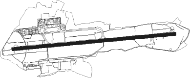
Biarritz/anglet/bayonne - Biarritz Pays Basque
Airport details
| Country | France |
| State | Nouvelle-Aquitaine |
| Region | LF |
| Airspace | Bordeaux Ctr |
| Municipality | Biarritz |
| Elevation | 245ft (75m) |
| Timezone | GMT +1 |
| Coordinates | 43.46613, -1.53550 |
| Magnetic var | |
| Type | land |
| Available since | X-Plane v10.40 |
| ICAO code | LFBZ |
| IATA code | BIQ |
| FAA code | n/a |
Communication
| Biarritz Pays Basque BIARRITZ ATIS | 128.225 |
| Biarritz Pays Basque BIARRITZ Ground Control | 121.950 |
| Biarritz Pays Basque BIARRITZ Tower | 118.700 |
| Biarritz Pays Basque BIARRITZ Approach | 125.600 |
Approach frequencies
| ILS-cat-I | RW27 | 111.35 | 18.00mi |
| 3° GS | RW27 | 111.35 | 18.00mi |
Nearby Points of Interest:
Château de Françon
-Château Boulard
-Le Réduit
-Citadelle de Bayonne
-atalaye de Guéthary
-hôtel de ville de Guéthary
-Séminaire de Larressore
-maison Betbeder-Baïta
-villa Lehen-Tokia
-redoute de Biscarzoun
-maison de Ferdinand Pinney Earle
-redoute d'Esnaur
-Espelette Castle
-Ihartze Artea etxea
-Villa Mendichka
-Église Sainte-Anne d'Hendaye Plage
-Dutaria palace
-Chapelle Sainte-Thérèse (Capbreton)
-Église de l'Assomption de Zugarramurdi
-villa Maison Rouge
-Cueva de Alkerdi
-Great Cross of Hendaye
-villa Bakhar Etchea
-Église de Saint-Laurent-de-Gosse
-Ramery jauregia
Nearby beacons
| code | identifier | dist | bearing | frequency |
|---|---|---|---|---|
| BTZ | BIARRITZ PAYS BASQUE VOR/DME | 1 | 89° | 114.15 |
| BZ | BIARRITZ PAYS BASQUE NDB | 5.7 | 88° | 341 |
| HIG | SAN SEBASTIAN NDB | 12.3 | 253° | 328 |
| SSN | SAN SEBASTIAN VOR/DME | 15.8 | 242° | 117.90 |
| DX | DAX SEYRESSE NDB | 26 | 65° | 334 |
| PP | PAMPLONA NDB | 36.8 | 197° | 354 |
| PPN | PAMPLONA VOR/DME | 44.5 | 193° | 112.30 |
| PAM | PAMPLONA NDB | 45.3 | 188° | 422 |
| PAP | PAMPLONA SOUTH VOR/DME | 47 | 189° | 113.55 |
| BRS | BISCARROSSE NDB | 56.8 | 24° | 358 |
Departure and arrival routes
| Transition altitude | 5000ft |
| SID end points | distance | outbound heading | |
|---|---|---|---|
| RW09 | |||
| VAVI1E, VAVI1D, SOST1D | 61mi | 46° | |
| SOVO1D | 28mi | 97° | |
| BIDA1E | 18mi | 97° | |
| DONO1E, DONO1D | 11mi | 166° | |
| SSN1D, SSN1E | 16mi | 242° | |
| RW27 | |||
| VAVI1F, VAVI1W | 61mi | 46° | |
| SOVO1F | 28mi | 97° | |
| BIDA1W | 18mi | 97° | |
| DONO1W, DONO1F | 11mi | 166° | |
| SSN1F, SSN1W | 16mi | 242° | |
| STAR starting points | distance | inbound heading | |
|---|---|---|---|
| RW09 | |||
| SSN9R | 15.8 | 62° | |
| MAGE9M, MAGE9R | 22.4 | 230° | |
| BIDA9M, BIDA9R | 17.6 | 277° | |
| DONO9M, DONO9R | 11.1 | 346° | |
| RW27 | |||
| SSN9S | 15.8 | 62° | |
| MAGE9L, MAGE9V, MAGE9S, MAGE9B | 22.4 | 230° | |
| BIDA9B, BIDA9L, BIDA9V | 17.6 | 277° | |
| BIDA9S | 28.1 | 277° | |
| DONO9V, DONO9S, DONO9B | 11.1 | 346° | |
Instrument approach procedures
| runway | airway (heading) | route (dist, bearing) |
|---|---|---|
| RW09 | BZ092 (110°) | BZ092 IBZ09 (5mi, 179°) 2500ft |
| RW09 | BZ507 (70°) | BZ507 IBZ09 (5mi, 0°) 2500ft |
| RW09 | OSGOT (164°) | OSGOT BZ092 (8mi, 242°) IBZ09 (5mi, 179°) 2500ft |
| RNAV | IBZ09 2000ft FBZ09 (3mi, 89°) 2000ft LFBZ (5mi, 90°) 291ft BZ090 (3mi, 88°) 4000ft OSGOT (11mi, 323°) OSGOT (turn) | |
| RW27 | BIDAC (277°) | BIDAC IBZ27 (6mi, 293°) 2500ft |
| RW27 | BZ (121°) | BZ 3500ft BZ275 (7mi, 60°) BZ276 (7mi, 89°) IBZ27 (5mi, 193°) 2500ft |
| RW27 | BZ274 (245°) | BZ274 BZ276 (4mi, 193°) IBZ27 (5mi, 193°) 2500ft |
| RW27 | BZ501 (284°) | BZ501 IBZ27 (5mi, 0°) 2500ft |
| RNAV | IBZ27 2500ft FBZ27 (4mi, 270°) 2500ft LFBZ (8mi, 269°) 268ft BZ270 (3mi, 271°) 4000ft BZ272 (11mi, 359°) 4000ft BZ274 (16mi, 97°) 4000ft |
Holding patterns
| STAR name | hold at | type | turn | heading* | altitude | leg | speed limit |
|---|---|---|---|---|---|---|---|
| BIDA9B | BZ | FIX | right | 89 (269)° | 3000ft - 7000ft | 1.0min timed | 210 |
| BIDA9L | BZ | FIX | right | 89 (269)° | 3000ft - 7000ft | 1.0min timed | 210 |
| BIDA9M | OSGOT | VHF | right | 341 (161)° | 3000ft - 7000ft | DME 3.3mi | 200 |
| BIDA9S | BZ | FIX | right | 89 (269)° | 3000ft - 7000ft | 1.0min timed | 210 |
| BIDA9V | UREKU | VHF | right | 84 (264)° | 3000ft - 7000ft | DME 5.0mi | 200 |
| DONO9B | BZ | FIX | right | 89 (269)° | 3000ft - 7000ft | 1.0min timed | 210 |
| DONO9M | OSGOT | VHF | right | 341 (161)° | 3000ft - 7000ft | DME 3.3mi | 200 |
| DONO9S | BZ | FIX | right | 89 (269)° | 3000ft - 7000ft | 1.0min timed | 210 |
| DONO9V | UREKU | VHF | right | 84 (264)° | 3000ft - 7000ft | DME 5.0mi | 200 |
| MAGE9B | BZ | FIX | right | 89 (269)° | 3000ft - 7000ft | 1.0min timed | 210 |
| MAGE9L | BZ | FIX | right | 89 (269)° | 3000ft - 7000ft | 1.0min timed | 210 |
| MAGE9M | OSGOT | VHF | right | 341 (161)° | 3000ft - 7000ft | DME 3.3mi | 200 |
| MAGE9R | OSGOT | VHF | right | 341 (161)° | 3000ft - 7000ft | DME 3.3mi | 200 |
| MAGE9S | BZ | FIX | right | 89 (269)° | 3000ft - 7000ft | 1.0min timed | 210 |
| MAGE9V | UREKU | VHF | right | 84 (264)° | 3000ft - 7000ft | DME 5.0mi | 200 |
| SSN9S | BZ | FIX | right | 89 (269)° | 3000ft - 7000ft | 1.0min timed | 210 |
| *) magnetic outbound (inbound) holding course | |||||||
Disclaimer
The information on this website is not for real aviation. Use this data with the X-Plane flight simulator only! Data taken with kind consent from X-Plane 12 source code and data files. Content is subject to change without notice.