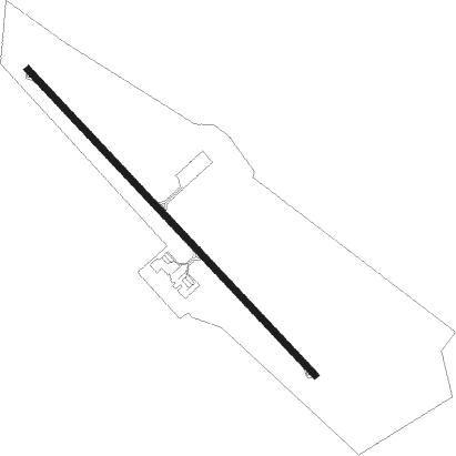
Castres/mazamet - Castres Mazamet
Airport details
| Country | France |
| State | Occitania |
| Region | LF |
| Airspace | Bordeaux Ctr |
| Municipality | Labruguière |
| Elevation | 788ft (240m) |
| Timezone | GMT +1 |
| Coordinates | 43.55482, 2.28852 |
| Magnetic var | |
| Type | land |
| Available since | X-Plane v10.40 |
| ICAO code | LFCK |
| IATA code | DCM |
| FAA code | n/a |
Communication
| Castres Mazamet CASTRES INFO | 118.500 |
| Castres Mazamet TOULOUSE Approach | 123.850 |
Approach frequencies
| ILS-cat-I | RW14 | 111.35 | 18.00mi |
| 3.5° GS | RW14 | 111.35 | 18.00mi |
Nearby Points of Interest:
Halle de Labruguière
-tower of Navès
-Immeuble, 42 rue Villegoudou
-Maison natale de Jean Jaurès
-Palais épiscopal de Castres
-Hôtel Poncet
-Hôtel Leroy
-Maison, 31 rue de l'Hôtel-de-Ville
-Hôtel de Nayrac
-Tour des Cordeliers de Castres
-prieuré de Burlats
-Domaine de la Fédial
-chaussée de Coudières
-Montauban-Puylaurens Academy
-Croix de La Tourette-Cabardès
-portail Bas
-Croix du lavoir
-Remparts de Saissac
-Château d'Aragon
-Croix de chemin d'Aragon
-Centre national de vol à voile de la Montagne Noire
-château d'Aguts
-Carrière du Roi
-Hôtel de Sicard (Caunes-Minervois)
-abbatiale Saint-Pierre-et-Saint-Paul de Caunes-Minervois
Nearby beacons
| code | identifier | dist | bearing | frequency |
|---|---|---|---|---|
| CVU | CASTRES-MAZAMET NDB | 5.8 | 314° | 356 |
| CS | CARCASSONNE SALVAZA NDB | 20.2 | 194° | 345 |
| AB | ALBI NDB | 23.5 | 328° | 323 |
| TOE | TOULOUSE NDB | 26.8 | 263° | 415 |
| GAI | GAILLAC VOR | 31.3 | 311° | 115.80 |
| TS | TOULOUSE NDB | 35 | 267° | 423 |
| PMR | PAMIERS NDB | 41 | 236° | 384 |
| TOU | TOULOUSE BLAGNAC VOR/DME | 43.2 | 277° | 117.70 |
| TLB | TOULOUSE NDB | 43.6 | 295° | 368 |
| ZR | BEZIERS VIAS NDB | 45.4 | 103° | 397 |
| ROM | RODEZ NDB | 48.6 | 22° | 302 |
| RZ | RODEZ NDB | 53 | 10° | 387 |
| PPG | PERPIGNAN RIVESALTES VOR/DME | 54.6 | 144° | 117.20 |
| PL | RIVESALTES (PERPIGNAN) NDB | 59.5 | 144° | 351 |
| CL | CAHORS NDB | 62.5 | 314° | 348 |
Departure and arrival routes
| Transition altitude | 5000ft |
| SID end points | distance | outbound heading | |
|---|---|---|---|
| RW14 | |||
| BISB3M | 32mi | 18° | |
| MEN3M | 74mi | 40° | |
| AFRI3M | 28mi | 69° | |
| FINO3M | 15mi | 302° | |
| RW32 | |||
| BISB3C | 32mi | 18° | |
| MEN3C | 74mi | 40° | |
| AFRI3C | 28mi | 69° | |
| FINO3C | 15mi | 302° | |
| STAR starting points | distance | inbound heading | |
|---|---|---|---|
| RW14 | |||
| FINO2M | 14.7 | 122° | |
| GAI3V | 31.3 | 131° | |
| MEN2M | 73.6 | 220° | |
| AFRI2M | 28.4 | 249° | |
Instrument approach procedures
| runway | airway (heading) | route (dist, bearing) |
|---|---|---|
| RW14-X | CK410 (113°) | CK410 ICK14 (5mi, 60°) 3500ft |
| RW14-X | CK411 (157°) | CK411 ICK14 (5mi, 240°) 3500ft |
| RW14-X | CVU (134°) | CVU CK420 (5mi, 240°) CK410 (7mi, 312°) ICK14 (5mi, 60°) 3500ft |
| RNAV | ICK14 3500ft FCK14 (5mi, 132°) 3500ft MK14X (6mi, 132°) 1385ft CK420 (6mi, 268°) 3500ft CK410 (7mi, 312°) | |
| RW14-Y | CK410 (113°) | CK410 ICK14 (5mi, 60°) 3500ft |
| RW14-Y | CK411 (157°) | CK411 ICK14 (5mi, 240°) 3500ft |
| RW14-Y | CVU (134°) | CVU CK420 (5mi, 240°) CK410 (7mi, 312°) ICK14 (5mi, 60°) 3500ft |
| RNAV | ICK14 3500ft FCK14 (5mi, 132°) 3500ft MK14Y (6mi, 132°) 1125ft (2620mi, 183°) 1190ft CK420 (2620mi, 3°) 3500ft CK410 (7mi, 312°) | |
| RW14-Z | CK410 (113°) | CK410 ICK14 (5mi, 60°) 3500ft |
| RW14-Z | CK411 (157°) | CK411 ICK14 (5mi, 240°) 3500ft |
| RW14-Z | CVU (134°) | CVU CK420 (5mi, 240°) CK410 (7mi, 312°) ICK14 (5mi, 60°) 3500ft |
| RNAV | ICK14 3500ft FCK14 (5mi, 132°) 3500ft LFCK (8mi, 133°) 753ft (2619mi, 183°) 1190ft CK420 (2620mi, 3°) 3500ft CK410 (7mi, 312°) |
Holding patterns
| STAR name | hold at | type | turn | heading* | altitude | leg | speed limit |
|---|---|---|---|---|---|---|---|
| AFRI2M | CVU | FIX | right | 322 (142)° | 3500ft - 8000ft | 1.0min timed | 190 |
| FINO2M | CVU | FIX | right | 322 (142)° | 3500ft - 8000ft | 1.0min timed | 190 |
| MASA2M | CVU | FIX | right | 322 (142)° | 3500ft - 8000ft | 1.0min timed | 190 |
| MEN2M | CVU | FIX | right | 322 (142)° | 3500ft - 8000ft | 1.0min timed | 190 |
| *) magnetic outbound (inbound) holding course | |||||||
Disclaimer
The information on this website is not for real aviation. Use this data with the X-Plane flight simulator only! Data taken with kind consent from X-Plane 12 source code and data files. Content is subject to change without notice.