Egletons
Airport details
| Country | France |
| State | Nouvelle-Aquitaine |
| Region | LF |
| Airspace | Bordeaux Ctr |
| Municipality | Égletons |
| Elevation | 1856ft (566m) |
| Timezone | GMT +1 |
| Coordinates | 45.42051, 2.07104 |
| Magnetic var | |
| Type | land |
| Available since | X-Plane v10.40 |
| ICAO code | LFDE |
| IATA code | n/a |
| FAA code | n/a |
Communication
| Egletons CTAF | 128.800 |
Nearby Points of Interest:
Prefecture hotel of Corrèze
-maison d'Anjaliac
-Château de Madic
-Église Sainte-Croix de Saignes
-Christ de Vebret
-Maison de Tayac
-Église Saint-Martial de Gentioux-Pigerolles
-Canal des moines
-maison du Maître Tanneur
-Tour d'Ayen
-Couvent des Ursulines d'Eymoutiers
-Maison Bertrandy
-Maison Escure
-mise au tombeau de Reygade
-Prieuré Saint-Xantin
-Castrum de Malemort
-Demeure de Dilhac
-Viaduc de Barajol
-Maison Cavaignac (Brive-la-Gaillarde)
-Pont Roby
-Tour de Felletin
-Immeuble du Bessol
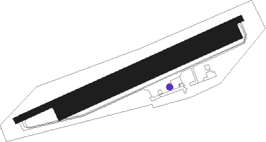
Runway info
Runway 7 / 25  | ||
| length | 813m (2667ft) | |
| bearing | 76° / 256° | |
| width | 20m (66ft) | |
| surface | asphalt | |
| displ threshold | 129m (423ft) / 130m (427ft) | |
| Runway 7R / 25L | ||
| length | 622m (2041ft) | |
| bearing | 76° / 256° | |
| width | 50m (164ft) | |
| surface | grass | |
| displ threshold | 0m (0ft) / 58m (190ft) | |
Nearby beacons
| code | identifier | dist | bearing | frequency |
|---|---|---|---|---|
| AR | AURILLAC NDB | 30.6 | 147° | 343 |
| BSC | SOUILLAC (BRIVE) NDB | 31.8 | 227° | 351 |
| LSU | LIMOGES NDB | 46 | 291° | 320 |
| FC | FIGEAC LIVERNON NDB | 46.6 | 201° | 395 |
| LOE | LIMOGES NDB | 47.7 | 310° | 424 |
| LPD | MONTLUCON-GUERET NDB | 54.1 | 17° | 398 |
| RZ | RODEZ NDB | 61.3 | 160° | 387 |
Disclaimer
The information on this website is not for real aviation. Use this data with the X-Plane flight simulator only! Data taken with kind consent from X-Plane 12 source code and data files. Content is subject to change without notice.