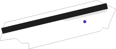
Courlaoux - Lons Le Saunier Courlaoux
Airport details
| Country | France |
| State | Bourgogne-Franche-Comté |
| Region | LF |
| Airspace | Reims Ctr |
| Municipality | Courlaoux |
| Elevation | 761ft (232m) |
| Timezone | GMT +1 |
| Coordinates | 46.67500, 5.46917 |
| Magnetic var | |
| Type | land |
| Available since | X-Plane v10.40 |
| ICAO code | LFGL |
| IATA code | n/a |
| FAA code | n/a |
Communication
| Lons le Saunier Courlaoux INFO | 123.500 |
Nearby Points of Interest:
Saline de Montmorot
-Saline de Montaigu
-Maison de la Familiarité
-Fontaine aux dauphins de Conliège
-Mairie de Flacey-en-Bresse
-La Chevana d'Or
-Pont sur la Seille
-Manoir-ferme bressan de Sagy
-Hôtel du Commerce
-site archéologique du lac de Chalain
-Le Grand Lac de Clairvaux
-Saline de Poligny
-Maison à pans de bois de Mervans
-Croix monumentale de Balanod
-Lac d'Onoz
-Château de Pierre-de-Bresse
-Ferme de Bevay
-Fontaine-lavoir de Villechantria
-Château Pécauld
-Demeure Delort
-Moulin de Pertuizet
-Sanctuaire gallo-romain de Villards d’Héria
-Maison à pans de bois (Romenay)
-Ferme bressanne de Tenarre
-Château de Cuisery
Nearby beacons
| code | identifier | dist | bearing | frequency |
|---|---|---|---|---|
| DO | DOLE NDB | 19.4 | 332° | 309 |
| CC | CHAMPFORGEUIL NDB | 25.9 | 274° | 391 |
| GLA | GLAND NDB | 35.7 | 109° | 375 |
| GVA | GENEVA VOR/DME | 37.3 | 122° | 115.75 |
| PAS | PASSEIRY VOR/DME | 37.7 | 134° | 116.60 |
| DJL | DIJON LONGVIC VOR/DME | 38.8 | 328° | 111.45 |
| LAP | PRAZ DME | 38.9 | 90° | 110.65 |
| SPR | ST PREX VOR/DME | 42.2 | 102° | 113.90 |
| BSV | BESANCON NDB | 46.5 | 51° | 370 |
| CBY | CHAMBERY VOR/DME | 49.1 | 160° | 115.40 |
| AT | ANNECY NDB | 53.9 | 146° | 384 |
| LSE | LYON SAINT EXUPERY VOR/DME | 57.9 | 202° | 114.75 |
Disclaimer
The information on this website is not for real aviation. Use this data with the X-Plane flight simulator only! Data taken with kind consent from X-Plane 12 source code and data files. Content is subject to change without notice.
