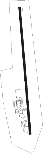
Calvi/sainte-catherine - St Catherine
Airport details
| Country | France |
| State | Corsica |
| Region | LF |
| Airspace | Marseille Ctr |
| Municipality | Calenzana |
| Elevation | 208ft (63m) |
| Timezone | GMT +1 |
| Coordinates | 42.52444, 8.79306 |
| Magnetic var | |
| Type | land |
| Available since | X-Plane v10.40 |
| ICAO code | LFKC |
| IATA code | CLY |
| FAA code | n/a |
Communication
| St Catherine LFKC ATIS | 131.175 |
| St Catherine CALVI Ground Control | 121.700 |
| St Catherine CALVI Tower | 123.200 |
| St Catherine BASTIA Approach | 123.825 |
Approach frequencies
| LOC | RW18 | 109.5 | 18.00mi |
Nearby Points of Interest:
Couvent de Marcasso
-Institut des Filles-de-Marie de l'Île-Rousse
-Gulf of Porto: Calanche of Piana, Gulf of Girolata, Scandola Reserve
-église San Giovanni Battista de Corte
-site archéologique du Monte Revincu
-Ancien couvent d'Orezza
-Torra di Capigliolu
-Vescovato Cathedral
-Torra d'Ancone
-Carrière d'amiante et usine de Canari
Nearby beacons
| code | identifier | dist | bearing | frequency |
|---|---|---|---|---|
| CV | CALVI SAINTE CATHERINE NDB | 3.2 | 14° | 375 |
| BTA | BASTIA PORETTA VOR/DME | 30.3 | 86° | 114.15 |
| BP | BASTIA NDB | 33.5 | 98° | 369 |
| RB | AJACCIO NDB | 36.6 | 179° | 365 |
| IS | AJACCIO NDB | 38.4 | 196° | 341 |
| CT | AJACCIO NDB | 43.8 | 185° | 387 |
| SZA | SOLENZARA TACAN | 44.3 | 134° | 114 |
| SZA | SOLENZARA NDB | 44.4 | 135° | 349 |
| AJO | AJACCIO VOR/DME | 45.2 | 181° | 114.80 |
| FA | FIGARI NDB | 59.1 | 153° | 325 |
Departure and arrival routes
| Transition altitude | 5000ft |
| SID end points | distance | outbound heading | |
|---|---|---|---|
| RW36 | |||
| TORT1R | 52mi | 11° | |
| MEGE1R, MEGE7C | 51mi | 25° | |
| CAPC7C, CAPC1R | 40mi | 68° | |
| AJO7C, AJO1R | 45mi | 181° | |
| MERL7C, MERL1R | 55mi | 299° | |
| SODR1R | 35mi | 319° | |
| NORK1R, NORK7C | 26mi | 360° | |
| STAR starting points | distance | inbound heading | |
|---|---|---|---|
| RW18 | |||
| SODR2L | 34.7 | 139° | |
| NIRD2L | 40.5 | 150° | |
| LIGU2L | 61.7 | 190° | |
| CAPC2L | 39.5 | 248° | |
| LIBL2L | 16.4 | 353° | |
Instrument approach procedures
| runway | airway (heading) | route (dist, bearing) |
|---|---|---|
| RW18-W | BISKI (180°) | BISKI 3000ft FC18W (5mi, 180°) 3000ft |
| RW18-W | SOUKA (180°) | SOUKA BISKI (7mi, 180°) 3000ft FC18W (5mi, 180°) 3000ft |
| RW18-W | VAVIT (204°) | VAVIT BISKI (6mi, 255°) 3000ft FC18W (5mi, 180°) 3000ft |
| RNAV | FC18W 3000ft KC510 (7mi, 180°) 834ft BUNAX (8mi, 299°) KC514 (5mi, 322°) KC516 (10mi, 360°) SOUKA (8mi, 90°) BISKI (7mi, 180°) 3000ft BISKI (turn) 3000ft | |
| RW18-X | BISKI (180°) | BISKI 3000ft FC18X (5mi, 180°) 3000ft |
| RW18-X | SOUKA (180°) | SOUKA BISKI (7mi, 180°) 3000ft FC18X (5mi, 180°) 3000ft |
| RW18-X | VAVIT (204°) | VAVIT BISKI (6mi, 255°) 3000ft FC18X (5mi, 180°) 3000ft |
| RNAV | FC18X 3000ft KC512 (6mi, 180°) 1062ft BUNAX (7mi, 295°) KC514 (5mi, 322°) KC516 (10mi, 360°) SOUKA (8mi, 90°) BISKI (7mi, 180°) 3000ft BISKI (turn) 3000ft | |
| RW18-Y | BISKI (180°) | BISKI 3000ft FC18Y (5mi, 180°) 3000ft |
| RW18-Y | SOUKA (180°) | SOUKA BISKI (7mi, 180°) 3000ft FC18Y (5mi, 180°) 3000ft |
| RW18-Y | VAVIT (204°) | VAVIT BISKI (6mi, 255°) 3000ft FC18Y (5mi, 180°) 3000ft |
| RNAV | FC18Y 3000ft MC18Y (6mi, 180°) 1166ft BUNAX (7mi, 293°) KC514 (5mi, 322°) KC516 (10mi, 360°) SOUKA (8mi, 90°) BISKI (7mi, 180°) 3000ft BISKI (turn) 3000ft | |
| RW18-Z | BISKI (180°) | BISKI 3000ft FC18Z (5mi, 180°) 3000ft |
| RW18-Z | SOUKA (180°) | SOUKA BISKI (7mi, 180°) 3000ft FC18Z (5mi, 180°) 3000ft |
| RW18-Z | VAVIT (204°) | VAVIT BISKI (6mi, 255°) 3000ft FC18Z (5mi, 180°) 3000ft |
| RNAV | FC18Z 3000ft MC18Z (5mi, 180°) 1421ft BUNAX (7mi, 288°) KC514 (5mi, 322°) KC516 (10mi, 360°) SOUKA (8mi, 90°) BISKI (7mi, 180°) 3000ft BISKI (turn) 3000ft |
Holding patterns
| STAR name | hold at | type | turn | heading* | altitude | leg | speed limit |
|---|---|---|---|---|---|---|---|
| CAPC2L | ILROU | VHF | left | 357 (177)° | 3000ft - 10000ft | DME 5.0mi | 220 |
| LIBL2L | CV | FIX | left | 227 (47)° | 9400ft - 12000ft | 1.0min timed | 220 |
| LIBL2L | ILROU | VHF | left | 357 (177)° | 3000ft - 10000ft | DME 5.0mi | 220 |
| LIGU2L | ILROU | VHF | left | 357 (177)° | 3000ft - 10000ft | DME 5.0mi | 220 |
| NIRD2L | ILROU | VHF | left | 357 (177)° | 3000ft - 10000ft | DME 5.0mi | 220 |
| SODR2L | ILROU | VHF | left | 357 (177)° | 3000ft - 10000ft | DME 5.0mi | 220 |
| *) magnetic outbound (inbound) holding course | |||||||
Disclaimer
The information on this website is not for real aviation. Use this data with the X-Plane flight simulator only! Data taken with kind consent from X-Plane 12 source code and data files. Content is subject to change without notice.