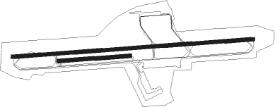
Grenoble/saint-geoirs - Alpes–isère
Airport details
| Country | France |
| State | Auvergne-Rhône-Alpes |
| Region | LF |
| Airspace | Marseille Ctr |
| Municipality | Saint-Étienne-de-Saint-Geoirs |
| Elevation | 1299ft (396m) |
| Timezone | GMT +1 |
| Coordinates | 45.36294, 5.33266 |
| Magnetic var | |
| Type | land |
| Available since | X-Plane v10.40 |
| ICAO code | LFLS |
| IATA code | GNB |
| FAA code | n/a |
Communication
| Alpes–Isère Grenoble ATIS | 133.850 |
| Alpes–Isère GRENOBLE Ground Control | 121.925 |
| Alpes–Isère GRENOBLE Tower | 119.300 |
| Alpes–Isère LYON Approach | 125.800 |
| Alpes–Isère LYON Approach | 132.000 |
| Alpes–Isère GRENOBLE Approach | 119.300 |
| Alpes–Isère GRENOBLE Approach | 120.400 |
Approach frequencies
| ILS-cat-I | RW09 | 109.3 | 18.00mi |
| 3° GS | RW09 | 109.3 | 18.00mi |
Nearby Points of Interest:
ferme Berlioz
-Hôtel de Bocsozel
-La Côte-Saint-André. Hôtel de ville
-Ferme des Bonnettes
-Forges de Bonpertuis
-grange de Louisias
-Château de Quincivet
-Abbey of Saint-Antoine-l'Abbaye
-Château de Tournin
-Prieuré de Manthes
-mur de terrasse antique
-Château de Voissant
-château de Vaulserre
-Château de Montplaisant
-Rhône du Pont de Groslée à Murs-et-Gélignieux
-Palais du parlement du Dauphiné
-Garage hélicoïdal de Grenoble
-Château de Trept
-Hôtel de François Marc
-Vauban powder magazine in Grenoble
-Isère prefecture (building)
-Bibliothèque municipale de Grenoble
-Town hall of Grenoble
-Chaise du Seigneur
-Alpexpo

Nearby beacons
| code | identifier | dist | bearing | frequency |
|---|---|---|---|---|
| EG | GRENOBLE NDB | 2.7 | 89° | 397 |
| WS | GRENOBLE NDB | 7.5 | 270° | 291 |
| LTP | LA TOUR DU PIN VOR/DME | 8.7 | 40° | 115.55 |
| BR | LYON-BRON NDB | 20.8 | 307° | 388 |
| VNE | VIENNE REVENTIN VOR | 22.2 | 293° | 108.20 |
| LSE | LYON SAINT EXUPERY VOR/DME | 25.1 | 328° | 114.75 |
| CH | CHAMBERY NDB | 26.9 | 67° | 346 |
| VE | VALENCE NDB | 34.7 | 216° | 320 |
| CBY | CHAMBERY VOR/DME | 35.9 | 39° | 115.40 |
| AT | ANNECY NDB | 41.6 | 54° | 384 |
| MTL | MONTELIMAR ANCONE VOR/DME | 53.9 | 214° | 113.65 |
| PAS | PASSEIRY VOR/DME | 55.6 | 40° | 116.60 |
| GVA | GENEVA VOR/DME | 63.1 | 42° | 115.75 |
Departure and arrival routes
| Transition altitude | 5000ft |
| SID end points | distance | outbound heading | |
|---|---|---|---|
| RW09 | |||
| WS4E | 143mi | 17° | |
| PIRU4E | 34mi | 34° | |
| BELU4E | 22mi | 40° | |
| SOPL4E | 28mi | 48° | |
| RISO4E | 29mi | 74° | |
| EB4E | 117mi | 180° | |
| ROMA4E | 17mi | 213° | |
| MURO4E | 40mi | 268° | |
| REPS4E | 46mi | 279° | |
| BELE4E | 57mi | 290° | |
| DANB4E | 35mi | 334° | |
| MOKI4E | 66mi | 348° | |
| RW27 | |||
| PIRU4W | 34mi | 34° | |
| BELU4W | 22mi | 40° | |
| SOPL4W | 28mi | 48° | |
| RISO4W | 29mi | 74° | |
| EB4W | 117mi | 180° | |
| ROMA4W | 17mi | 213° | |
| MURO4W | 40mi | 268° | |
| REPS4W | 46mi | 279° | |
| BELE4W | 57mi | 290° | |
| DANB4W | 35mi | 334° | |
| MOKI4W | 66mi | 348° | |
| STAR starting points | distance | inbound heading | |
|---|---|---|---|
| ALL | |||
| MTL1A | 53.9 | 34° | |
| MEZI1A, MEZI1B | 52.4 | 73° | |
| ROA1A | 69.8 | 118° | |
| MILP1A | 60.8 | 210° | |
| AMVA1A | 25.5 | 273° | |
| PINE1A | 23.2 | 333° | |
Instrument approach procedures
| runway | airway (heading) | route (dist, bearing) |
|---|---|---|
| RW09 | ARB1E (7°) | ARBON ARBON (turn) ODUXA (8mi, 64°) 3300ft |
| RW09 | GOM1E (7°) | GOMET GOMET (turn) ODUXA (18mi, 270°) 3300ft |
| RW09 | RIP1E (7°) | RIPTU RIPTU (turn) ODUXA (46mi, 200°) 3300ft |
| RW09 | WS (90°) | WS 3300ft |
| RNAV | ODUXA 3300ft FLS09 (5mi, 90°) 3300ft LFLS (7mi, 90°) 1276ft LS510 (5mi, 90°) LS512 (7mi, 297°) LS514 (3mi, 251°) 4300ft ARBON (17mi, 251°) 5000ft ARBON (turn) 5000ft | |
| RW27 | ABRET (236°) | ABRET LS404 (5mi, 121°) 5000ft ILS27 (4mi, 181°) 4200ft |
| RW27 | ARBON (80°) | ARBON 5000ft LS402 (11mi, 105°) DOPIM (9mi, 79°) 4500ft LS401 (9mi, 79°) 4500ft LS400 (2mi, 71°) 4500ft ILS27 (3mi, 1°) 4200ft |
| RW27 | GOM1W (7°) | GOMET GOMET (turn) ILS27 (4mi, 89°) 4200ft |
| RW27 | RIP1W (7°) | RIPTU RIPTU (turn) ILS27 (46mi, 161°) 4200ft |
| RW27 | WS (90°) | WS 3300ft |
| RNAV | ILS27 4200ft FLS27 (3mi, 270°) 3700ft LFLS (7mi, 270°) 1352ft LS410 (2mi, 270°) ARBON (17mi, 258°) 5000ft ARBON (turn) 5000ft |
Holding patterns
| STAR name | hold at | type | turn | heading* | altitude | leg | speed limit |
|---|---|---|---|---|---|---|---|
| AMVA1A | GOMET | VHF | left | 163 (343)° | 10000ft - 14000ft | DME 5.0mi | 230 |
| MEZI1A | ARBON | VHF | left | 195 (15)° | 7000ft - 14000ft | DME 5.0mi | 220 |
| MEZI1B | ARBON | VHF | left | 195 (15)° | 7000ft - 14000ft | DME 5.0mi | 220 |
| MILP1A | RIPTU | VHF | right | 24 (204)° | 7000ft - 14000ft | 1.0min timed | 220 |
| MTL1A | ARBON | VHF | left | 195 (15)° | 7000ft - 14000ft | DME 5.0mi | 220 |
| PINE1A | GOMET | VHF | left | 163 (343)° | 10000ft - 14000ft | DME 5.0mi | 230 |
| ROA1A | ARBON | VHF | left | 195 (15)° | 7000ft - 14000ft | DME 5.0mi | 220 |
| *) magnetic outbound (inbound) holding course | |||||||
Disclaimer
The information on this website is not for real aviation. Use this data with the X-Plane flight simulator only! Data taken with kind consent from X-Plane 12 source code and data files. Content is subject to change without notice.