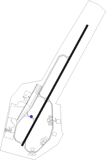
Châteauroux/déols - Chateauroux Deols
Airport details
| Country | France |
| State | Centre-Val de Loire |
| Region | LF |
| Airspace | Bordeaux Ctr |
| Municipality | Coings |
| Elevation | 525ft (160m) |
| Timezone | GMT +1 |
| Coordinates | 46.86031, 1.72113 |
| Magnetic var | |
| Type | land |
| Available since | X-Plane v10.40 |
| ICAO code | LFLX |
| IATA code | CHR |
| FAA code | n/a |
Communication
| Chateauroux Deols CHATEAUROUX Tower | 125.875 |
| Chateauroux Deols POITERS Approach | 130.900 |
Approach frequencies
| ILS-cat-I | RW21 | 110.3 | 18.00mi |
| 3° GS | RW21 | 110.3 | 18.00mi |
Nearby Points of Interest:
Couvent des Cordeliers de Châteauroux
-Porte de Châteauroux
-Château du Parc
-Prieuré de Saint-Marin de Saint-Marcel
-Ancien collège d'Argenton-sur-Creuse
-Manoir de Cluis-Dessus
-Église Saint-Denis de Condé
-Monuments historiques in La Châtre
-Château de La Châtre
-Abbaye Saint-Martin de Massay
-Lanterne des morts de Ciron
-Abbaye de Beaugerais
-Maison Grégueil
-Prieuré Saint-Étienne de Châteaumeillant
-Église Saint-Martin de Vallenay
Nearby beacons
| code | identifier | dist | bearing | frequency |
|---|---|---|---|---|
| CTX | CHATEAUROUX DEOLS NDB | 5.6 | 46° | 428 |
| BRG | BOURGES NDB | 24.8 | 74° | 375 |
| AVD | AVORD TACAN | 39 | 78° | 110.60 |
| LPD | MONTLUCON-GUERET NDB | 42 | 132° | 398 |
| AMB | AMBOISE VOR/DME | 43.4 | 311° | 113.70 |
| AMB | AMBOISE NDB | 43.5 | 309° | 341 |
| LOE | LIMOGES NDB | 52.2 | 205° | 424 |
| TUR | TOURS VAL DE LOIRE TACAN | 52.6 | 300° | 113.80 |
| BLB | BLOIS NDB | 53.2 | 327° | 397 |
| TUR | TOURS VAL DE LOIRE NDB | 57.1 | 307° | 331 |
Departure and arrival routes
| Transition altitude | 5000ft |
| SID end points | distance | outbound heading | |
|---|---|---|---|
| RW03 | |||
| ETAM6E, ETAM7J | 25mi | 92° | |
| GUSO7J, GUSO6E | 25mi | 212° | |
| OLIN6E, OLIN7J | 28mi | 272° | |
| SOPI6E, SOPI7J | 29mi | 284° | |
| RW21 | |||
| ETAM7K, ETAM6G | 25mi | 92° | |
| GUSO6G, GUSO7K | 25mi | 212° | |
| OLIN6G, OLIN7K | 28mi | 272° | |
| SOPI6G, SOPI7K | 29mi | 284° | |
| STAR starting points | distance | inbound heading | |
|---|---|---|---|
| RW03 | |||
| GUSO4S | 25.2 | 32° | |
| OLIN4S | 27.6 | 92° | |
| VERO4S | 34.8 | 225° | |
| RW21 | |||
| GUSO4C, GUSO4N | 25.2 | 32° | |
| OLIN4N, OLIN4C | 27.6 | 92° | |
| VERO4C, VERO4N | 34.8 | 225° | |
Instrument approach procedures
| runway | airway (heading) | route (dist, bearing) |
|---|---|---|
| RW03 | CTX (226°) | CTX LX302 (9mi, 253°) LX304 (10mi, 223°) 3000ft ILX03 (5mi, 116°) 3000ft |
| RW03 | LX304 (64°) | LX304 3000ft ILX03 (5mi, 116°) 3000ft |
| RW03 | LX305 (43°) | LX305 ILX03 (4mi, 43°) 3000ft |
| RNAV | ILX03 3000ft FLX03 (4mi, 43°) 3000ft LFLX (8mi, 42°) 577ft CTX (6mi, 46°) 3000ft LX302 (9mi, 253°) | |
| RW21 | CTX (226°) | CTX 3000ft LX212 (5mi, 296°) 3000ft LX214 (8mi, 46°) 3000ft ILX21 (4mi, 114°) 3000ft |
| RW21 | LX214 (202°) | LX214 3000ft ILX21 (4mi, 114°) 3000ft |
| RW21 | ROXIL (225°) | ROXIL ILX21 (5mi, 224°) 3000ft |
| RNAV | ILX21 3000ft FLX21 (4mi, 224°) 3000ft LFLX (9mi, 225°) 562ft LX210 (4mi, 219°) LX212 (11mi, 10°) 3000ft |
Holding patterns
| STAR name | hold at | type | turn | heading* | altitude | leg | speed limit |
|---|---|---|---|---|---|---|---|
| GUSO4C | CTX | FIX | right | 33 (213)° | 3000ft - 6000ft | 1.0min timed | 210 |
| OLIN4C | CTX | FIX | right | 33 (213)° | 3000ft - 6000ft | 1.0min timed | 210 |
| VERO4C | CTX | FIX | right | 33 (213)° | 3000ft - 6000ft | 1.0min timed | 210 |
| VERO4N | CTX | FIX | right | 33 (213)° | 3000ft - 6000ft | 1.0min timed | 210 |
| VERO4S | CTX | FIX | right | 33 (213)° | 3000ft - 6000ft | 1.0min timed | 210 |
| *) magnetic outbound (inbound) holding course | |||||||
Disclaimer
The information on this website is not for real aviation. Use this data with the X-Plane flight simulator only! Data taken with kind consent from X-Plane 12 source code and data files. Content is subject to change without notice.
