Lyon/bron - Lyon Bron
Airport details
| Country | France |
| State | Auvergne-Rhône-Alpes |
| Region | LF |
| Airspace | Marseille Ctr |
| Municipality | Saint-Priest |
| Elevation | 659ft (201m) |
| Timezone | GMT +1 |
| Coordinates | 45.72438, 4.94214 |
| Magnetic var | |
| Type | land |
| Available since | X-Plane v10.40 |
| ICAO code | LFLY |
| IATA code | LYN |
| FAA code | n/a |
Communication
| Lyon Bron ATIS | 128.130 |
| Lyon Bron Ground Control | 121.705 |
| Lyon Bron Tower | 118.100 |
| Lyon Bron LYON Approach | 131.315 |
| Lyon Bron LYON Approach 1 | 133.150 |
| Lyon Bron LYON Approach | 136.075 |
| Lyon Bron LYON Approach 2 | 125.430 |
| Lyon Bron LYON Approach 3 | 120.230 |
Nearby Points of Interest:
hôpital Édouard-Herriot
-monument à la gloire du service de santé militaire
-Villeurbanne City Hall
-Gratte-ciel
-Montluc prison
-Palais de Flore
-Gare des Brotteaux
-théâtre de l'Eldorado
-Garage Citroën
-Prefecture hotel of Rhône
-Rhône's Pool
-Hôtel de Sarron
-Hôtel de Lacroix-Laval
-Hôtel du Gouverneur militaire de Lyon
-Chapelle de la Trinité
-9 quai Jean-Moulin
-Gare du Bourbonnais
-Hôtel de Ville de Lyon
-monument fontaine à Jean-Pierre Pléney
-Condition des Soies
-Groupe épiscopal (Lyon)
-Palais de justice historique de Lyon
-Manécanterie
-Antiquaille Hospital
-Chapelle Saint-Thomas
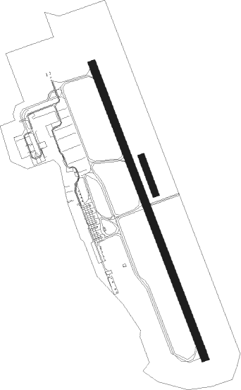
Runway info
Runway 16 / 34  | ||
| length | 1823m (5981ft) | |
| bearing | 157° / 337° | |
| width | 45m (148ft) | |
| surface | asphalt | |
| displ threshold | 300m (984ft) / 300m (984ft) | |
| blast zone | 255m (837ft) / 13m (43ft) | |
| Runway 16L / 34R | ||
| length | 222m (728ft) | |
| bearing | 157° / 337° | |
| width | 40m (131ft) | |
| surface | grass | |
Nearby beacons
| code | identifier | dist | bearing | frequency |
|---|---|---|---|---|
| LSE | LYON SAINT EXUPERY VOR/DME | 6.3 | 82° | 114.75 |
| BR | LYON-BRON NDB | 6.8 | 155° | 388 |
| VNE | VIENNE REVENTIN VOR | 10.3 | 199° | 108.20 |
| WS | GRENOBLE NDB | 23.4 | 150° | 291 |
| LTP | LA TOUR DU PIN VOR/DME | 25.2 | 115° | 115.55 |
| EB | SAINT ETIENNE NDB | 28.1 | 263° | 379 |
| EG | GRENOBLE NDB | 28.9 | 128° | 397 |
| BO | SAINT ETIENNE NDB | 29.6 | 252° | 299 |
| CBY | CHAMBERY VOR/DME | 35.4 | 79° | 115.40 |
| CH | CHAMBERY NDB | 40.3 | 98° | 346 |
| ROA | ROANNE VOR | 44.2 | 290° | 110.25 |
| RNN | ROANNE NDB | 44.4 | 293° | 358 |
| SN | SAINT YAN NDB | 48.4 | 305° | 430 |
| VE | VALENCE NDB | 52.5 | 179° | 320 |
| CC | CHAMPFORGEUIL NDB | 60 | 354° | 391 |
Departure and arrival routes
| Transition altitude | 5000ft |
| SID end points | distance | outbound heading | |
|---|---|---|---|
| RW16 | |||
| ALUR2T | 47mi | 1° | |
| MOKI2T | 44mi | 12° | |
| MABE2T | 39mi | 28° | |
| BELU2T | 27mi | 94° | |
| RISO2T | 44mi | 100° | |
| ROMA2T | 38mi | 160° | |
| EB2T | 140mi | 171° | |
| MURO2T | 33mi | 235° | |
| REPS2T | 31mi | 253° | |
| BELE2T | 34mi | 275° | |
| BUSI2T | 35mi | 339° | |
| RW34 | |||
| ALUR2P | 47mi | 1° | |
| MOKI2P | 44mi | 12° | |
| MABE2P | 39mi | 28° | |
| BELU2P | 27mi | 94° | |
| RISO2P | 44mi | 100° | |
| ROMA2P | 38mi | 160° | |
| EB2P | 140mi | 171° | |
| MURO2Q, MURO2P | 33mi | 235° | |
| REPS2Q | 31mi | 253° | |
| BELE2P | 34mi | 275° | |
| BUSI2P | 35mi | 339° | |
| STAR starting points | distance | inbound heading | |
|---|---|---|---|
| RW16 | |||
| MTL5S | 70.5 | 8° | |
| MEZI5S, MEZI5D | 52.8 | 47° | |
| CFA5S | 73.4 | 92° | |
| TIS5S | 58.8 | 96° | |
| LABA5S | 68.8 | 101° | |
| ARSO5S | 68.2 | 105° | |
| MOU5S | 80.2 | 127° | |
| MILP5S | 52.2 | 238° | |
| AMVA5S | 48.0 | 292° | |
| PINE5S | 49.8 | 321° | |
| RW34 | |||
| MTL5N | 70.5 | 8° | |
| MEZI5N, MEZI5E | 52.8 | 47° | |
| CFA5N | 73.4 | 92° | |
| TIS5N | 58.8 | 96° | |
| LABA5N | 68.8 | 101° | |
| ARSO5N | 68.2 | 105° | |
| MOU5N | 80.2 | 127° | |
| MILP5N | 52.2 | 238° | |
| AMVA5N | 48.0 | 292° | |
| PINE5N | 49.8 | 321° | |
Instrument approach procedures
| runway | airway (heading) | route (dist, bearing) |
|---|---|---|
| RW16 | ARB1S (6°) | ARBON VNE (16mi, 359°) D240K (7mi, 356°) D240K (turn) FAGOR (15mi, 358°) 3000ft |
| RW16 | ARBON (7°) | ARBON LY411 (22mi, 345°) LY413 (15mi, 345°) FAGOR (6mi, 78°) 3000ft |
| RW16 | GOM1S (6°) | GOMET LTP (8mi, 339°) D345F (6mi, 342°) D345F (turn) FAGOR (30mi, 301°) 3000ft |
| RW16 | GOMET (304°) | GOMET LY401 (14mi, 340°) LY405 (13mi, 335°) LY407 (12mi, 315°) FAGOR (12mi, 258°) 3000ft |
| RW16 | RIP1S (6°) | RIPTU RIPTU (turn) FAGOR (23mi, 247°) 3000ft |
| RW16 | RIPTU (225°) | RIPTU LY407 (11mi, 234°) FAGOR (12mi, 258°) 3000ft |
| RW16 | TAL1S (6°) | TALAR TALAR (turn) FAGOR (11mi, 99°) 3000ft |
| RW16 | TALAR (124°) | TALAR LY413 (7mi, 119°) FAGOR (6mi, 78°) 3000ft |
| RNAV | FAGOR 3000ft FLY16 (4mi, 157°) 3000ft LFLY (8mi, 158°) 697ft LY404 (7mi, 156°) ARBON (20mi, 197°) 5000ft ARBON (turn) | |
| RW34 | ARB1N (6°) | ARBON ARBON (turn) RESKU (16mi, 27°) 3000ft |
| RW34 | GOM1N (6°) | GOMET GOMET (turn) RESKU (22mi, 291°) 3000ft |
| RW34 | RIP1N (6°) | RIPTU RIPTU (turn) RESKU (36mi, 208°) 3000ft |
| RW34 | TAL1N (6°) | TALAR D258M (17mi, 145°) VNE (10mi, 145°) VNE (turn) RESKU (6mi, 96°) 3000ft |
| RNAV | RESKU 3000ft FLY34 (4mi, 337°) 3000ft LFLY (7mi, 336°) 707ft LY504 (9mi, 338°) TALAR (13mi, 287°) 4500ft TALAR (turn) |
Holding patterns
| STAR name | hold at | type | turn | heading* | altitude | leg | speed limit |
|---|---|---|---|---|---|---|---|
| AMVA5N | GOMET | VHF | left | 163 (343)° | 10000ft - 14000ft | DME 5.0mi | 230 |
| AMVA5S | GOMET | VHF | left | 163 (343)° | 10000ft - 14000ft | DME 5.0mi | 230 |
| ARSO5N | TALAR | VHF | left | 307 (127)° | 7000ft - 14000ft | DME 5.0mi | 230 |
| ARSO5S | TALAR | VHF | left | 307 (127)° | 7000ft - 14000ft | DME 5.0mi | 230 |
| CFA5N | TALAR | VHF | left | 307 (127)° | 7000ft - 14000ft | DME 5.0mi | 230 |
| CFA5S | TALAR | VHF | left | 307 (127)° | 7000ft - 14000ft | DME 5.0mi | 230 |
| LABA5N | TALAR | VHF | left | 307 (127)° | 7000ft - 14000ft | DME 5.0mi | 230 |
| LABA5S | TALAR | VHF | left | 307 (127)° | 7000ft - 14000ft | DME 5.0mi | 230 |
| MEZI5D | ARBON | VHF | left | 195 (15)° | 7000ft - 14000ft | DME 5.0mi | 220 |
| MEZI5E | ARBON | VHF | left | 195 (15)° | 7000ft - 14000ft | DME 5.0mi | 220 |
| MEZI5N | ARBON | VHF | left | 195 (15)° | 7000ft - 14000ft | DME 5.0mi | 220 |
| MEZI5S | ARBON | VHF | left | 195 (15)° | 7000ft - 14000ft | DME 5.0mi | 220 |
| MILP5N | RIPTU | VHF | right | 24 (204)° | 7000ft - 14000ft | 1.0min timed | 220 |
| MILP5S | RIPTU | VHF | right | 24 (204)° | 7000ft - 14000ft | 1.0min timed | 220 |
| MOU5N | TALAR | VHF | left | 307 (127)° | 7000ft - 14000ft | DME 5.0mi | 230 |
| MOU5S | TALAR | VHF | left | 307 (127)° | 7000ft - 14000ft | DME 5.0mi | 230 |
| MTL5N | ARBON | VHF | left | 195 (15)° | 7000ft - 14000ft | DME 5.0mi | 220 |
| MTL5S | ARBON | VHF | left | 195 (15)° | 7000ft - 14000ft | DME 5.0mi | 220 |
| PINE5N | GOMET | VHF | left | 163 (343)° | 10000ft - 14000ft | DME 5.0mi | 230 |
| PINE5S | GOMET | VHF | left | 163 (343)° | 10000ft - 14000ft | DME 5.0mi | 230 |
| TIS5N | TALAR | VHF | left | 307 (127)° | 7000ft - 14000ft | DME 5.0mi | 230 |
| TIS5S | TALAR | VHF | left | 307 (127)° | 7000ft - 14000ft | DME 5.0mi | 230 |
| *) magnetic outbound (inbound) holding course | |||||||
Disclaimer
The information on this website is not for real aviation. Use this data with the X-Plane flight simulator only! Data taken with kind consent from X-Plane 12 source code and data files. Content is subject to change without notice.