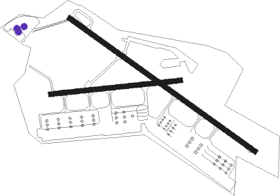
Le Luc/le Cannet - Le Luc Le Cannet
Airport details
| Country | France |
| State | Provence-Alpes-Côte d'Azur |
| Region | LF |
| Airspace | Marseille Ctr |
| Municipality | Le Cannet-des-Maures |
| Elevation | 264ft (80m) |
| Timezone | GMT +1 |
| Coordinates | 43.38186, 6.38840 |
| Magnetic var | |
| Type | land |
| Available since | X-Plane v10.40 |
| ICAO code | LFMC |
| IATA code | n/a |
| FAA code | n/a |
Communication
| Le Luc Le Cannet LE LUC INFO | 128.650 |
| Le Luc Le Cannet LE LUC Ground Control | 121.850 |
| Le Luc Le Cannet LE LUC Tower | 123.000 |
| Le Luc Le Cannet LE LUC Approach | 122.200 |
Nearby Points of Interest:
Menhirs de la Ferme Lambert
-Port Grimaud
-Château Bertaud
-Domaine des Treilles
-Tour Suffren
-Chapelle Sainte-Anne de Saint-Tropez
-Dolmen de la Gaillarde-sur-Mer
-Ramparts of Fréjus
-Missiri mosque
-cité épiscopale de Fréjus
-Église Notre-Dame de Favas
-Dolmen de la Verrerie-Vieille
-hotel du parc
-Dellor mansion
-Porte Saint-Paul, Hyères
-Porte de Fenouillet, Hyères
-Menhirs de Veyssières
-Villa tunisienne
-Villa mauresque
-Le Plantier de Costebelle
-Remparts de Bargème
-Église Saint-Laurent de Bargème
-Couvent des Dominicains de Saint-Maximin-la-Sainte-Baume
-Grotte de la Baume Bonne
-South Mauvans dolmen
Nearby beacons
| code | identifier | dist | bearing | frequency |
|---|---|---|---|---|
| LC | CANNET DME-ILS | 0.3 | 297° | 109.30 |
| LUC | LE LUC LE CANNET VOR/DME | 5.7 | 270° | 113 |
| LU | LE LUC NDB | 5.9 | 88° | 378 |
| MUS | NICE COTE D'AZUR NDB | 9.5 | 89° | 428 |
| STP | SAINT TROPEZ VOR/DME | 13.4 | 127° | 116.50 |
| NFA | CUERS NDB | 13.9 | 243° | 640 |
| MFB | BRIGNOLES NDB | 16.3 | 275° | 688 |
| HYE | HYERES LE PALYVESTRE TACAN | 19.9 | 221° | 109 |
| TLN | HYERES NDB | 23.3 | 214° | 322 |
| CNM | CANNES VOR | 23.6 | 70° | 111.40 |
| CSC | MANDELIEU (CANNES) NDB | 29.8 | 78° | 385 |
| OB | MARSEILLE PROVENCE NDB | 32.8 | 258° | 395 |
| NC | NICE NDB | 34.6 | 74° | 338 |
| CGS | CAGNES-SUR-MER VOR/DME | 36.5 | 71° | 109.20 |
| DGN | DIGNE VOR | 38.6 | 335° | 113.85 |
| AZR | NICE VOR/DME | 40 | 72° | 109.65 |
| NIZ | NICE COTE D'AZUR VOR/DME | 44.3 | 66° | 112.40 |
| SCL | SAINT CHRISTOL NDB | 55.5 | 307° | 348 |
Departure and arrival routes
| Transition altitude | 5000ft |
| SID end points | distance | outbound heading | |
|---|---|---|---|
| RW09 | |||
| GILON1 | 13mi | 283° | |
| RW27 | |||
| GILON2 | 13mi | 283° | |
Disclaimer
The information on this website is not for real aviation. Use this data with the X-Plane flight simulator only! Data taken with kind consent from X-Plane 12 source code and data files. Content is subject to change without notice.

