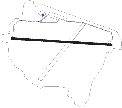
Châteaudun - Chateaudun
Airport details
| Country | France |
| State | Centre-Val de Loire |
| Region | LF |
| Airspace | Paris Ctr |
| Municipality | Châteaudun |
| Elevation | 433ft (132m) |
| Timezone | GMT +1 |
| Coordinates | 48.05788, 1.37944 |
| Magnetic var | |
| Type | land |
| Available since | X-Plane v10.40 |
| ICAO code | LFOC |
| IATA code | n/a |
| FAA code | n/a |
Communication
| Chateaudun Tower | 121.750 |
| Chateaudun Tower | 125.625 |
| Chateaudun BRICY Approach | 122.700 |
Nearby Points of Interest:
dolmen de la Nivardière 2
-Dolmen des Grosses-Pierres
-Château d'Illiers-Combray
-Camp de Voves
-Pigeonnier de la Commanderie d'Arville
-Viaduc ferroviaire de Beaugency
-Église Saint-Étienne de Beaugency
-Hôtel de Ville de Beaugency
-théâtre gallo-romain d'Areines
-Abbaye Notre-Dame de Beaugency
-Pont de Beaugency
-Trinity Abbey, Vendôme
-Abbaye Notre-Dame de l'Eau
-Éolienne de Berchères-les-Pierres
-Hôpital Porte Madeleine d'Orléans
-Maison de la Chancellerie
-Palais de Justice d'Orléans
-Hôtel Pommeret
-Hôtel Tassin de Montcour
-Hôtel Tassin de Villiers
-Logis de la Pinellière
-Prefecture hotel of Loiret
-episcopal palace
-Couvent des Cordeliers (Chartres)
-Marceau statue in Chartres
Nearby beacons
| code | identifier | dist | bearing | frequency |
|---|---|---|---|---|
| CHN | CHATEAUDUN TACAN | 0.2 | 243° | 110.20 |
| CAD | CHATEAUDUN VOR/DME | 0.3 | 80° | 115.95 |
| BCY | ORLEANS VOR/DME | 15.7 | 101° | 117.35 |
| OAN | ORLEANS-BRICY NDB | 16 | 98° | 385 |
| BLB | BLOIS NDB | 24.1 | 205° | 397 |
| CHW | CHARTRES VOR/DME | 29.8 | 317° | 115.20 |
| ORS | ORLEANS SAINT DENIS DE L'HOTEL NDB | 35.4 | 98° | 322 |
| EPR | EPERNON VOR/DME | 35.8 | 26° | 115.65 |
| PTV | PITHIVIERS VOR | 35.9 | 84° | 116.50 |
| TUR | TOURS VAL DE LOIRE NDB | 38.1 | 230° | 331 |
| AMB | AMBOISE VOR/DME | 39.8 | 207° | 113.70 |
| AMB | AMBOISE NDB | 40.7 | 208° | 341 |
| RBT | RAMBOUILLET VOR/DME | 43.3 | 46° | 114.70 |
| HOL | VILLACOUBLAY NDB | 44 | 33° | 315 |
| TUR | TOURS VAL DE LOIRE TACAN | 46.2 | 226° | 113.80 |
| TSU | TOUSSUS LE NOBLE VOR | 50.7 | 46° | 108.25 |
| TA | VILLACOUBLAY NDB | 51.5 | 45° | 286 |
| LGL | L'AIGLE VOR/DME | 55.5 | 311° | 112.70 |
| EVX | EVREUX FAUVILLE VORTAC | 58.8 | 351° | 112.40 |
Instrument approach procedures
| runway | airway (heading) | route (dist, bearing) |
|---|---|---|
| RW10 | OC407 (113°) | OC407 2200ft IOC10 (5mi, 192°) 2100ft |
| RW10 | OC408 (95°) | OC408 2700ft IOC10 (5mi, 95°) 2100ft |
| RW10 | OC409 (79°) | OC409 2100ft IOC10 (5mi, 12°) 2100ft |
| RNAV | IOC10 2100ft FOC10 (5mi, 95°) 2100ft LFOC (6mi, 95°) 481ft OC412 (4mi, 95°) OC413 (5mi, 192°) OC409 (15mi, 275°) 2100ft | |
| RW28 | OC400 (258°) | OC400 2100ft IOC28 (5mi, 192°) 2100ft |
| RW28 | OC401 (275°) | OC401 2100ft IOC28 (5mi, 276°) 2100ft |
| RW28 | OC402 (294°) | OC402 2100ft IOC28 (5mi, 12°) 2100ft |
| RNAV | IOC28 2100ft FOC28 (5mi, 275°) 2100ft LFOC (6mi, 275°) 473ft OC405 (4mi, 275°) OC406 (5mi, 192°) OC402 (15mi, 95°) 2100ft |
Disclaimer
The information on this website is not for real aviation. Use this data with the X-Plane flight simulator only! Data taken with kind consent from X-Plane 12 source code and data files. Content is subject to change without notice.
