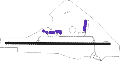
Saumur/saint-florent - Saumur Saint Florent
Airport details
| Country | France |
| State | Pays de la Loire |
| Region | LF |
| Airspace | Paris Ctr |
| Municipality | Saumur |
| Elevation | 269ft (82m) |
| Timezone | GMT +1 |
| Coordinates | 47.25673, -0.11355 |
| Magnetic var | |
| Type | land |
| Available since | X-Plane v10.40 |
| ICAO code | LFOD |
| IATA code | n/a |
| FAA code | n/a |
Communication
| Saumur Saint Florent SAUMUR INFO | 120.600 |
| Saumur Saint Florent Dep | 120.600 |
Nearby Points of Interest:
Château Bouvet-Ladubay
-École de cavalerie de Saumur
-Château du Vieux Bagneux
-Hôtel de ville de Saumur
-Maison de la Reine de Sicile de Saumur
-Couvent Notre-Dame des Ardilliers
-Église Saint-André de Verrie
-Pierre couverte du Mousseau
-Église Saint-Pierre d'Artannes-sur-Thouet
-Hermitage Saint-Jean
-manoir de la Vignolle
-Maison du Prieur de Cunault
-Caves des Mousseaux
-Nymphée gallo-romain de Gennes
-Église de Varenne
-Cour de Douces
-Presbytère de Montreuil-Bellay
-Logis de la Chesnaie-Archenon
-château de La Coutancière
-Maison La Minotière
-The Loire Valley between Sully-sur-Loire and Chalonnes
-Prieuré des Nobis
-couvent des Augustins de Montreuil-Bellay
-Enceinte fortifiée de Montreuil-Bellay
-Église Saint-Pierre de Vaudelnay
Runway info
| Runway 10 / 28 | ||
| length | 1451m (4760ft) | |
| bearing | 93° / 273° | |
| width | 30m (98ft) | |
| surface | asphalt | |
| displ threshold | 0m (0ft) / 140m (459ft) | |
Nearby beacons
| code | identifier | dist | bearing | frequency |
|---|---|---|---|---|
| AS | ANGERS NDB | 19.3 | 353° | 392 |
| LP | CHOLET NDB | 30.5 | 260° | 357 |
| ANG | ANGERS VOR | 34.4 | 291° | 113 |
| TUR | TOURS VAL DE LOIRE TACAN | 35.7 | 79° | 113.80 |
| PI | POITIERS NDB | 39.4 | 137° | 363 |
| LM | LE MANS NDB | 39.9 | 24° | 326 |
| TUR | TOURS VAL DE LOIRE NDB | 40.8 | 71° | 331 |
| POI | POITIERS BIARDS VOR | 43.9 | 149° | 113.30 |
| AMB | AMBOISE NDB | 47.9 | 82° | 341 |
| LA | LAVAL NDB | 48.8 | 322° | 401 |
| AMB | AMBOISE VOR/DME | 49 | 82° | 113.70 |
Disclaimer
The information on this website is not for real aviation. Use this data with the X-Plane flight simulator only! Data taken with kind consent from X-Plane 12 source code and data files. Content is subject to change without notice.
