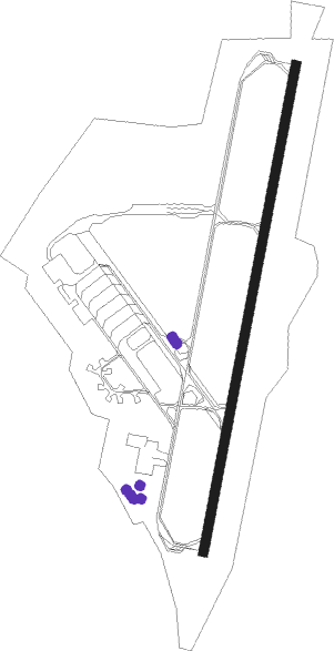
Tours/val De Loire (loire Valley) - Tours Val De Loire
Airport details
| Country | France |
| State | Centre-Val de Loire |
| Region | LF |
| Airspace | Paris Ctr |
| Municipality | Tours |
| Elevation | 354ft (108m) |
| Timezone | GMT +1 |
| Coordinates | 47.43184, 0.72318 |
| Magnetic var | |
| Type | land |
| Available since | X-Plane v10.40 |
| ICAO code | LFOT |
| IATA code | TUF |
| FAA code | n/a |
Communication
| Tours Val De Loire TOURS FSS | 118.300 |
| Tours Val De Loire TOURS INFO | 118.300 |
| Tours Val De Loire TOURS Ground Control | 122.100 |
| Tours Val De Loire TOURS Tower | 124.400 |
| Tours Val De Loire TOURS GCA Approach | 119.950 |
| Tours Val De Loire TOURS GCA Approach | 123.300 |
| Tours Val De Loire TOURS Approach | 121.000 |
Approach frequencies
| ILS-cat-I | RW20 | 110.55 | 18.00mi |
| 3° GS | RW20 | 110.55 | 18.00mi |
Nearby Points of Interest:
château du Pilorget
-Couvent des Capucins de Tours
-Pont suspendu de Saint-Symphorien
-Hôtel du Doyenné de Saint-Gatien
-Toll houses in Tours
-Ancienne maison canoniale, 1 place Grégoire-de-Tours
-maison canoniale du Curé de Tours
-Ancienne maison canoniale de Saint-Gatien
-hôtel de Chanoines
-Enceinte gallo-romaine de Tours
-Hôtel de Jean Galland (Tours)
-maison de Bonaventure
-Couvent des Ursulines de Tours
-hôtel, 7 rue de la Barre
-hôtel, 17 place Foire-le-Roi
-Hôtel Liebert de Nitray
-jeu de paume de Tours
-Maison, 48 rue Colbert (Tours)
-hôtel, 33bis rue du Cygne
-hôtel, 43 rue Émile-Zola, 60 rue de la Préfecture
-Abbaye Saint-Julien (Tours)
-Chambre de commerce et d'industrie de Touraine
-Hôtel de la Crouzille
-hôtel particulier
-Hôtel Mame, Tours
Nearby beacons
| code | identifier | dist | bearing | frequency |
|---|---|---|---|---|
| TUR | TOURS VAL DE LOIRE TACAN | 0.6 | 141° | 113.80 |
| TUR | TOURS VAL DE LOIRE NDB | 8.4 | 24° | 331 |
| AMB | AMBOISE NDB | 12.9 | 92° | 341 |
| AMB | AMBOISE VOR/DME | 13.8 | 90° | 113.70 |
| BLB | BLOIS NDB | 24.2 | 63° | 397 |
| LM | LE MANS NDB | 35.5 | 310° | 326 |
| AS | ANGERS NDB | 36.5 | 279° | 392 |
| PI | POITIERS NDB | 45.5 | 203° | 363 |
| CHN | CHATEAUDUN TACAN | 45.8 | 46° | 110.20 |
| CAD | CHATEAUDUN VOR/DME | 46.2 | 47° | 115.95 |
| POI | POITIERS BIARDS VOR | 53.9 | 207° | 113.30 |
| ANG | ANGERS VOR | 64.2 | 274° | 113 |
| LA | LAVAL NDB | 65.4 | 291° | 401 |
| LP | CHOLET NDB | 66.1 | 259° | 357 |
Instrument approach procedures
| runway | airway (heading) | route (dist, bearing) |
|---|---|---|
| RW02 | IOT02 (21°) | IOT02 2400ft FOT02 (7mi, 22°) 2400ft |
| RW02 | TUR (321°) | TUR 2600ft OT403 (8mi, 252°) OT404 (8mi, 202°) 2400ft IOT02 (6mi, 101°) 2400ft FOT02 (7mi, 22°) 2400ft |
| RNAV | FOT02 2400ft LFOT (7mi, 20°) 400ft OT407 (3mi, 26°) 2400ft OT403 (11mi, 239°) 2400ft OT404 (8mi, 202°) 2400ft IOT02 (6mi, 101°) 2400ft | |
| RW20 | OT425 (204°) | OT425 TUR (17mi, 201°) 2000ft FOT20 (6mi, 18°) 2000ft |
| RW20 | TUR (321°) | TUR 2000ft FOT20 (6mi, 18°) 2000ft |
| RNAV | FOT20 2000ft LFOT (6mi, 204°) 400ft TUR (turn) 2000ft |
Disclaimer
The information on this website is not for real aviation. Use this data with the X-Plane flight simulator only! Data taken with kind consent from X-Plane 12 source code and data files. Content is subject to change without notice.
