Guillerval - Etampes Mondesir
Airport details
| Country | France |
| State | Ile-de-France |
| Region | LF |
| Airspace | Paris Ctr |
| Municipality | Guillerval |
| Elevation | 486ft (148m) |
| Timezone | GMT +1 |
| Coordinates | 48.38111, 2.07389 |
| Magnetic var | |
| Type | land |
| Available since | X-Plane v10.40 |
| ICAO code | LFOX |
| IATA code | n/a |
| FAA code | n/a |
Communication
| Etampes Mondesir MONDESIR ATIS | 129.900 |
| Etampes Mondesir MONDESIR GROUND | 121.850 |
| Etampes Mondesir MONDESIR TOWER | 119.050 |
Nearby Points of Interest:
borne seigneuriale de Saclas
-Menhir de Pierrefitte (Étampes)
-Pont du Moulin
-Lavoir de Méréville (Essonne)
-Vestiges des anciens remparts
-Hôtel Dieu
-Prieuré d'Étampes
-polissoir de la Petite-Garenne
-polissoir du bois de la Guigneraie
-polissoir du bois de la Charmille
-Château de Farcheville
-Ferme de Châteaupers
-polissoir du bois de la Briche
-Ferme des Tourelles
-Moulin de Villeneuve
-Château de Rochefort-en-Yvelines
-Collegiale Saint Georges de Pithiviers
-Château du Saussay
-Roche Grénolée
-polissoir du Goulet
-Menhir de la Pierre-aux-Prêtres
-Croix Boissée
-polissoir de la Pierre-aux-Prêtres
-Autodrome de Linas-Montlhéry
-Château de Ronqueux
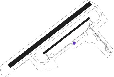
Runway info
Runway 06L / 24R  | ||
| length | 1226m (4022ft) | |
| bearing | 66° / 246° | |
| width | 50m (164ft) | |
| surface | grass | |
| displ threshold | 169m (554ft) / 189m (620ft) | |
| Runway 06 / 24 | ||
| length | 699m (2293ft) | |
| bearing | 66° / 246° | |
| width | 23m (74ft) | |
| surface | asphalt | |
Nearby beacons
| code | identifier | dist | bearing | frequency |
|---|---|---|---|---|
| PTV | PITHIVIERS VOR | 15.5 | 140° | 116.50 |
| RBT | RAMBOUILLET VOR/DME | 16.6 | 344° | 114.70 |
| EPR | EPERNON VOR/DME | 22.1 | 300° | 115.65 |
| TSU | TOUSSUS LE NOBLE VOR | 22.4 | 4° | 108.25 |
| HOL | VILLACOUBLAY NDB | 23.2 | 324° | 315 |
| TA | VILLACOUBLAY NDB | 23.4 | 3° | 286 |
| POY | ORLY (PARIS) NDB | 24.4 | 42° | 334 |
| OAN | ORLEANS-BRICY NDB | 25.8 | 219° | 385 |
| BCY | ORLEANS VOR/DME | 26.9 | 219° | 117.35 |
| ORS | ORLEANS SAINT DENIS DE L'HOTEL NDB | 27.4 | 159° | 322 |
| MLN | MELUN VILLAROCHE VOR/DME | 29.8 | 84° | 113.60 |
| CAD | CHATEAUDUN VOR/DME | 33.6 | 245° | 115.95 |
| CHN | CHATEAUDUN TACAN | 34.1 | 245° | 110.20 |
| MV | MELUN NDB | 37.4 | 79° | 434 |
| BT | LE BOURGET (PARIS) VOR/DME | 38.7 | 33° | 116.10 |
| CGN | (PARIS) DME | 41.9 | 34° | 115.35 |
| PON | PONTOISE CORMEILLES EN VE VOR | 42.9 | 357° | 111.60 |
| PGS | CHARLES-DE-GAULLE (PARIS) VOR/DME | 43 | 42° | 117.05 |
| CLM | COULOMMIERS VOR/DME | 46.5 | 64° | 112.90 |
| EVX | EVREUX FAUVILLE VORTAC | 51.6 | 307° | 112.40 |
| BLB | BLOIS NDB | 55 | 231° | 397 |
| BSN | DME | 62.1 | 51° | 114.85 |
Disclaimer
The information on this website is not for real aviation. Use this data with the X-Plane flight simulator only! Data taken with kind consent from X-Plane 12 source code and data files. Content is subject to change without notice.