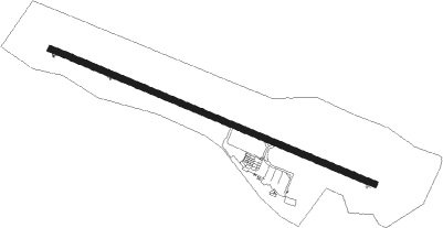
Saint Gatien Des Bois - Deauville Normandie
Airport details
| Country | France |
| State | Normandy |
| Region | LF |
| Airspace | Paris Ctr |
| Municipality | Saint-Gatien-des-Bois |
| Elevation | 479ft (146m) |
| Timezone | GMT +1 |
| Coordinates | 49.36340, 0.16000 |
| Magnetic var | |
| Type | land |
| Available since | X-Plane v10.40 |
| ICAO code | LFRG |
| IATA code | DOL |
| FAA code | n/a |
Communication
| Deauville Normandie ATIS | 119.180 |
| Deauville Normandie DEAUVILLE Tower | 118.300 |
| Deauville Normandie DEAUVILLE Approach | 120.350 |
| Deauville Normandie Dep | 118.300 |
Approach frequencies
| ILS-cat-I | RW30 | 111.55 | 18.00mi |
| 3° GS | RW30 | 111.55 | 18.00mi |
Nearby Points of Interest:
Manoir des Vallées
-manoir du Grenier à sel
-well, Rue du Puits, Rue Bucaille
-manoir Vigneron
-prison d'Honfleur
-Grenier à sel d'Honfleur
-hospice d'Honfleur
-Maisons Satie
-Propriété de Paul-Élie Gernez
-Ancienne prison
-Ancien couvent des dominicains de l'Isle
-Siège de la vicomté d'Auge
-Tribunal
-Hôtel Montpensier
-Hôtel de ville de Pont-l'Évêque
-église Saint-Étienne de Reux
-Prieuré de Saint-Hymer
-Grestain Abbey
-Hôtel des Ingénieurs des Tréfileries
-encuvement sur abri pour canon
-hôtel Homberg
-hôtel Dubocage de Bléville
-reconstructed center of Le Havre
-Hôtel de Brocques
-Arsenal du Havre
Nearby beacons
| code | identifier | dist | bearing | frequency |
|---|---|---|---|---|
| DVL | DEAUVILLE NORMANDIE VOR | 6.7 | 109° | 110.20 |
| LHO | LE HAVRE NDB | 14 | 5° | 346 |
| CNE | CAEN NDB | 24 | 243° | 404 |
| CAN | CAEN CARPIQUET VOR/DME | 26.6 | 253° | 114.45 |
| LGL | L'AIGLE VOR/DME | 37.3 | 147° | 112.70 |
| DSA | DIEPPE NDB | 47.5 | 61° | 351 |
| CHW | CHARTRES VOR/DME | 62.2 | 137° | 115.20 |
Departure and arrival routes
| Transition altitude | 5000ft |
| SID end points | distance | outbound heading | |
|---|---|---|---|
| RW12 | |||
| ETRA4E | 19mi | 1° | |
| DPE4E | 52mi | 61° | |
| ELBO4E | 26mi | 97° | |
| LGL4E | 37mi | 147° | |
| CAN4E | 27mi | 253° | |
| NEVI4E | 43mi | 320° | |
| RW30 | |||
| ETRA4W | 19mi | 1° | |
| DPE4Z, DPE4W | 52mi | 61° | |
| ELBO4W | 26mi | 97° | |
| LGL4W | 37mi | 147° | |
| CAN4W | 27mi | 253° | |
| NEVI4W | 43mi | 320° | |
| STAR starting points | distance | inbound heading | |
|---|---|---|---|
| RW12 | |||
| CAN4R | 26.6 | 73° | |
| ETRA4R | 19.2 | 181° | |
| DPE4R | 51.8 | 241° | |
| ROU4R | 44.2 | 265° | |
| BERN4R | 25.0 | 301° | |
| LGL4R | 37.3 | 327° | |
| RW30 | |||
| CAN4D | 26.6 | 73° | |
| ETRA4D | 19.2 | 181° | |
| DPE4D | 51.8 | 241° | |
| BERN4D | 25.0 | 301° | |
| LGL4D | 37.3 | 327° | |
Instrument approach procedures
| runway | airway (heading) | route (dist, bearing) |
|---|---|---|
| RW12 | ABAMU (95°) | ABAMU IRG12 (6mi, 59°) 3000ft |
| RW12 | BAGEK (108°) | BAGEK IRG12 (5mi, 108°) 3000ft |
| RW12 | DEMOM (122°) | DEMOM IRG12 (5mi, 191°) 3000ft |
| RNAV | IRG12 3000ft FRG12 (5mi, 108°) 3000ft LFRG (8mi, 108°) 521ft RG410 (2mi, 109°) LULIP (11mi, 261°) ABAMU (9mi, 297°) 3000ft ABAMU (turn) 3000ft | |
| RW30 | GODOV (314°) | GODOV IRG30 (7mi, 38°) 3000ft |
| RW30 | XANOR (257°) | XANOR IRG30 (14mi, 218°) 3000ft |
| RW30 | XASUD (2°) | XASUD GODOV (9mi, 87°) IRG30 (7mi, 38°) 3000ft |
| RNAV | IRG30 3000ft FRG30 (5mi, 289°) 3000ft LFRG (8mi, 289°) 515ft RG510 (3mi, 289°) XASUD (14mi, 166°) 3000ft XASUD (turn) 3000ft |
Holding patterns
| STAR name | hold at | type | turn | heading* | altitude | leg | speed limit |
|---|---|---|---|---|---|---|---|
| BERN4D | DVL | NDB | right | 118 (298)° | 3000ft - 6000ft | 1.0min timed | 220 |
| BERN4R | ABAMU | VHF | left | 227 (47)° | 3000ft - 5000ft | 1.0min timed | 200 |
| CAN4D | DVL | NDB | right | 118 (298)° | 3000ft - 6000ft | 1.0min timed | 220 |
| CAN4R | ABAMU | VHF | left | 227 (47)° | 3000ft - 5000ft | 1.0min timed | 200 |
| DPE4D | DVL | NDB | right | 118 (298)° | 3000ft - 6000ft | 1.0min timed | 220 |
| DPE4R | ABAMU | VHF | left | 227 (47)° | 3000ft - 5000ft | 1.0min timed | 200 |
| ETRA4D | DVL | NDB | right | 118 (298)° | 3000ft - 6000ft | 1.0min timed | 220 |
| ETRA4R | ABAMU | VHF | left | 227 (47)° | 3000ft - 5000ft | 1.0min timed | 200 |
| LGL4D | DVL | NDB | right | 118 (298)° | 3000ft - 6000ft | 1.0min timed | 220 |
| LGL4R | ABAMU | VHF | left | 227 (47)° | 3000ft - 5000ft | 1.0min timed | 200 |
| ROU4R | ABAMU | VHF | left | 227 (47)° | 3000ft - 5000ft | 1.0min timed | 200 |
| *) magnetic outbound (inbound) holding course | |||||||
Disclaimer
The information on this website is not for real aviation. Use this data with the X-Plane flight simulator only! Data taken with kind consent from X-Plane 12 source code and data files. Content is subject to change without notice.