Lorient/lann/bihoué - Lorient Lann-bihoue
Airport details
| Country | France |
| State | Brittany |
| Region | LF |
| Airspace | Brest Ctr |
| Municipality | Plœmeur |
| Elevation | 159ft (48m) |
| Timezone | GMT +1 |
| Coordinates | 47.76053, -3.43995 |
| Magnetic var | |
| Type | land |
| Available since | X-Plane v10.40 |
| ICAO code | LFRH |
| IATA code | LRT |
| FAA code | n/a |
Communication
| Lorient Lann-Bihoue LFRH ATIS | 129.125 |
| Lorient Lann-Bihoue LORIENT Ground Control | 119.700 |
| Lorient Lann-Bihoue LORIENT Tower | 122.700 |
| Lorient Lann-Bihoue LORIENT Approach | 122.100 |
| Lorient Lann-Bihoue LORIENT Approach | 122.300 |
| Lorient Lann-Bihoue LORIENT Approach | 123.000 |
| Lorient Lann-Bihoue LORIENT Approach | 119.700 |
Approach frequencies
| ILS-cat-I | RW25 | 108.15 | 18.00mi |
| 3° GS | RW25 | 108.15 | 18.00mi |
Nearby Points of Interest:
croix de chemin en schiste de Kerduellic
-Croix de Kerduellic
-Croix de Kervegan
-Cité de Soye
-253 bis cité de Soye
-253 Cité de Soye
-Calvaire de Quéven
-Croix de Kergouledec
-Maison, 18 rue Jules Legrand (Lorient)
-Monument expiatoire de Lorient
-Town hall of Port-Louis
-Église Saints-Pierre-et-Paul de Caudan
-Usine de salaison gallo-romaine du Resto
-petite mer de Gâvres
-Puits Ferré d'Hennebont
-Haras national d'Hennebont
-Croix armoriée de Kério
-Puits de Calan
-dolmen de Tri-Men-de-Castello
-Domaine de Kerlivio
-oppidum de Mané-Coh-Castel
-Puits et niche du Lion
-Glacière d'Étel
-Etel lifeboat station
-Dolmen à galerie avec la base de son tumulus
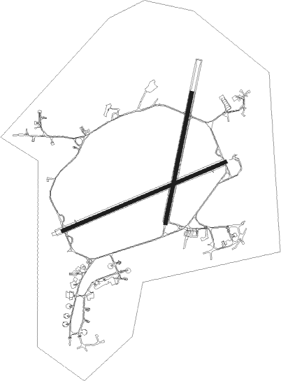
Runway info
Runway 07 / 25  | ||
| length | 2225m (7300ft) | |
| bearing | 77° / 257° | |
| width | 45m (148ft) | |
| surface | asphalt | |
| blast zone | 99m (325ft) / 195m (640ft) | |
| Runway 02 / 20 | ||
| length | 1670m (5479ft) | |
| bearing | 23° / 203° | |
| width | 45m (148ft) | |
| surface | asphalt | |
Airport layout
Taxiway locations
Parking locations
Nearby beacons
| code | identifier | dist | bearing | frequency |
|---|---|---|---|---|
| LOR | LORIENT LANN BIHOUE TACAN | 0 | 308° | 115.80 |
| LOR | LORIENT LANN BIHOUE NDB | 0.1 | 344° | 359 |
| RQ | QUIMPER NDB | 25.7 | 290° | 380 |
| PNT | PONTIVY NDB | 31.3 | 66° | 377 |
| VA | VANNES NDB | 31.4 | 89° | 342 |
| QPR | QUIMPER PLUGUFFAN VOR/DME | 32.2 | 285° | 117.80 |
| ARE | MONTS D'ARREE VOR | 34.9 | 344° | 112.50 |
| BST | LANVEOC POULMIC NDB | 50.7 | 298° | 428 |
| LDV | LANDIVISIAU TACAN | 54.3 | 317° | 115.15 |
| GU | BREST NDB | 54.8 | 310° | 338 |
| SB | SAINT BRIEUC NDB | 55.1 | 39° | 353 |
| LN | LANNION NDB | 57.8 | 8° | 345 |
Departure and arrival routes
| Transition altitude | 5000ft |
| SID end points | distance | outbound heading | |
|---|---|---|---|
| RW07 | |||
| LENS1E | 23mi | 67° | |
| BAGA1E | 25mi | 108° | |
| ROSP1E | 17mi | 303° | |
| ARE1E | 35mi | 344° | |
| RW20 | |||
| LENS1S | 23mi | 67° | |
| BAGA1C, BAGA1S | 25mi | 108° | |
| ROSP1S | 17mi | 303° | |
| ARE1S | 35mi | 344° | |
| RW25 | |||
| LENS1W | 23mi | 67° | |
| BAGA1W, BAGA1B | 25mi | 108° | |
| ADSE1W | 25mi | 138° | |
| ROSP1W | 17mi | 303° | |
| ARE1W | 35mi | 344° | |
| STAR starting points | distance | inbound heading | |
|---|---|---|---|
| RW07 | |||
| QPR1L | 32.2 | 105° | |
| ARE1L | 34.9 | 164° | |
| LENS1L | 22.8 | 247° | |
| BAGA1L | 24.9 | 288° | |
| RW20 | |||
| QPR1R, QPR1N | 32.2 | 105° | |
| ARE1N | 34.9 | 164° | |
| LENS1N | 22.8 | 247° | |
| BAGA1N | 24.9 | 288° | |
| RW25 | |||
| QPR1K | 32.2 | 105° | |
| ARE1M | 34.9 | 164° | |
| LENS1M, LENS1K | 22.8 | 247° | |
| BAGA1M | 24.9 | 288° | |
Instrument approach procedures
| runway | airway (heading) | route (dist, bearing) |
|---|---|---|
| RW07 | IRH07 (77°) | IRH07 3000ft FRH07 (5mi, 77°) 3000ft |
| RW07 | RH401 (91°) | RH401 3000ft IRH07 (5mi, 154°) 3000ft FRH07 (5mi, 77°) 3000ft |
| RNAV | FRH07 3000ft LFRH (10mi, 77°) 183ft (2874mi, 176°) 1000ft RH401 (2876mi, 355°) 3000ft | |
| RW20 | ROKAL (203°) | ROKAL 3000ft FRH20 (3mi, 203°) 3000ft |
| RNAV | FRH20 3000ft LFRH (9mi, 203°) 208ft (2874mi, 176°) 1000ft RH417 (2881mi, 356°) 3000ft RH414 (12mi, 23°) RH415 (5mi, 101°) ROKAL (5mi, 203°) 3000ft | |
| RW25 | LALMO (257°) | LALMO 3000ft FRH25 (3mi, 257°) 3000ft |
| RNAV | FRH25 3000ft LFRH (9mi, 258°) 189ft (2874mi, 176°) 1000ft RH427 (2880mi, 356°) 3000ft RH424 (15mi, 78°) RH425 (5mi, 154°) LALMO (6mi, 258°) 3000ft |
Holding patterns
| STAR name | hold at | type | turn | heading* | altitude | leg | speed limit |
|---|---|---|---|---|---|---|---|
| ARE1L | LOR | FIX | right | 73 (253)° | 3000ft - 8000ft | 1.0min timed | 220 |
| ARE1M | LALMO | VHF | left | 73 (253)° | 3000ft - 6000ft | 1.0min timed | 220 |
| ARE1N | ROKAL | VHF | left | 17 (197)° | 3000ft - 6000ft | 1.0min timed | 185 |
| BAGA1L | LOR | FIX | right | 73 (253)° | 3000ft - 8000ft | 1.0min timed | 220 |
| BAGA1M | LALMO | VHF | left | 73 (253)° | 3000ft - 6000ft | 1.0min timed | 220 |
| BAGA1N | ROKAL | VHF | left | 17 (197)° | 3000ft - 6000ft | 1.0min timed | 185 |
| LENS1K | KERAK | VHF | left | 74 (254)° | 3000ft - 8000ft | DME 5.0mi | 220 |
| LENS1L | LOR | FIX | right | 73 (253)° | 3000ft - 8000ft | 1.0min timed | 220 |
| LENS1M | LALMO | VHF | left | 73 (253)° | 3000ft - 6000ft | 1.0min timed | 220 |
| LENS1N | ROKAL | VHF | left | 17 (197)° | 3000ft - 6000ft | 1.0min timed | 185 |
| QPR1K | LOR | FIX | right | 73 (253)° | 3000ft - 8000ft | 1.0min timed | 220 |
| QPR1L | LIRMA | VHF | right | 252 (72)° | 3000ft - 8000ft | DME 5.0mi | 220 |
| QPR1N | ROKAL | VHF | left | 17 (197)° | 3000ft - 6000ft | 1.0min timed | 185 |
| QPR1R | LOR | FIX | right | 73 (253)° | 3000ft - 8000ft | 1.0min timed | 220 |
| *) magnetic outbound (inbound) holding course | |||||||
Disclaimer
The information on this website is not for real aviation. Use this data with the X-Plane flight simulator only! Data taken with kind consent from X-Plane 12 source code and data files. Content is subject to change without notice.