La Roche-sur-yon - La Roche Sur Yon Les Ajoncs
Airport details
| Country | France |
| State | Pays de la Loire |
| Region | LF |
| Airspace | Brest Ctr |
| Municipality | La Roche-sur-Yon |
| Elevation | 296ft (90m) |
| Timezone | GMT +1 |
| Coordinates | 46.70238, -1.38176 |
| Magnetic var | |
| Type | land |
| Available since | X-Plane v10.40 |
| ICAO code | LFRI |
| IATA code | EDM |
| FAA code | n/a |
Communication
| La Roche sur Yon les Ajoncs CTAF | 119.900 |
| La Roche sur Yon les Ajoncs Twr | 119.900 |
| La Roche sur Yon les Ajoncs NANTES Approach | 124.425 |
| La Roche sur Yon les Ajoncs Dep | 119.900 |
Nearby Points of Interest:
hôtel du Département
-equestrian statue of Napoleon
-Prefecture hotel of Vendée
-Sanctuaire Notre-Dame-de-la-Salette de La Rabatelière
-Abbaye de Trizay, Bournezeau
-menhirs du champ de la Pierre
-Ponts du Port-la-Claye
-Croix hosannière d'Apremont
-Ancienne église Saint-Christophe de Mesnard-la-Barotière
-Croix hosannière de La Jonchère
-Château de Sainte-Hermine
-Category:Palais épiscopal (Luçon)
-Château de Pierre-Levée
-Nécropole des Cous
-château de la Bonnelière
-Villa Mirasol (Les Sables d'Olonne)
-Villa Blanche
-Abbaye royale de Saint-Michel-en-l'Herm
-Château de La Garnache
-Croix hosannière de Soullans
-Chapelle des Templiers
-Halles de Clisson
-Église Saint-Julien de Petosse
-Château de l'Oiselinière
-Lac de Grand-Lieu
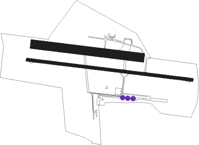
Runway info
Runway 10 / 28  | ||
| length | 1551m (5089ft) | |
| bearing | 98° / 278° | |
| width | 30m (98ft) | |
| surface | asphalt | |
| Runway 10L / 28R | ||
| length | 991m (3251ft) | |
| bearing | 98° / 278° | |
| width | 80m (262ft) | |
| surface | grass | |
| displ threshold | 0m (0ft) / 110m (361ft) | |
Nearby beacons
| code | identifier | dist | bearing | frequency |
|---|---|---|---|---|
| YN | LA ROCHE SUR YON LES AJONCS NDB | 4 | 98° | 334 |
| GL | NANTES NDB | 24.5 | 319° | 369 |
| NTS | NANTES ATLANTIQUE VOR/DME | 29.1 | 333° | 115.50 |
| RL | LA ROCHELLE NDB | 33.6 | 152° | 322 |
| LP | CHOLET NDB | 34.2 | 51° | 357 |
| MT | SAINT NAZAIRE NDB | 46.6 | 314° | 398 |
| ROC | ROCHEFORT NDB | 51.5 | 154° | 396 |
| ANG | ANGERS VOR | 54.5 | 32° | 113 |
| PI | POITIERS NDB | 73.6 | 90° | 363 |
Instrument approach procedures
| runway | airway (heading) | route (dist, bearing) |
|---|---|---|
| RW10 | RIKLO (115°) | RIKLO RI116 (1mi, 196°) IRI10 (3mi, 196°) 2000ft |
| RW10 | RILAV (98°) | RILAV IRI10 (5mi, 98°) 2000ft |
| RW10 | RINED (80°) | RINED RI104 (4mi, 46°) 3000ft IRI10 (3mi, 46°) 2000ft |
| RNAV | IRI10 2000ft FRI10 (4mi, 98°) 2000ft LFRI (5mi, 98°) 338ft RI112 (3mi, 98°) RI114 (7mi, 330°) 1700ft RI116 (9mi, 264°) 2000ft | |
| RW28 | ROGEK (278°) | ROGEK 3000ft IRI28 (5mi, 278°) 2000ft |
| RW28 | ROKIX (262°) | ROKIX 2200ft IRI28 (5mi, 222°) 2000ft |
| RW28 | ROLNU (295°) | ROLNU IRI28 (5mi, 348°) 2000ft |
| RNAV | IRI28 2000ft FRI28 (4mi, 278°) 2000ft LFRI (5mi, 278°) 337ft RI212 (3mi, 278°) ROKIX (15mi, 85°) 2000ft |
Disclaimer
The information on this website is not for real aviation. Use this data with the X-Plane flight simulator only! Data taken with kind consent from X-Plane 12 source code and data files. Content is subject to change without notice.