Dijon/longvic - Dijon Longvic
Airport details
| Country | France |
| State | Bourgogne-Franche-Comté |
| Region | LF |
| Airspace | Reims Ctr |
| Municipality | Ouges |
| Elevation | 726ft (221m) |
| Timezone | GMT +1 |
| Coordinates | 47.26895, 5.08393 |
| Magnetic var | |
| Type | land |
| Available since | X-Plane v10.40 |
| ICAO code | LFSD |
| IATA code | DIJ |
| FAA code | n/a |
Communication
| Dijon Longvic DIJON AFIS | 118.325 |
Nearby Points of Interest:
poudrière de Dijon
-Sculptures du campus de l'université de Bourgogne
-maison Creusot
-maison des Argentières
-Kiosque à musique place Wilson
-Hôtel de Cirey ou de Frantin
-Hôtel Grasset
-Hôtel Buffon
-Hôtel Gonthier d'Auvillars
-Couvent des Cordeliers de Dijon
-Bibliothèque municipale de Dijon - Le Puits d'amour
-hospice Sainte-Anne
-Hôtel Viard de Samerey (Dijon)
-Hôtel des Barres
-Hôtel Montillet
-Monastère des Bernardines de Dijon
-Hôtel Muteau
-Hôtel Rigoley de Chevigny
-Hôtel de Thianges
-Hôtel Gruère
-Hôtel Maleteste
-Hôtel Lemullier de Bressey
-Portelle de l'Abbaye Saint-Étienne
-Hôtel Patarin
-Hôtel Fyot de Mimeure
Runway info
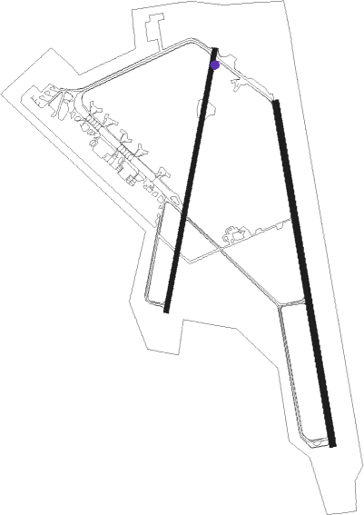
Runway 17 / 35  | ||
| length | 2399m (7871ft) | |
| bearing | 173° / 353° | |
| width | 45m (148ft) | |
| surface | asphalt | |
| blast zone | 255m (837ft) / 255m (837ft) | |
| Runway 01 / 19 | ||
| length | 1840m (6037ft) | |
| bearing | 22° / 202° | |
| width | 36m (118ft) | |
| surface | asphalt | |
| blast zone | 100m (328ft) / 135m (443ft) | |
Nearby beacons
| code | identifier | dist | bearing | frequency |
|---|---|---|---|---|
| DJL | DIJON LONGVIC VOR/DME | 0.5 | 82° | 111.45 |
| DO | DOLE NDB | 19.5 | 143° | 309 |
| CC | CHAMPFORGEUIL NDB | 34.3 | 204° | 391 |
| RLP | ROLAMPONT VOR/DME | 38.8 | 15° | 117.30 |
| SN | SAINT YAN NDB | 70.6 | 225° | 430 |
Instrument approach procedures
| runway | airway (heading) | route (dist, bearing) |
|---|---|---|
| RW35 | DJL (262°) | DJL 3500ft SD412 (7mi, 229°) 3000ft SD411 (5mi, 173°) 3000ft ISD35 (5mi, 88°) 2400ft |
| RW35 | SD411 (25°) | SD411 ISD35 (5mi, 88°) 2400ft |
| RNAV | ISD35 2400ft FSD35 (5mi, 353°) 2400ft LFSD (6mi, 347°) 760ft SD403 (5mi, 1°) SD406 (16mi, 148°) 2500ft ISD35 (5mi, 262°) 2400ft |
Disclaimer
The information on this website is not for real aviation. Use this data with the X-Plane flight simulator only! Data taken with kind consent from X-Plane 12 source code and data files. Content is subject to change without notice.