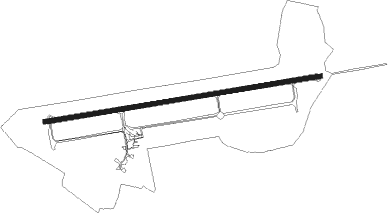
Juvaincourt - Epinal Mirecourt
Airport details
| Country | France |
| State | Grand Est |
| Region | LF |
| Airspace | Reims Ctr |
| Municipality | Juvaincourt |
| Elevation | 1083ft (330m) |
| Timezone | GMT +1 |
| Coordinates | 48.32500, 6.06674 |
| Magnetic var | |
| Type | land |
| Available since | X-Plane v10.40 |
| ICAO code | LFSG |
| IATA code | EPL |
| FAA code | n/a |
Communication
| Epinal Mirecourt EPINAL MULT | 120.200 |
| Epinal Mirecourt AFIS | 120.200 |
| Epinal Mirecourt OCHEY/LORRAINE Approach | 127.250 |
Approach frequencies
| ILS-cat-I | RW26 | 110.9 | 18.00mi |
| 3° GS | RW26 | 110.9 | 18.00mi |
Nearby Points of Interest:
Monument Barrès
-Château de Vaudémont
-Mairie-halle de Vicherey
-Croix de Belmont-sur-Vair
-Maison des Loups
-Château Lobstein
-Château de Thuillières
-Château de Saint-Baslemont
-Château de Lichécourt
-Château de Darney
-Couvent de la Congrégation Notre-Dame de Neufchâteau
-Ancien théâtre municipal de Neufchâteau
-Sous-préfecture de Neufchâteau
-Maison dite du Bailli
-Moulin Gentrey
-Tombeau de Hugues des Hazards
-Bois l'Évêque dolmen
-Château de Gerbéviller
-château de l'abbé de Bouzey
-papeterie de la Rochette
-villa Fournier-Defaut
-City walls of Toul
-Synagogue of Toul
-Hôtel de Ville de Toul
-Tour Joffre Saint-Thiébaut
Nearby beacons
| code | identifier | dist | bearing | frequency |
|---|---|---|---|---|
| EPL | EPINAL MIRECOURT VOR | 0.5 | 226° | 113 |
| EMT | EPINAL NDB | 5 | 87° | 419 |
| NAY | NANCY OCHEY TACAN | 16.1 | 336° | 116.80 |
| LXI | LUXEUIL SAINT SAUVEUR TACAN | 34.5 | 152° | 108.20 |
| LUL | LUXEUIL VOR | 39.3 | 160° | 117.10 |
| LOU | LORRAINE NDB | 41.2 | 17° | 388 |
| RLP | ROLAMPONT VOR/DME | 41.3 | 243° | 117.30 |
| GTQ | GROSTENQUIN VOR/DME | 47.3 | 44° | 111.25 |
| HR | HERICOURT NDB | 53 | 139° | 289 |
| ETN | ETAIN NDB | 56.4 | 337° | 410 |
| MTZ | METZ NDB | 57.3 | 8° | 354 |
| MB | MONTBELIARD NDB | 60.1 | 134° | 330 |
Instrument approach procedures
| runway | airway (heading) | route (dist, bearing) |
|---|---|---|
| RW26 | ISG26 (267°) | ISG26 3000ft EMT (7mi, 267°) 3000ft SG411 (5mi, 352°) 3000ft SG403 (7mi, 87°) 3000ft ISG26 (5mi, 173°) 3000ft |
| RW26 | SG402 (282°) | SG402 3000ft ISG26 (5mi, 352°) 3000ft |
| RW26 | SG403 (251°) | SG403 3000ft ISG26 (5mi, 173°) 3000ft |
| RNAV | ISG26 3000ft FSG26 (5mi, 267°) 3000ft LFSG (7mi, 267°) 1083ft SG409 (2mi, 267°) SG402 (15mi, 100°) 3000ft |
Disclaimer
The information on this website is not for real aviation. Use this data with the X-Plane flight simulator only! Data taken with kind consent from X-Plane 12 source code and data files. Content is subject to change without notice.