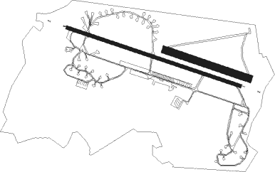
Saint-dizier/robinson - Saint Dizier Robinson
Airport details
| Country | France |
| State | Grand Est |
| Region | LF |
| Airspace | Paris Ctr |
| Municipality | Saint-Dizier |
| Elevation | 458ft (140m) |
| Timezone | GMT +1 |
| Coordinates | 48.63249, 4.90717 |
| Magnetic var | |
| Type | land |
| Available since | X-Plane v10.40 |
| ICAO code | LFSI |
| IATA code | n/a |
| FAA code | n/a |
Communication
| Saint Dizier Robinson ST DIZIER Tower | 122.100 |
| Saint Dizier Robinson ST DIZIER Departure | 122.100 |
Approach frequencies
| ILS-cat-I | RW29 | 108.9 | 18.00mi |
| 3° GS | RW29 | 108.9 | 18.00mi |
Nearby Points of Interest:
Maison, 17 rue Émile Giros (Saint-Dizier)
-Maison, 31 rue Émile Giros
-étangs de la Champagne humide
-Château de la Forge
-Hôtel de Radouan
-Hôtel de l'Escale
-Hôtel de la Bessière
-Notre-Dame du Guet
-Cadaver Tomb of René of Chalon
-Maison de la Gabbe
-Maison Morel
-Collège Gilles-de-Trèves
-Hôtel de Marne
-Maison des deux Barbeaux
-Fonderie du Val d'Osne
-Hôtel de ville de Vitry-le-François
-Abbaye d'Écurey
-hôtel de ville de Soulaines-Dhuys
-Pont Henri IV
-Croix de Vallentigny
-Hôtel de ville de Brienne-le-Château
-Hôpital de la Charité de Brienne-le-Château
-Halles de Brienne-le-Château
-Château de Vitry-la-Ville
-Halle de Lesmont

Nearby beacons
| code | identifier | dist | bearing | frequency |
|---|---|---|---|---|
| SDI | SAINT DIZIER ROBINSON TACAN | 0.7 | 284° | 114 |
| CVT | CHALONS NDB | 24.5 | 282° | 347 |
| CAV | CHALONS VOR/DME | 31.4 | 281° | 111.65 |
| VAT | CHALONS NDB | 36.6 | 281° | 367 |
| TY | TROYES NDB | 38.5 | 256° | 320 |
| TRO | TROYES BARBEREY VOR | 44 | 248° | 116 |
| RLP | ROLAMPONT VOR/DME | 45.7 | 155° | 117.30 |
| MMD | MONTMEDY VOR | 46.3 | 16° | 109.40 |
| ETN | ETAIN NDB | 46.8 | 52° | 410 |
| REM | REIMS VOR | 53 | 308° | 112.30 |
Departure and arrival routes
| Transition altitude | 5000ft |
| STAR starting points | distance | inbound heading | |
|---|---|---|---|
| RW11 | |||
| LOUP1W | 15.9 | 217° | |
| RW29 | |||
| LOUP1E | 15.9 | 217° | |
Instrument approach procedures
| runway | airway (heading) | route (dist, bearing) |
|---|---|---|
| RW11 | LOUPY (217°) | LOUPY SI401 (17mi, 265°) ISI11 (7mi, 213°) 3400ft |
| RNAV | ISI11 3400ft FSI11 (3mi, 106°) 3400ft LFSI (10mi, 106°) 493ft ISI29 (14mi, 106°) 2700ft ISI29 (turn) 2700ft | |
| RW29 | LOUPY (217°) | LOUPY SI400 (15mi, 133°) ISI29 (8mi, 213°) 3500ft |
| RNAV | ISI29 3500ft FSI29 (4mi, 286°) 3500ft LFSI (10mi, 285°) 507ft SI406 (9mi, 286°) 1900ft SI406 (turn) 1900ft |
Holding patterns
| STAR name | hold at | type | turn | heading* | altitude | leg | speed limit |
|---|---|---|---|---|---|---|---|
| LOUP1E | LOUPY | VHF | right | 27 (207)° | 6000ft - 12000ft | DME 5.2mi | 220 |
| LOUP1W | LOUPY | VHF | right | 27 (207)° | 6000ft - 12000ft | DME 5.2mi | 220 |
| *) magnetic outbound (inbound) holding course | |||||||
Disclaimer
The information on this website is not for real aviation. Use this data with the X-Plane flight simulator only! Data taken with kind consent from X-Plane 12 source code and data files. Content is subject to change without notice.