Heraklion - Iraklion Nikos Kazantzakis
Airport details
| Country | Greece |
| State | Region of Crete |
| Region | LG |
| Airspace | Athens Ctr |
| Municipality | Nea Alikarnassos Municipal Unit |
| Elevation | 115ft (35m) |
| Timezone | GMT +2 |
| Coordinates | 35.33972, 25.18028 |
| Magnetic var | |
| Type | land |
| Available since | X-Plane v10.40 |
| ICAO code | LGIR |
| IATA code | HER |
| FAA code | n/a |
Communication
| Iraklion Nikos Kazantzakis ATIS | 127.550 |
| Iraklion Nikos Kazantzakis KAZANTZAKIS Ground Control | 121.700 |
| Iraklion Nikos Kazantzakis KAZANTZAKIS Tower | 122.100 |
| Iraklion Nikos Kazantzakis IRAKLION RADAR | 123.975 |
Nearby Points of Interest:
Eileithyia Cave
-Loggia of Heraklion
-Chronake House
-Saint Peter of the Dominicans, Heraklion
-Bey Sekeria Mansion
-Malia
-Chalepa Monastery
-Naos Panagias
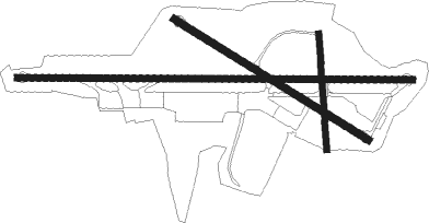
Runway info
Runway 09 / 27  | ||
| length | 2709m (8888ft) | |
| bearing | 94° / 274° | |
| width | 45m (148ft) | |
| surface | asphalt | |
| displ threshold | 477m (1565ft) / 0m (0ft) | |
| blast zone | 61m (200ft) / 64m (210ft) | |
| Runway 12 / 30 | ||
| length | 1565m (5135ft) | |
| bearing | 121° / 301° | |
| width | 50m (164ft) | |
| surface | asphalt | |
| blast zone | 58m (190ft) / 0m (0ft) | |
| Runway 18 / 36 | ||
| length | 794m (2605ft) | |
| bearing | 180° / 0° | |
| width | 40m (131ft) | |
| surface | asphalt | |
| displ threshold | 0m (0ft) / 100m (328ft) | |
Nearby beacons
| code | identifier | dist | bearing | frequency |
|---|---|---|---|---|
| HER | IRAKLION NDB | 0.1 | 183° | 431 |
| IRA | IRAKLION VOR/DME | 0.2 | 78° | 108.80 |
| SHT | SITIA VOR/DME | 46 | 97° | 112.90 |
Departure and arrival routes
| Transition altitude | 6000ft |
| SID end points | distance | outbound heading | |
|---|---|---|---|
| RW09 | |||
| NAVU1K, NAVU1H, NAVU1E | 22mi | 16° | |
| XAVI1H, XAVI1E | 29mi | 48° | |
| LABU1H | 36mi | 70° | |
| DELA1E | 76mi | 70° | |
| SIT2H, SIT1E | 52mi | 105° | |
| OTRE1E, OTRE2K | 16mi | 232° | |
| BAVE1K, BAVE1E | 23mi | 281° | |
| EPAL1K, EPAL1E, EPAL1H | 24mi | 336° | |
| RW12 | |||
| NAVU1Q, NAVU1S, NAVU1R | 22mi | 16° | |
| XAVI1Q | 29mi | 48° | |
| LABU1Q | 36mi | 70° | |
| SIT1Q, SIT1R | 52mi | 105° | |
| OTRE1S | 16mi | 232° | |
| BAVE1S | 23mi | 281° | |
| EPAL1S, EPAL1Q, EPAL1R | 24mi | 336° | |
| RW27 | |||
| NAVU1F, NAVU1D | 22mi | 16° | |
| XAVI1C, XAVI1D | 29mi | 48° | |
| LABU1C, LABU1T | 36mi | 70° | |
| DELA1D | 76mi | 70° | |
| SIT2D, SIT3C, SIT3T | 52mi | 105° | |
| OTRE3C, OTRE2D | 16mi | 232° | |
| BAVE1D, BAVE1C | 23mi | 281° | |
| EPAL1V, EPAL1T, EPAL1D | 24mi | 336° | |
| RW30 | |||
| NAVU1N | 22mi | 16° | |
| XAVI1N | 29mi | 48° | |
| LABU1N | 36mi | 70° | |
| SIT1N, SIT1P | 52mi | 105° | |
| OTRE1N | 16mi | 232° | |
| BAVE1N | 23mi | 281° | |
| EPAL1P, EPAL1N | 24mi | 336° | |
| STAR starting points | distance | inbound heading | |
|---|---|---|---|
| RW09 | |||
| OTRE2L | 16.2 | 52° | |
| TIPU2L | 28.5 | 73° | |
| BAVE2L | 22.7 | 101° | |
| EPAL2L | 24.0 | 156° | |
| NAVU2L | 22.1 | 196° | |
| XAVI2L | 28.8 | 228° | |
| LABU2L | 36.2 | 250° | |
| SIT2L | 52.1 | 285° | |
| RW27 | |||
| OTRE3A | 16.2 | 52° | |
| BAVE1A | 22.7 | 101° | |
| EPAL1A, EPAL1B | 24.0 | 156° | |
| NAVU1A, NAVU1B | 22.1 | 196° | |
| XAVI1A | 28.8 | 228° | |
| LABU1B, LABU1A | 36.2 | 250° | |
| SIT2A, SIT2B | 52.1 | 285° | |
Instrument approach procedures
| runway | airway (heading) | route (dist, bearing) |
|---|---|---|
| RW27 | BASAS (273°) | BASAS 6000ft IR401 (11mi, 273°) 2300ft |
| RW27 | GONSO (242°) | GONSO 3000ft IR402 (6mi, 146°) 3000ft IR401 (5mi, 249°) 2300ft |
| RNAV | IR401 2300ft IR400 (3mi, 274°) 2000ft LGIR (6mi, 274°) 132ft IR700 (7mi, 11°) GONSO (9mi, 94°) 3000ft GONSO (turn) 3000ft |
Holding patterns
| STAR name | hold at | type | turn | heading* | altitude | leg | speed limit |
|---|---|---|---|---|---|---|---|
| BAVE1A | GONSO | VHF | right | 53 (233)° | 3000ft - 15000ft | DME 5.0mi | 230 |
| BAVE2L | ADORI | VHF | left | 323 (143)° | 3000ft - 6000ft | DME 5.0mi | 230 |
| EPAL1A | GONSO | VHF | right | 53 (233)° | 3000ft - 15000ft | DME 5.0mi | 230 |
| EPAL1B | GONSO | VHF | right | 53 (233)° | 3000ft - 15000ft | DME 5.0mi | 230 |
| EPAL2L | ADORI | VHF | left | 323 (143)° | 3000ft - 6000ft | DME 5.0mi | 230 |
| LABU1B | GONSO | VHF | right | 53 (233)° | 3000ft - 15000ft | DME 5.0mi | 230 |
| LABU2L | ADORI | VHF | left | 323 (143)° | 3000ft - 6000ft | DME 5.0mi | 230 |
| NAVU1A | GONSO | VHF | right | 53 (233)° | 3000ft - 15000ft | DME 5.0mi | 230 |
| NAVU1B | GONSO | VHF | right | 53 (233)° | 3000ft - 15000ft | DME 5.0mi | 230 |
| NAVU2L | ADORI | VHF | left | 323 (143)° | 3000ft - 6000ft | DME 5.0mi | 230 |
| OTRE2L | ADORI | VHF | left | 323 (143)° | 3000ft - 6000ft | DME 5.0mi | 230 |
| OTRE3A | GONSO | VHF | right | 53 (233)° | 3000ft - 15000ft | DME 5.0mi | 230 |
| SIT2B | GONSO | VHF | right | 53 (233)° | 3000ft - 15000ft | DME 5.0mi | 230 |
| SIT2L | ADORI | VHF | left | 323 (143)° | 3000ft - 6000ft | DME 5.0mi | 230 |
| TIPU2L | ADORI | VHF | left | 323 (143)° | 3000ft - 6000ft | DME 5.0mi | 230 |
| XAVI1A | GONSO | VHF | right | 53 (233)° | 3000ft - 15000ft | DME 5.0mi | 230 |
| XAVI2L | ADORI | VHF | left | 323 (143)° | 3000ft - 6000ft | DME 5.0mi | 230 |
| *) magnetic outbound (inbound) holding course | |||||||
Disclaimer
The information on this website is not for real aviation. Use this data with the X-Plane flight simulator only! Data taken with kind consent from X-Plane 12 source code and data files. Content is subject to change without notice.