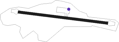
Kalymnos Island - Kalymnos
Airport details
| Country | Greece |
| State | Aegean |
| Region | LG |
| Airspace | Athens Ctr |
| Municipality | Municipality of Kalymnos |
| Elevation | 770ft (235m) |
| Timezone | GMT +2 |
| Coordinates | 36.96333, 26.94056 |
| Magnetic var | |
| Type | land |
| Available since | X-Plane v10.40 |
| ICAO code | LGKY |
| IATA code | JKL |
| FAA code | n/a |
Communication
| Kalymnos Kalymnos Information | 118.875 |
| Kalymnos Kos Approach | 119.950 |
| Kalymnos Kos Approach | 122.100 |
Nearby beacons
| code | identifier | dist | bearing | frequency |
|---|---|---|---|---|
| KOS | KOS NDB | 12.2 | 139° | 311 |
| KOS | KOS VOR/DME | 12.6 | 139° | 109 |
| LRO | LEROS NDB | 14.8 | 328° | 419 |
| ATL | ASTYPALAIA NDB | 35.5 | 236° | 422 |
| BDR | MILAS BODRUM NDB | 37.7 | 67° | 389 |
| SMO | SAMOS NDB | 43.3 | 358° | 375 |
| SAM | SAMOS VOR/DME | 43.4 | 357° | 111.60 |
| IKA | IKARIA NDB | 51.7 | 320° | 322 |
| SEL | SELCUK-EFES NDB | 62 | 22° | 424 |
| CLD | CILDIR (AYDIN) NDB | 68.2 | 48° | 480 |
| CLD | CILDIR (AYDIN) VOR/DME | 68.5 | 48° | 113.85 |
Disclaimer
The information on this website is not for real aviation. Use this data with the X-Plane flight simulator only! Data taken with kind consent from X-Plane 12 source code and data files. Content is subject to change without notice.
