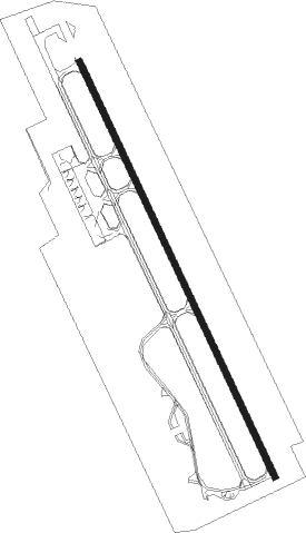
Santorini Island - Santorini
Airport details
| Country | Greece |
| State | Aegean |
| Region | LG |
| Airspace | Athens Ctr |
| Municipality | Thira Municipal Unit |
| Elevation | 125ft (38m) |
| Timezone | GMT +2 |
| Coordinates | 36.39917, 25.47917 |
| Magnetic var | |
| Type | land |
| Available since | X-Plane v10.40 |
| ICAO code | LGSR |
| IATA code | JTR |
| FAA code | n/a |
Communication
| Santorini ATIS | 126.450 |
| Santorini Tower | 118.050 |
| Santorini Tower | 122.100 |
| Santorini Approach | 122.100 |
| Santorini Approach | 118.050 |
| Santorini Departure | 122.100 |
| Santorini Departure | 118.050 |
Nearby Points of Interest:
Chora of Ios
Nearby beacons
| code | identifier | dist | bearing | frequency |
|---|---|---|---|---|
| THR | SANTORINI NDB | 0 | 55° | 307 |
| SNI | SANTORINI VOR/DME | 0.3 | 141° | 110.40 |
| PAO | PAROS NDB | 40.4 | 330° | 386 |
| NXO | NAXOS NDB | 41.2 | 351° | 326 |
| ATL | ASTYPALAIA NDB | 44.6 | 79° | 422 |
| MIL | MILOS VOR/DME | 50.7 | 290° | 113.50 |
Departure and arrival routes
| Transition altitude | 5000ft |
| SID end points | distance | outbound heading | |
|---|---|---|---|
| RW15 | |||
| UVRI1E | 38mi | 78° | |
| KUPI1E | 22mi | 111° | |
| GIVI1W | 17mi | 195° | |
| NETI1W, NETI1E | 31mi | 300° | |
| MADE1W, MADE1E | 16mi | 342° | |
| IRBE1W, IRBE1E | 25mi | 353° | |
| RW33 | |||
| UVRI1X | 38mi | 78° | |
| KUPI1X | 22mi | 111° | |
| GIVI1X | 17mi | 195° | |
| NETI1X | 31mi | 300° | |
| MADE1X | 16mi | 342° | |
| IRBE1X | 25mi | 353° | |
| STAR starting points | distance | inbound heading | |
|---|---|---|---|
| RW15 | |||
| GIVI1C, GIVI1D | 16.9 | 15° | |
| PEXA1D, PEXA1E, PEXA1C | 22.2 | 133° | |
| IRBE1D, IRBE1C | 24.8 | 173° | |
| UVRI1D | 21.0 | 239° | |
| UVRI1C | 37.7 | 258° | |
| BINK1D | 21.2 | 273° | |
| BINK1C | 68.9 | 291° | |
| RW33 | |||
| GIVI1A | 16.9 | 15° | |
| PEXA1A | 22.2 | 133° | |
| IRBE1A | 24.8 | 173° | |
| UVRI1A | 37.7 | 258° | |
| BINK1A | 68.9 | 291° | |
Instrument approach procedures
| runway | airway (heading) | route (dist, bearing) |
|---|---|---|
| RW15 | EXOSI (155°) | EXOSI 3500ft SR444 (6mi, 155°) 3000ft |
| RW15 | LEKRA (188°) | LEKRA 3500ft EXOSI (8mi, 253°) 3500ft SR444 (6mi, 155°) 3000ft |
| RNAV | SR444 3000ft LGSR (9mi, 155°) 173ft SR490 (2mi, 136°) LEKRA (19mi, 2°) 3500ft LEKRA (turn) 3500ft |
Holding patterns
| STAR name | hold at | type | turn | heading* | altitude | leg | speed limit |
|---|---|---|---|---|---|---|---|
| BINK1A | SNI | NDB | left | 297 (117)° | > 3500ft | 1.0min timed | ICAO rules |
| BINK1C | KORAX | VHF | left | 335 (155)° | > 3500ft | 1.0min timed | ICAO rules |
| BINK1D | LEKRA | VHF | left | 117 (297)° | 3500ft - 6500ft | 1.0min timed | 230 |
| GIVI1A | SNI | NDB | left | 297 (117)° | > 3500ft | 1.0min timed | ICAO rules |
| GIVI1C | KORAX | VHF | left | 335 (155)° | > 3500ft | 1.0min timed | ICAO rules |
| GIVI1D | LEKRA | VHF | left | 117 (297)° | 3500ft - 6500ft | 1.0min timed | 230 |
| IRBE1A | SNI | NDB | left | 297 (117)° | > 3500ft | 1.0min timed | ICAO rules |
| IRBE1C | KORAX | VHF | left | 335 (155)° | > 3500ft | 1.0min timed | ICAO rules |
| IRBE1D | LEKRA | VHF | left | 117 (297)° | 3500ft - 6500ft | 1.0min timed | 230 |
| PEXA1A | SNI | NDB | left | 297 (117)° | > 3500ft | 1.0min timed | ICAO rules |
| PEXA1C | KORAX | VHF | left | 335 (155)° | > 3500ft | 1.0min timed | ICAO rules |
| PEXA1D | LEKRA | VHF | left | 117 (297)° | 3500ft - 6500ft | 1.0min timed | 230 |
| UVRI1A | SNI | NDB | left | 297 (117)° | > 3500ft | 1.0min timed | ICAO rules |
| UVRI1C | KORAX | VHF | left | 335 (155)° | > 3500ft | 1.0min timed | ICAO rules |
| UVRI1D | LEKRA | VHF | left | 117 (297)° | 3500ft - 6500ft | 1.0min timed | 230 |
| *) magnetic outbound (inbound) holding course | |||||||
Disclaimer
The information on this website is not for real aviation. Use this data with the X-Plane flight simulator only! Data taken with kind consent from X-Plane 12 source code and data files. Content is subject to change without notice.
