Tanagra
Airport details
| Country | Greece |
| State | Thessaly and Central Greece |
| Region | LG |
| Airspace | Athens Ctr |
| Municipality | Δημοτική Ενότητα Σχηματαρίου |
| Elevation | 483ft (147m) |
| Timezone | GMT +2 |
| Coordinates | 38.33985, 23.56496 |
| Magnetic var | |
| Type | land |
| Available since | X-Plane v10.40 |
| ICAO code | LGTG |
| IATA code | n/a |
| FAA code | n/a |
Communication
| Tanagra Tower | 122.100 |
| Tanagra Tower | 120.250 |
| Tanagra Approach | 120.250 |
| Tanagra Approach | 122.100 |
Approach frequencies
| ILS-cat-I | RW28C | 111.5 | 18.00mi |
| 3° GS | RW28C | 111.5 | 18.00mi |
Nearby Points of Interest:
Chalkida station
-Eretria
-Cadmea of Thebes
-Phyle
-Larymna
-Queen's Tower
-Omorfokklisia
-Moni Phaneromeni
-Livieratos Mansion
-Averof building
-Lapathiotis House
-Athens City Hall
-Athens trilogy
-Agii Theodori (Athens)
-Hall of the Academy of Athens
-tempi hotel
-Gasparis house
-Agios Ioannis Theologos (Athens)
-Old Royal Palace
-Old Temple of Athena
-Church House
-Brauroneion
-Chalkotheke
-Sarogleio Mansion
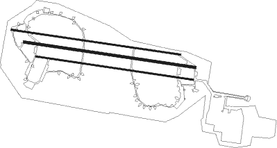
Runway info
Runway 10L / 28R  | ||
| length | 2880m (9449ft) | |
| bearing | 100° / 280° | |
| width | 25m (82ft) | |
| surface | asphalt | |
| displ threshold | 150m (492ft) / 0m (0ft) | |
| blast zone | 5m (16ft) / 0m (0ft) | |
| Runway 10R / 28L | ||
| length | 2675m (8776ft) | |
| bearing | 100° / 280° | |
| width | 25m (82ft) | |
| surface | asphalt | |
| displ threshold | 150m (492ft) / 0m (0ft) | |
| blast zone | 236m (774ft) / 255m (837ft) | |
| Runway 10C / 28C | ||
| length | 2914m (9560ft) | |
| bearing | 100° / 280° | |
| width | 45m (148ft) | |
| surface | asphalt | |
| displ threshold | 152m (499ft) / 0m (0ft) | |
| blast zone | 255m (837ft) / 202m (663ft) | |
Nearby beacons
| code | identifier | dist | bearing | frequency |
|---|---|---|---|---|
| TGG | TANAGRA VOR/DME | 0.3 | 255° | 111.80 |
| TGR | TANAGRA TACAN | 2.3 | 281° | 108.40 |
| TNG | TANAGRA NDB | 7.9 | 95° | 303 |
| ELF | ELEFSIS TACAN | 16.4 | 181° | 108.20 |
| LEF | ELEFSIS VOR/DME | 16.7 | 181° | 109.85 |
| MGR | MEGARA NDB | 23.6 | 210° | 405 |
| ATV | ATHENS VOR/DME | 29.3 | 152° | 114.40 |
| SAT | ATHENS VOR/DME | 30.3 | 140° | 109.60 |
| SPA | ATHENS VOR/DME | 30.8 | 139° | 117.50 |
| EGN | AIGINA NDB | 35 | 194° | 382 |
| KOR | KORINTHOS NDB | 38.5 | 237° | 392 |
| KRO | KARISTOS VOR/DME | 48.5 | 110° | 112.20 |
| SKC | SKIATHOS NDB | 50.1 | 356° | 326 |
| SKP | SKOPELOS VOR/DME | 50.5 | 3° | 113.40 |
| DDM | DIDIMON VOR/DME | 54.3 | 202° | 117.20 |
| SKS | SKIROS VOR/DME | 57.8 | 55° | 116.60 |
| SKY | SKYROS TACAN | 57.8 | 56° | 116.10 |
| KEA | KEA VOR/DME | 58.4 | 137° | 115 |
| AGH | ANCHIALOS VOR/DME | 63.8 | 319° | 110.40 |
| ANL | NEA ANCHIALOS TACAN | 65 | 317° | 115.60 |
Departure and arrival routes
| Transition altitude | 9000ft |
| SID end points | distance | outbound heading | |
|---|---|---|---|
| RW10C | |||
| OLID1D | 63mi | 87° | |
| SOSI1P | 74mi | 88° | |
| ELF1P | 16mi | 181° | |
| IXO1P, IXON1D | 63mi | 269° | |
| ANL1P | 65mi | 317° | |
| AGH1D | 64mi | 319° | |
| RW28C | |||
| OLID1C | 63mi | 87° | |
| SOSI1N | 74mi | 88° | |
| ELF1N | 16mi | 181° | |
| IXON1C, IXON1N | 63mi | 269° | |
| ANL1N | 65mi | 317° | |
| AGH1C | 64mi | 319° | |
| STAR starting points | distance | inbound heading | |
|---|---|---|---|
| RW10C | |||
| ELF1Y | 16.4 | 1° | |
| IXON1Y | 62.8 | 89° | |
| XANI1Y | 66.3 | 100° | |
| ANL1Y | 65.0 | 137° | |
| SIGF1Y | 36.4 | 188° | |
| SOSI1Y | 73.6 | 268° | |
| RW28C | |||
| ELF1M | 10.4 | 7° | |
| IXON1M | 43.1 | 89° | |
| ANL1L, ANL1M | 41.8 | 136° | |
| AGH3E | 41.1 | 139° | |
| SIGF1R, SIGF1Q | 36.4 | 188° | |
| ATV3A | 13.8 | 310° | |
Holding patterns
| STAR name | hold at | type | turn | heading* | altitude | leg | speed limit |
|---|---|---|---|---|---|---|---|
| AGH3E | D055L | VHF | left | 235 (55)° | 8000ft - 13000ft | DME 5.0mi | 260 |
| ANL1M | D060N | VHF | left | 240 (60)° | 8000ft - 13000ft | DME 5.0mi | 260 |
| ANL1Y | D328K | VHF | right | 148 (328)° | 1.0min timed | ICAO rules | |
| ATV2Y | D328K | VHF | right | 148 (328)° | 1.0min timed | ICAO rules | |
| ATV3A | D055L | VHF | left | 235 (55)° | 8000ft - 13000ft | DME 5.0mi | 260 |
| ELF1Y | D328K | VHF | right | 148 (328)° | 1.0min timed | ICAO rules | |
| IXON1M | D060N | VHF | left | 240 (60)° | 8000ft - 13000ft | DME 5.0mi | 260 |
| IXON1Y | D328K | VHF | right | 148 (328)° | 1.0min timed | ICAO rules | |
| IXON3A | D055L | VHF | left | 235 (55)° | 8000ft - 13000ft | DME 5.0mi | 260 |
| SIGF1Q | D060N | VHF | left | 240 (60)° | 8000ft - 13000ft | DME 5.0mi | 260 |
| SIGF1Y | D328K | VHF | right | 148 (328)° | 1.0min timed | ICAO rules | |
| SKP3D | D055L | VHF | left | 235 (55)° | 8000ft - 13000ft | DME 5.0mi | 260 |
| SKY1Y | D328K | VHF | right | 148 (328)° | 1.0min timed | ICAO rules | |
| SOSI1Y | D328K | VHF | right | 148 (328)° | 1.0min timed | ICAO rules | |
| SOSI3A | D055L | VHF | left | 235 (55)° | 8000ft - 13000ft | DME 5.0mi | 260 |
| *) magnetic outbound (inbound) holding course | |||||||
Disclaimer
The information on this website is not for real aviation. Use this data with the X-Plane flight simulator only! Data taken with kind consent from X-Plane 12 source code and data files. Content is subject to change without notice.