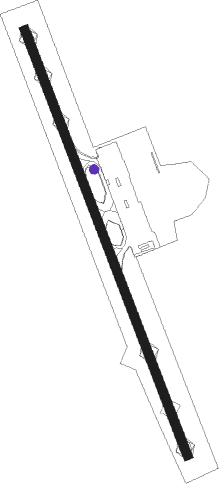
Zakynthos Island - Zakynthos
Airport details
| Country | Greece |
| State | Peloponnese, Western Greece and the Ioni |
| Region | LG |
| Airspace | Athens Ctr |
| Municipality | Zakynthos Municipality |
| Elevation | 14ft (4m) |
| Timezone | GMT +2 |
| Coordinates | 37.75111, 20.88417 |
| Magnetic var | |
| Type | land |
| Available since | X-Plane v10.40 |
| ICAO code | LGZA |
| IATA code | ZTH |
| FAA code | n/a |
Communication
| Zakynthos ZAKINTHOS Tower | 125.425 |
| Zakynthos ANDRAVIDA Approach | 120.650 |
Nearby beacons
| code | identifier | dist | bearing | frequency |
|---|---|---|---|---|
| ZAT | ZAKINTHOS NDB | 0.1 | 55° | 326 |
| ZAK | ZAKINTHOS VOR/DME | 0.3 | 173° | 110.80 |
| AML | ANDRAVIDA TACAN | 21.8 | 66° | 133.40 |
| AML | AMALIAS NDB | 22 | 87° | 367 |
| KEF | KEFALLINIA NDB | 28.2 | 314° | 318 |
| KFN | KEFALLINIA VOR/DME | 28.2 | 314° | 115.50 |
| ARX | ARAXOS TACAN | 35.3 | 53° | 112.40 |
| ARA | ARAXOS VOR/DME | 35.5 | 53° | 112.70 |
Departure and arrival routes
| Transition altitude | 8000ft |
| SID end points | distance | outbound heading | |
|---|---|---|---|
| RW16 | |||
| OSDE2H | 37mi | 4° | |
| ENES1F, ENES1H | 45mi | 312° | |
| KFN4C, KFN2K, KFN1X | 28mi | 314° | |
| RW34 | |||
| OSDE2D | 37mi | 4° | |
| ENES1D, ENES1L | 45mi | 312° | |
| KFN1L, KFN1R, KFN2G, KFN3D | 28mi | 314° | |
| STAR starting points | distance | inbound heading | |
|---|---|---|---|
| RW16 | |||
| LASK1B, LASK2C | 63.8 | 117° | |
| ASTU1B, ASTU2C, ASTU2A | 128.1 | 129° | |
| KFN1H, KFN3B | 28.2 | 134° | |
| RW34 | |||
| LASK2J, LASK2F, LASK1K | 63.8 | 117° | |
| ASTU2J, ASTU1K, ASTU2D, ASTU2F | 128.1 | 129° | |
| KFN3A, KFN2S, KFN1F | 28.2 | 134° | |
Holding patterns
| STAR name | hold at | type | turn | heading* | altitude | leg | speed limit |
|---|---|---|---|---|---|---|---|
| ARA1C | ZAT | FIX | right | 171 (351)° | > 4000ft | 1.0min timed | ICAO rules |
| ARA1M | ZAT | FIX | right | 171 (351)° | > 4000ft | 1.0min timed | ICAO rules |
| ARA4A | LITSI | VHF | left | 160 (340)° | > 3000ft | DME 5.0mi | ICAO rules |
| ARA4B | ZAK | NDB | right | 178 (358)° | > 4000ft | 1.0min timed | ICAO rules |
| ASTU1B | AKETO | VHF | right | 245 (65)° | > 8000ft | 1.0min timed | ICAO rules |
| ASTU1K | AKETO | VHF | right | 245 (65)° | > 8000ft | 1.0min timed | ICAO rules |
| ASTU2A | ZAK | NDB | right | 178 (358)° | > 4000ft | 1.0min timed | ICAO rules |
| ASTU2C | ZAK | NDB | right | 178 (358)° | > 4000ft | 1.0min timed | ICAO rules |
| ASTU2J | LITSI | VHF | left | 160 (340)° | > 3000ft | DME 5.0mi | ICAO rules |
| KFN1F | ZAT | FIX | right | 171 (351)° | > 4000ft | 1.0min timed | ICAO rules |
| KFN1H | ZAT | FIX | right | 171 (351)° | > 4000ft | 1.0min timed | ICAO rules |
| KFN3A | LITSI | VHF | left | 160 (340)° | > 3000ft | DME 5.0mi | ICAO rules |
| KFN3B | ZAK | NDB | right | 178 (358)° | > 4000ft | 1.0min timed | ICAO rules |
| LASK1B | AKETO | VHF | right | 245 (65)° | > 8000ft | 1.0min timed | ICAO rules |
| LASK1K | AKETO | VHF | right | 245 (65)° | > 8000ft | 1.0min timed | ICAO rules |
| LASK2C | ZAK | NDB | right | 178 (358)° | > 4000ft | 1.0min timed | ICAO rules |
| LASK2J | LITSI | VHF | left | 160 (340)° | > 3000ft | DME 5.0mi | ICAO rules |
| *) magnetic outbound (inbound) holding course | |||||||
Disclaimer
The information on this website is not for real aviation. Use this data with the X-Plane flight simulator only! Data taken with kind consent from X-Plane 12 source code and data files. Content is subject to change without notice.
