Kiskunfélegyháza
Airport details
| Country | Hungary |
| State | Bács-Kiskun |
| Region | LH |
| Airspace | Budapest Ctr |
| Municipality | Kiskunfélegyháza |
| Elevation | 315ft (96m) |
| Timezone | GMT +1 |
| Coordinates | 46.73288, 19.89336 |
| Magnetic var | |
| Type | land |
| Available since | X-Plane v10.40 |
| ICAO code | LHKH |
| IATA code | n/a |
| FAA code | n/a |
Communication
| Kiskunfélegyháza Kiskun INFO | 118.850 |
Nearby Points of Interest:
Kecskemét City Hall
-Mártélyi Tájvédelmi Körzet
-Pusztaszeri Tájvédelmi Körzet
-Flood protection wall, Hódmezővásárhely
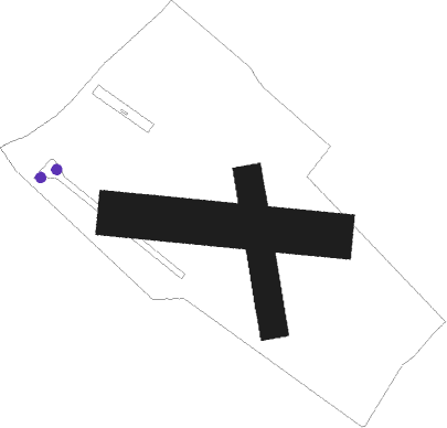
Runway info
Runway 17 / 35  | ||
| length | 535m (1755ft) | |
| bearing | 173° / 353° | |
| width | 100m (328ft) | |
| surface | grass | |
| Runway 10 / 28 | ||
| length | 770m (2526ft) | |
| bearing | 97° / 277° | |
| width | 160m (525ft) | |
| surface | grass | |
Nearby beacons
| code | identifier | dist | bearing | frequency |
|---|---|---|---|---|
| BUG | BUGAC VOR/DME | 9.3 | 255° | 113.40 |
| TN | KECSKEMET NDB | 10.2 | 331° | 313 |
| T | KECSKEMET NDB | 11.4 | 326° | 440 |
| KET | KECSKEMET VORTAC | 13.5 | 319° | 114.15 |
| N | KECSKEMET NDB | 13.6 | 319° | 440 |
| NT | KECSKEMET NDB | 15.2 | 316° | 313 |
| AO | SZOLNOK NDB | 24.6 | 42° | 282 |
| A | SZOLNOK NDB | 26.1 | 42° | 422 |
| O | SZOLNOK NDB | 28.2 | 41° | 422 |
| OA | SZOLNOK NDB | 29.8 | 40° | 282 |
| SEG | SZEGED NDB | 30.6 | 158° | 456 |
| MNR | MONOR VOR/DME | 41.2 | 321° | 112.50 |
| TPS | TAPIOSAP VOR/DME | 49.1 | 330° | 115.90 |
| BUD | BUDAPEST VOR/DME | 50.5 | 318° | 117.30 |
Disclaimer
The information on this website is not for real aviation. Use this data with the X-Plane flight simulator only! Data taken with kind consent from X-Plane 12 source code and data files. Content is subject to change without notice.