Kaposújlak
Airport details
| Country | Hungary |
| State | Somogy |
| Region | LH |
| Airspace | Budapest Ctr |
| Municipality | Kaposújlak |
| Elevation | 511ft (156m) |
| Timezone | GMT +1 |
| Coordinates | 46.38611, 17.73361 |
| Magnetic var | |
| Type | land |
| Available since | X-Plane v10.40 |
| ICAO code | LHKV |
| IATA code | n/a |
| FAA code | n/a |
Communication
| Kaposújlak Kapos INFO | 124.500 |
Nearby Points of Interest:
Ádám–Éva-ház
-Zselic National Landscape Protection Area
-Zselic
-Szerecsen Patikamúzeum
-Early Christian Necropolis of Pécs
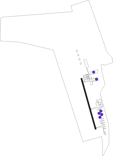
Runway info
| Runway 17 / 35 | ||
| length | 651m (2136ft) | |
| bearing | 164° / 344° | |
| width | 18m (59ft) | |
| surface | concrete | |
Nearby beacons
| code | identifier | dist | bearing | frequency |
|---|---|---|---|---|
| SME | SARMELLEK NDB | 28.8 | 296° | 436 |
| PP | POGANY (PECS) NDB | 30.8 | 127° | 412 |
| SVR | SAGVAR VOR/DME | 30.9 | 41° | 117.70 |
| VBA | BARNA VOR/DME | 45.4 | 223° | 117.40 |
| PC | PAPA NDB | 56.6 | 347° | 318 |
| P | PAPA NDB | 58.3 | 347° | 493 |
| C | PAPA NDB | 60.6 | 346° | 493 |
| PCT | PAPA VORTAC | 60.6 | 346° | 114.75 |
| CE | CEPIN NDB | 61.9 | 136° | 372 |
Disclaimer
The information on this website is not for real aviation. Use this data with the X-Plane flight simulator only! Data taken with kind consent from X-Plane 12 source code and data files. Content is subject to change without notice.